 Droppin’ In at the Smart Rain Garden
#3 in a series of 5 write-ups to introduce the processes and technology at work in the City of Cape Canaveral’s Veterans Memorial Park “Smart” Rain Garden. Please join us for all the posts in this series. The blog series was written by Mandy Baily with assistance from Dan Macchiarella and Tyler Deal with Embry-Riddle Aeronautical University, Zach Eichholz and Tim Carlisle with the City of Cape Canaveral, and Andrew Joesoef with Stetson University. All figures were created, and images taken by Mandy Baily unless otherwise noted.
How does filtration work in the Smart Rain Garden?
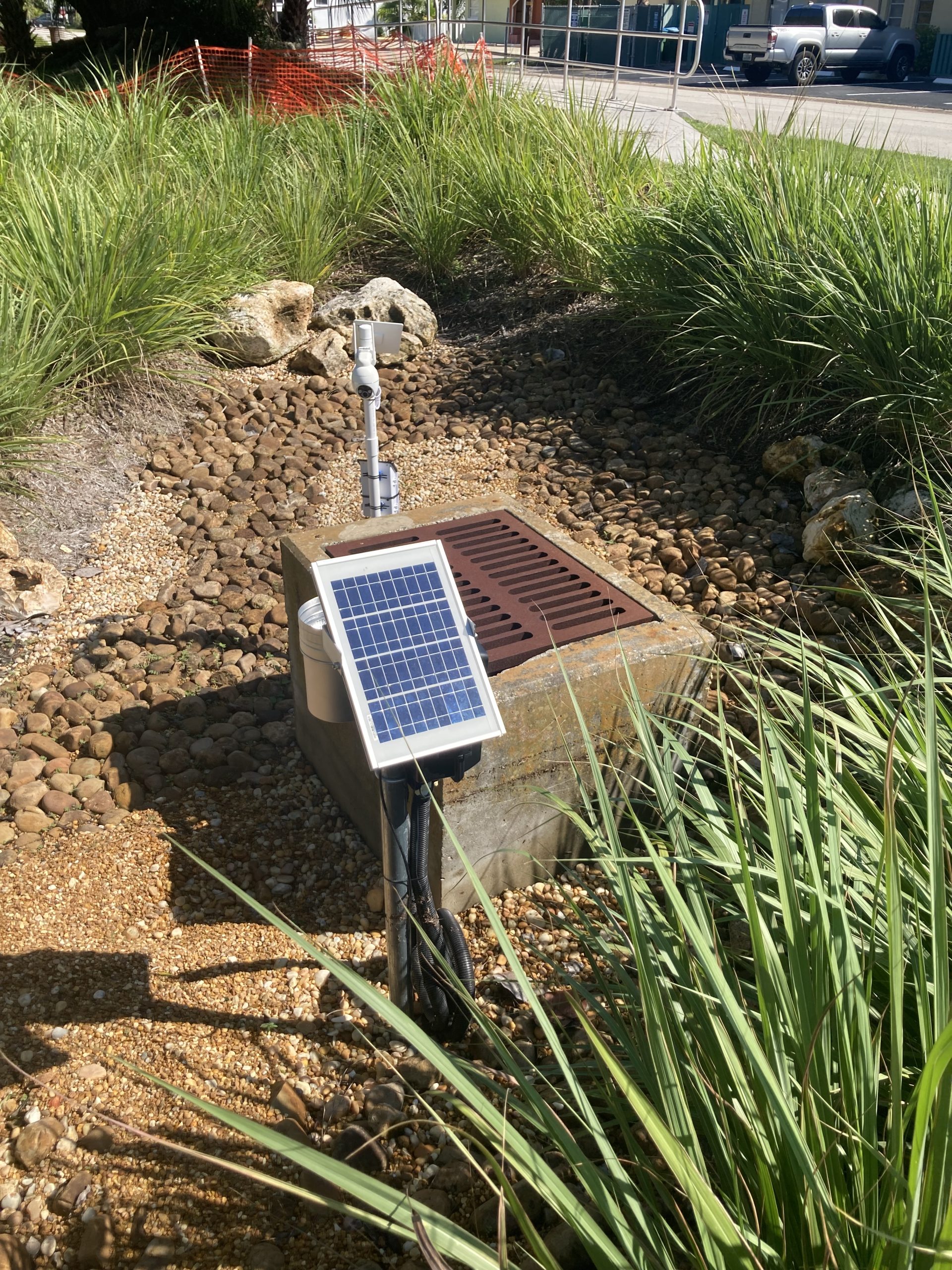
As stormwater rushes in, the true purpose of the bioswale is revealed. It clears the streets of excess stormwater and allows it time to be absorbed. Water continues to fill in and deepen in the lower parts of the garden as measurements are taken at three monitoring wells. “Smart” technology provides a live stream of data. This includes a simple camera to monitor water flow through portions of the bioswale.
These are the pipes and gadgets visibly sticking up in the center of the depressions. Next to each well are six soil moisture sensors. These live-stream sensors, solar-powered and connected to rechargeable batteries, are installed at equally distanced depths just above the groundwater table. The groundwater table here is typically 2-3 feet below the surface. This allows the sensors to collect data on the volume of liquid water per volume of soil every five minutes. This information provides rates of water absorption within the bioswale.
These sensors collect data needed to know how long water in the Rain Garden takes to reach the ground. Over time, plant roots also take up nutrients and moisture as needed. The concrete structure in Figure 1 was installed in the mid-1990s as an emergency overflow. It remains for emergency discharge in the unlikely event that the Rain Garden overflows. These pipes lead directly into the Banana River.
Automatic Sampling of Stormwater Runoff
Research of the stormwater run-off contaminants has previously been done through mechanical water sampling. In other words, someone was out there during a storm scooping up water before sending it to a water quality lab. Contaminants found include nitrates, nitrites, and phosphorus. While some of these are naturally occurring, many are land-based contaminants. These contaminants originate from human-driven systems, often in unhealthy amounts for a natural system to process effectively. An autosampler will be installed to better measure what contaminant and nutrient loads are present. This instrument will collect stormwater during heavy rainfalls for regular testing.
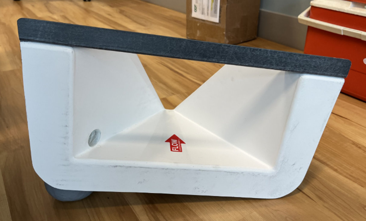
One challenging part of collecting data is accurately measuring the copious amount of water that quickly enters the Rain Garden during a storm. One method is creating a flume or narrowing channel inside a storm drain from a street (Figure 2). This provides a centralized water area to measure depth, length, and height (and therefore volume). The problem is that finding an already-made flume that fits perfectly into the drain is not easy. Keep a patient eye out. The National Science Foundation (NSF) Team partners* from Stetson Institute for Water and Environmental Resilience (IWER) working on this aspect of the Smart Rain Garden project are rising to the challenge. They use creativity and practicality to create a flume with the exact dimensions of the Taylor Avenue storm drain throat.
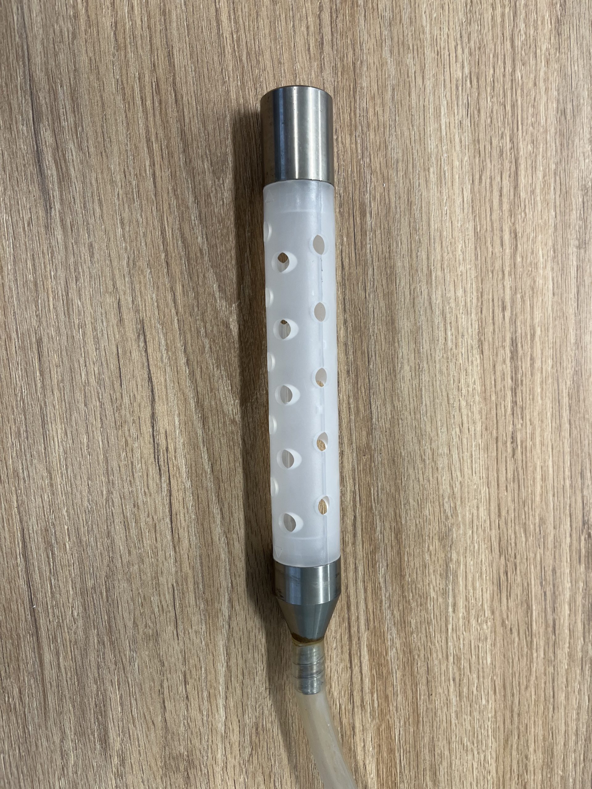
Once the flume is added, an ever-more accurate picture of water’s entry and seepage can be determined. As the runoff flows in, a water level gauge will trigger the autosampler pump to turn on and collect (suck up) a water sample (Figure 3).
Smart Rain Garden Series
Join us for the next blog post in this series where we’ll talk about “Why was Veterans Memorial Park chosen as the location for a Smart Rain Garden?”. Go back to read the other posts in this series.
- What happens in the Veterans Memorial Park Smart Rain Garden during and after a rain event?
- What is a bioswale?
*The City of Cape Canaveral, in partnership with various academic, civic, and private agencies, received a National Science Foundation (NSF) Civic Innovations Grant. Over a year, $1 million was awarded to provide the design, planning, construction, labor, research, and technological supplies for the Smart Rain Garden.
 2
2
