 Droppin’ In at the Smart Rain Garden
#4 in a series of 5 write-ups to introduce the processes and technology at work in the City of Cape Canaveral’s Veterans Memorial Park “Smart” Rain Garden. Please join us for all the posts in this series. The blog series was written by Mandy Baily with assistance from Dan Macchiarella and Tyler Deal with Embry-Riddle Aeronautical University, Zach Eichholz and Tim Carlisle with the City of Cape Canaveral, and Andrew Joesoef with Stetson University. All figures were created, and images taken by Mandy Baily unless otherwise noted.
Why was Veterans Memorial Park chosen for a Smart Rain Garden?
Historically, the park provided a foundation with its shallow detention ditch/swale. Current images obtained during initial surveys of the area showed that the elevation around the park remains low. This past and present information, coupled with the need for an effective method of decreasing flooding along the surrounding streets, provided the perfect location. You can learn more about Cape Canaveral’s Presidential Streets Master Plan and the Resilient Cape Canaveral Action Plan (2021).
Remote Sensing of the Park and the City
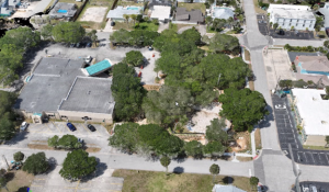
Throughout each Smart Rain Garden project step, remote sensing has been used to track and create visual models of current elevation and other land features. Remote sensing uses multispectral (different ranges in the electromagnetic spectrum) to analyze emitted energy from areas of interest. In the case of the bioswale, different drones were used to create images of the physical characteristics of the land to help clearly define the flow of water.
Stormwater drains due to land characteristics, elevation, and non-penetrable surfaces, such as roads and rooftops. Cape Canaveral’s elevation changes are not dramatic. They’re likely to be called micro-elevation changes. Elevation ranges from sea level to a maximum of 16 feet at an artificially built-up area near the port. Beach dunes typically rise to around 12 feet. Across the Presidential Streets, altitude averages closer to 9 feet. Calling these micro-elevations “altitude” may seem a misnomer, but the coast is not entirely flat!
Remote sensing is a valuable reference and concrete baseline for monitoring and planning in Cape Canaveral. The aerial perspective of drones provides a very current and accurate reading of the terrain and its topology or physical arrangement. With remote sensing data, features about 1 inch (2.1 cm) in size can be noted.
Drone Flying and LiDAR in Cape Canaveral
Did you hear or see drones flying overhead earlier in 2024? To collect remote sensing data, uncrewed aircraft systems (more commonly called drones) of various sizes and capabilities were used to carry the cameras and sensors that detect landscape variations. These aerial vehicles, safety certified to fly above residential areas, used LiDAR. The National Oceanic and Atmospheric Association (NOAA) defines LiDAR as follows: Lidar, which stands for Light Detection and Ranging, is a remote sensing method that uses light in the form of a pulsed laser to measure ranges (variable distances) to the Earth. These light pulses—combined with other data recorded by the airborne system — generate precise, three-dimensional information about the shape of the Earth and its surface characteristics.

Image Credit: Embry Riddle Aeronautical University (NSF Team partner)
Through partners on the NSF Team from Embry-Riddle Aeronautical University, we know that LiDAR pulse point returns have no color. They are simply locational points that align with a datum, which is a mathematical representation of the Earth, making it useful in a Geographical Information System (GIS) (Figure 1).

LiDAR provides an accurate understanding of elevation because it can triangulate locations and penetrate objects as much as light itself. Where the light goes, LiDAR goes. These LiDAR point clouds can be classified with the color filter applied. Then, with Digital Elevation Modeling (DEM), a surface without buildings and vegetation is revealed (Figure 2).
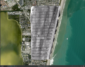
Onto the colorless images of LiDAR, photogrammetry (the science of taking measurements from photographs) and its aerial photos are then overlayed to create a colorful 3D visual of land features (Figure 3). This multi-image and overlapping photos fused together are called an orthomosaic image. Orthomosaic comes from the Greek orthos ‘straight, right’ and mosaic, meaning a pattern of smaller pieces creating a larger picture. In 2024, an estimated ten thousand pictures helped create the orthomosaic images of Cape Canaveral.

Smart Rain Garden Series
Join us for the next blog post in this series where we’ll talk about “What does all this mean for the City of Cape Canaveral?”. Go back to read the other posts in this series.
- What happens in the Veterans Memorial Park Smart Rain Garden during and after a rain event?
- What is a bioswale?
- How does filtration work in the Smart Rain Garden?
 1
1

