 Droppin’ In at the Smart Rain Garden
#1 in a series of 5 write-ups to introduce the processes and technology at work in the City of Cape Canaveral’s Veterans Memorial Park “Smart” Rain Garden. Please join us for all the posts in this series. The blog series was written by Mandy Baily with assistance from Dan Macchiarella and Tyler Deal with Embry-Riddle Aeronautical University, Zach Eichholz and Tim Carlisle with the City of Cape Canaveral, and Andrew Joesoef with Stetson University. All figures were created, and images taken by Mandy Baily unless otherwise noted.
What exactly happens in the Veterans Memorial Park “Smart” Rain Garden during and after a rain event?
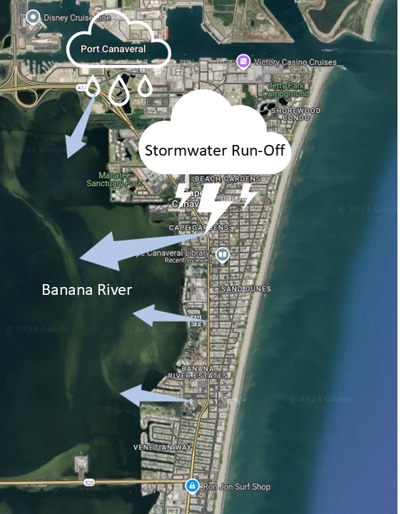
Let’s investigate the systems at work and explore technology’s part in making this Rain Garden ”smart”. If we were to follow the journey of raindrops, whether during small or large rain events, we’d quickly gather with others (water loves water), flow along the paths of least resistance, and then pool together in low-lying areas (Figure 1). The movement of stormwater run-off, also called sheet flow, runs quickly off impervious (impenetrable) surfaces such as streets and rooftops. From higher elevations, water continues its flow downhill, collecting sediments and contaminants as it goes.
Stormwater that travels over impervious surfaces ultimately enters larger water bodies like the Banana River (it’s not likely it would cross the higher dune heights to enter the ocean). As a side note, the Banana River is technically an estuarine lagoon or a brackish and shallow water body mostly separated from the sea by barrier islands. Once in the river, stormwater run-off adds unhealthy amounts of nutrients like those from surplus lawn fertilizers that exacerbate algal blooms, contaminants such as vehicle fluids and garbage, and excessive amounts of freshwater that imbalance the briny water (Figure 2).
Rain Gardens – A Nature-based Method of Reducing Stormwater Run-off
Rain gardens provide a nature-based method of reducing stormwater run-off by slowing sheet flow and capturing nutrients, contaminants, and sediments. A vital action of the rain garden is to allow the sandy soil to have the necessary time to filter out contaminants while plant roots take up excess nutrients. Of course, not every bit is sequestered, but it is a drastic improvement to the direct-to-river drainage of traditional infrastructure.
As stormwater flows along Taylor Avenue it arrives at either the Rain Garden’s east or west entrance drains (Figures 3 and 4). There is also another storm drain located in the Cape Canaveral Library parking lot that empties nearby the northernmost bridge in the park.
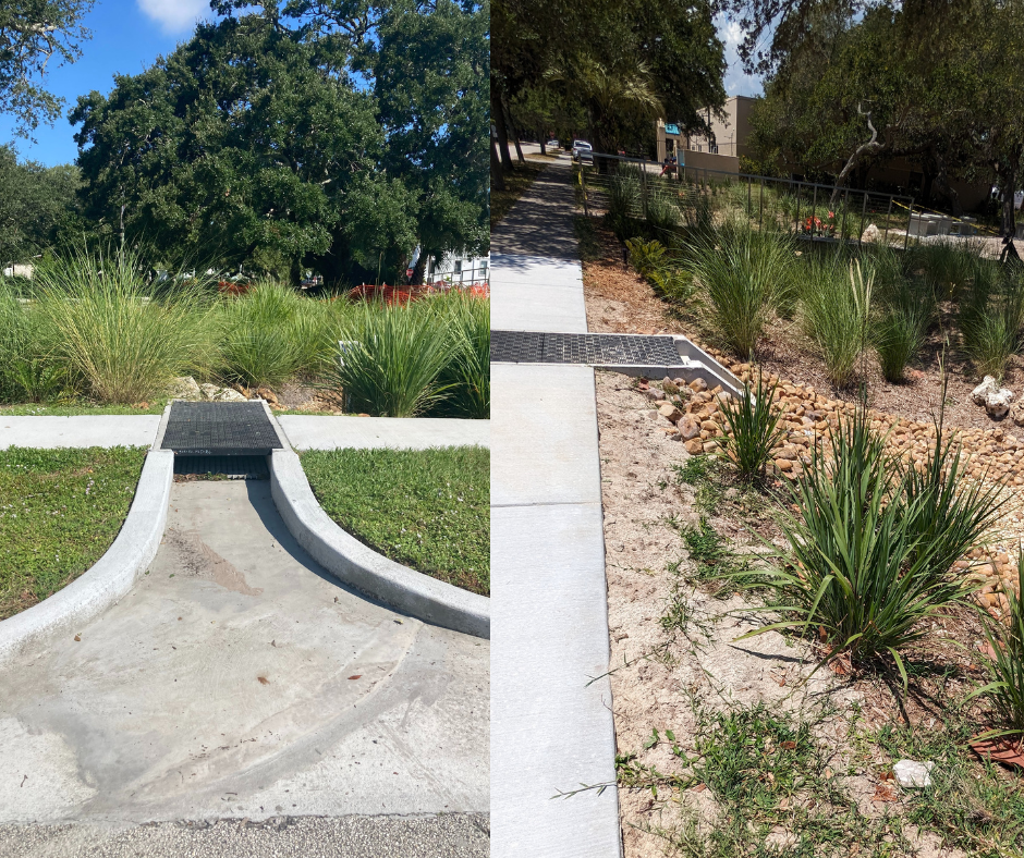
These “pre-treatment devices”, as they are collectively called, provide infrastructure that can handle heavy rain overflow without being washed out or too quickly filled in. The one that runs below the sidewalk on the southeast corner of the park is called a foxhole, while the circular structure with a grate on top on the west edge is referred to as a turret (Figure 5).
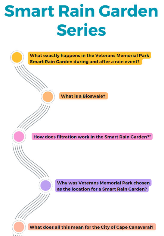
Smart Rain Garden Series
Join us for the next blog post in this series where we’ll talk about “What is a bioswale?”.
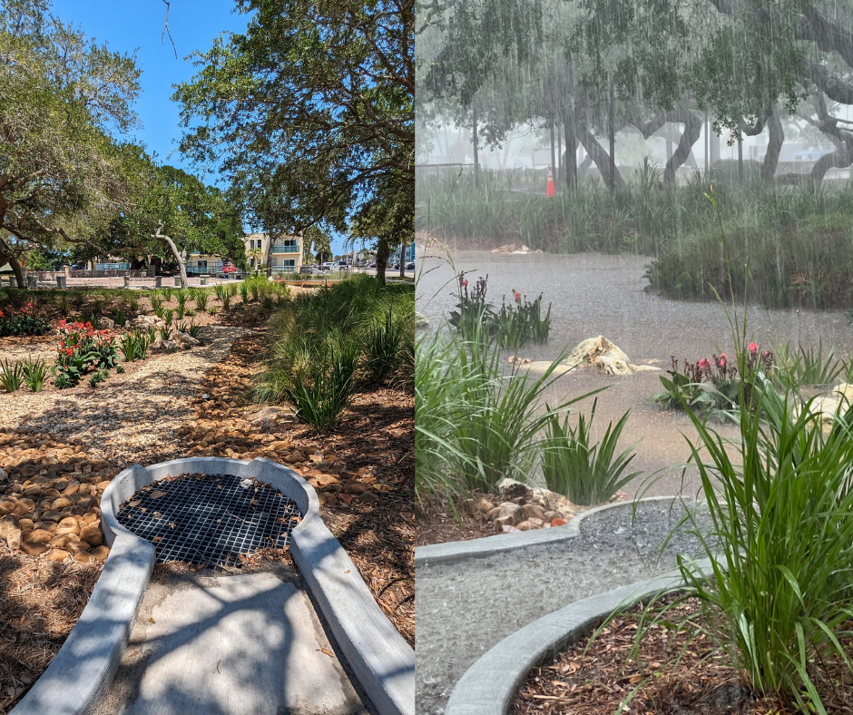
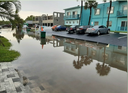
Right photo: Smart Rain Garden in action during rainfall event in May 2024.
Photo Credit: Cape Canaveral Resident
 1
1
