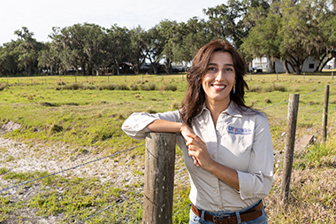
How do you measure the volume of a large lake when detailed maps of its underwater topography aren’t available? A new study led by Golmar Golmohammadi, assistant professor in the UF/IFAS Department of Soil, Water and Ecosystem Sciences, offers one solution. Instead of relying on bathymetric data — maps of lake depth that are often unavailable or outdated — the research team combined satellite observations with artificial intelligence to calculate lake volume. The approach uses the Google Earth Engine, or GEE, platform and a genetic algorithm, or GA, to analyze water surface areas and estimate how much water a lake holds.
A Smarter Way to Track Water
The key to the method is the Normalized Difference Water Index, or NDWI. It detects surface water by comparing reflected green and infrared light. Using GEE, the team processed NDWI data from satellite images to map water-covered areas over time. But mapping the surface is only half the challenge. To estimate volume, researchers applied a genetic algorithm, an AI technique inspired by natural selection. The algorithm tested thousands of possible volume estimates and refined them until the most accurate results emerged.
“This study shows how AI and cloud-based platforms like Google Earth Engine can make water monitoring faster, more accurate and more accessible worldwide,” Golmohammadi said. She conducts her research at the UF/IFAS Range Cattle Research and Education Center in Ona, Florida.
Traditional methods for estimating lake volume depend heavily on bathymetric surveys, which are costly, time-consuming and sometimes hard to obtain. By removing that barrier, the approach using GEE, AI and a genetic algorithm offers a practical solution for lakes in regions where bathymetric data are limited or unavailable.
“Being able to estimate lake volume without physical surveys opens up opportunities for water management in places where those resources simply don’t exist,” Golmohammadi said.
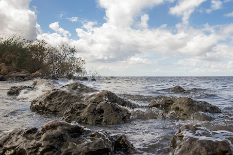
Case Study: Lake Okeechobee
To test the method, the researchers applied it to Lake Okeechobee, Florida’s largest freshwater lake. Its size and ecological importance made it a strong case study. The team showed the approach could track changes in water volume over time, providing insights for resource managers and policymakers. Their estimates closely matched results from traditional methods, confirming the approach’s accuracy and reliability.
While the study focused on Okeechobee, Golmohammadi said the method is scalable to large lakes around the world.
Freshwater availability is one of the world’s most pressing challenges, and tools for monitoring lakes are critical to sustainable use. By leveraging remote sensing, artificial intelligence and cloud-based computing, Golmohammadi and colleagues provide a pathway for more efficient, data-driven water management.
“Our goal is to equip scientists and policymakers with tools that are accurate and practical for global use,” Golmohammadi said. “This study is one step toward that future.”
The research team hopes to expand the approach to different types of lakes and reservoirs and to test additional machine-learning methods to improve precision.
The study, “Estimating Lake Okeechobee’s Water Volume Using NDWI-Derived Remote Sensing and Genetic Algorithm Optimization on Google Earth Engine,” was published in the journal Discover Water.
Featured image is UF/IFAS Photo of Lake Okeechobee by Tyler Jones.
 0
0
