Local officials discuss adaptation actions
As the rate of sea-level rise continues to accelerate along the Gulf Coast and other areas of the United States, the City of Cedar Key is making strides to address current and future flooding concerns. Last month, city commissioners conducted two Community Redevelopment Agency (CRA) workshops to discuss the next steps in the Resilient Cedar Key project.
During the meetings, Jeff Carney, Director of the Florida Institute for Built Environment Resilience (FIBER) at the University of Florida, summarized the flooding vulnerability assessment findings and discussed potential projects outlined in the Adaptation and Resilience Plan. Thomas Hawkins and Tom Ankerson of UF’s Levin College of Law Environmental and Community Development Clinic also presented information on how the City of Cedar Key can implement recommended adaptation strategies by integrating projects into the 2024-2054 CRA Plan. Recordings of both CRA workshops are available on the home page of the city’s website under “Zoom Recordings.” Meeting agendas and presentation materials, such as the draft CRA Plan, are also available online.
What is Resilient Cedar Key?
Since 2022, the city has partnered with the University of Florida on a two-part project that includes:
- Completing a comprehensive flooding vulnerability assessment (VA) for Cedar Key
- Creating an adaptation plan designed to increase local resilience
The Resilient Cedar Key project is funded by a grant from the Resilient Florida Program administered by the Florida Department of Environmental Protection (FDEP).
Vulnerability assessment completed
The Resilient Cedar Key team submitted a final draft of the VA to FDEP in March 2024. The assessment highlights problem areas prone to flooding and analyzes future risks. Once the VA is approved by FDEP, the city will be eligible to receive additional state funds to implement adaptation projects.
Finalizing adaptation strategies to reduce flood risk
The adaptation plan outlines practical projects, policy actions, and funding sources the community can pursue to reduce flood impacts. Throughout the assessment process, project team members at FIBER, the UF/IFAS Nature Coast Biological Station, and other partnering organizations sought feedback from residents and stakeholders in Cedar Key. This approach ensured that suggested actions and protective measures resonate with community values and needs. Based on the results of the VA, researchers divided the city into six zones characterized by unique vulnerabilities and adaptation objectives.
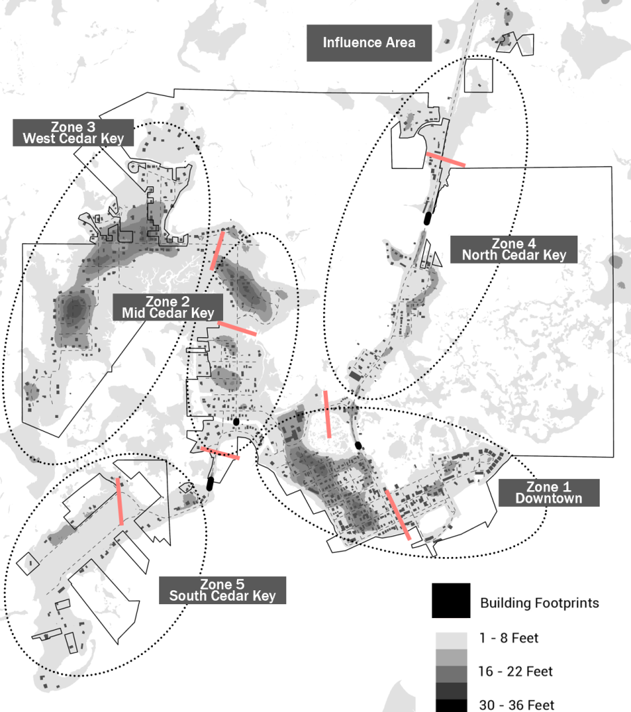
Within each zone, potential projects are identified by asset category (e.g., critical infrastructure, natural resources, etc.). A project’s assigned priority is based on the number of residents served, the time required to complete the action, and the potential for reducing flood risk. The 75 adaptation actions outlined in the draft plan emphasize the following project goals:
- Restore hydrologic connectivity among the islands that make up Cedar Key to minimize flood risk and shoreline stress.
- Strengthen Cedar Key’s transportation network to maintain connectivity during flood events and establish contingency routes for safe evacuations.
- Preserve district identities by customizing adaptation strategies to address specific concerns in each area.
- Safeguard natural ecosystems and critical environmental assets that sustain Cedar Key and its economy.
Cedar Key has already started implementing projects listed in the adaptation plan, such as relocating City Hall to higher ground.
Updates to FIBER’s flood mapping tool
In 2023, the project team launched a free, web-based mapping tool that allows users to view flood vulnerability maps and data from Cedar Key and surrounding areas. Developed by FIBER, the flood risk viewer helps residents, business owners, and local officials understand their risk and prepare for flooding events. App users can explore risk assessments across a range of scenarios accounting for sea-level rise, tide events, and storms from present-day conditions to 2070. For example, the Resilient Cedar Key team used project data to predict flood depths ahead of Hurricane Idalia last August.
While finalizing the Adaptation Plan, staff at FIBER have also updated the mapping tool to highlight specific adaptation projects. To learn more and access the dashboard, visit https://resilientcedarkey.web.app/.

What’s next?
The Resilient Florida Program grant portal is accepting applications for implementation projects through September 1, 2024. Cedar Key officials are again partnering with UF/FIBER to pursue funding to further design and carry out key projects from the adaptation plan.
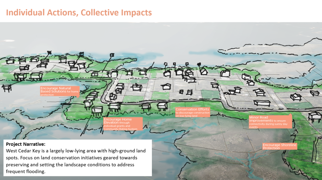
For individual homeowners, there are many recommendations in the adaptation plan related to personal actions that reduce future risks. These include raising homes and critical appliances above ground level, integrating salt-tolerant species into upland landscapes, and fortifying shorelines with resilient, nature-based approaches. Need help getting started? Reach out to Dr. Savanna Barry and/or Haley Cox for more information about recommendations for your property.
 3
3
