Birds, migration, and climate change. Mix them all together and intuitively, we can imagine an ecological train wreck in the making. Many migratory bird species have seen their numbers plummet over the past half-century – due not to climate change, but to habitat loss in the places they frequent as part of their jet-setting life history.

Now come climate simulation models forecasting more change to come. It will impact the strands of places migrants use as critical habitat. Critical because severe alteration of even one place in a strand can doom a migratory species to failure at completing its life cycle. So what aspect of climate change is now threatening these places, on top of habitat alteration by humans?
It’s the change in weather patterns and sea level that we’re already beginning to see, as the impacts of global warming on Earth’s ocean-atmosphere linkage shift our planetary climate system into higher gear.
For migratory birds, the journey itself is the most perilous link in the life history chain. A migratory songbird is up to 15 times more likely to die in migration than on its wintering or breeding grounds. Headwinds and storms can deplete its energy reserves. Stopover sites for resting and feeding are critical. And here’s where the Big Bend region of Florida figures prominently in the life history of many migratory birds.
According to a study published in March of this year (Lester et al., 2016), field research on St. George Island documented 57 transient species foraging there as they were migrating through in the spring. That number compares favorably with the number of species known to use similar habitat at stopover sites in Mississippi (East Ship Island, Horn Island) as well as other central and western Gulf Coast sites in Alabama, Louisiana, and Texas.
We now can point to published empirical evidence that the eastern Gulf Coast migratory route is used by as many species as other Gulf routes to our west. This confirmation makes conservation of our Big Bend stopover habitat all the more relevant.
The authors of the study observed 711 birds using high-canopy forest and scrub/shrub habitat on St. George Island. Birds were seeking energy replenishment from protein-rich insects, which were reported to be more abundant in those habitats than on primary dunes, or in freshwater marshes and meadows.
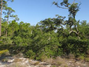
So now we know that specific places on our barrier islands that still harbor forests and scrub/shrub habitat are crucial. On privately-owned island property, prime foraging habitat may have been reduced to low-elevation mixed forest that is often too low and wet to be turned into dense clusters of beach houses.

Think tall slash pines and mid-story oaks slightly ‘upslope’ of marsh and transitional meadow, but ‘downslope’ of the dune scrub that is often cleared for development.
“OK, I get it,” you say. “It’s as if restaurant seating has been reduced and the kitchen staff laid off. Somebody’s not going to get served.” Destruction of forested habitat on our Gulf Coast islands has significantly reduced the amount of critical stopover habitat for birds weary from flying up to 620 miles across the Gulf of Mexico since their last bite to eat.
But why the concern with climate change on top of this familiar story of coastal habitat lost to development? After all, we have conservation lands with natural habitat on St. Vincent, Little St. George, the east end of St. George, and parts of Dog Island and Alligator Point. Shouldn’t these islands be able to withstand the impacts of stronger and/or more frequent coastal storms, and higher seas – and their forested habitat still serve the stopover needs of migratory birds?
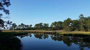
Let’s revisit the “low and wet” part of the equation. Coastal forested habitat that’s low and wet – either protected by conservation or too wet to be developed – is in the bull’s eye of sea level rise (SLR), and sooner rather than later.
Using what Lester et al. chose as a reasonably probable scenario within the range of SLR projections for this century – 32 inches, these low-elevation forests and associated freshwater marshes would shrink in extent by 45% before 2100. It could be less; it could be more. Conditions projected for a future date are usually expressed as probable ranges. Experience has proven them too conservative in some cases.
The year 2100 seems far away…but that’s when our kids or grandkids can hope to be enjoying retirement at the beach house we left them. Hmm.
Scientists CAN project with certainty that by the time SLR reaches two meters (six and a half feet) – in whatever future year that occurs, 98% of “low and wet” forested habitat will have transitioned to marsh, and then eroded to tidal flat.
But before we spool out the coming years to a future reality of SLR that has radically changed the coastline we knew, let’s consider where the crucial forested habitat might remain on the barrier islands of the next generation’s retirement years:
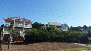
It could remain in the higher-elevation yard of your beach house, perhaps, if you saved what remnant of native habitat you could when building it. Or if you landscaped with native trees and shrubs, to restore a patch of natural habitat in your beach house yard.

We’ve all thought that doing these things must be important, but only now is it becoming clear just how important. Who would have thought, “My beach house yard: the island’s last foraging refuge for migratory songbirds!” even in our most apocalyptic imagination?
But what about coastal mainland habitat?
The authors of the March 2016 St. George Island study conclude that, “…adjacent inland forested habitats must be protected from development to increase the probability that forested stopover habitat will be available for migrants despite SLR.” Jim Cox with Tall Timbers Research Station says that, “birds stop at the first point of land they find under unfavorable weather conditions, but also continue to migrate inland when conditions are favorable.”
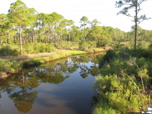
Migratory birds are fortunate that the St. Marks Refuge protects inland forested habitat just beyond coastal marshland. A longer flight will take them to the leading edge of salty tidal reach. There the beautifully sinuous forest edge lies up against the marsh. This edge – this trailing edge of inland forest – will succumb to tomorrow’s rising seas, however.

As the salt boundary moves relentlessly inland, it will run through the Refuge’s coastal buffer of public lands, and eventually knock on the surveyor’s boundary with private lands. All the while adding flight miles to the migration journey.
In today’s climate, migrants exhausted from bucking adverse weather conditions over the Gulf may not have enough energy to fly farther inland in search of forested foraging habitat. Will tomorrow’s climate make adverse Gulf weather more prevalent, and migration more arduous?
Spring migration weather over the Gulf can be expected to change as ocean waters warm and more water vapor is held in a warmer atmosphere. But HOW it will change is difficult to model. Any specific, predictable change to the variability of weather patterns during spring migration is therefore much less certain than SLR.
What will await exhausted and hungry migrants in future decades? Our community decisions about land use should consider this question. Likewise, our personal decisions about private land management – including beach house landscaping. And it’s not too early to begin.
Erik Lovestrand, Sea Grant Agent and County Extension Director in Franklin County, co-authored this article.
 0
0
