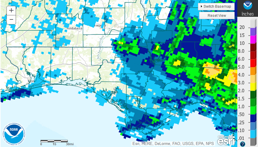
October Summary
October is historically one of the driest months of the year in the Florida Panhandle. Much of the western portion of the Panhandle, however, was “O-for-October,” with little to no rainfall this year. Northern Jefferson County did receive more than 3″ of rain (tan) in October, but the majority of the region had less than 0.25″ (light blue) for the month.
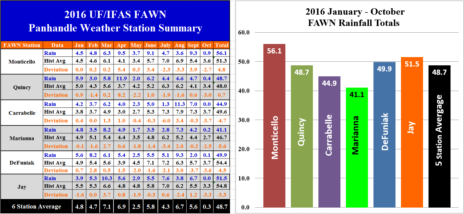 The University of Florida’s Florida Automated Weather Network (FAWN) stations recorded limited rainfall in the month of October as well. The highest total rainfall in October was recorded at the Monticello Station with only 0.9″, while both the Jay and Carrabelle stations did not record any rainfall for the month at all. The average for all six stations was only 0.3″, which is more than 3″ below average. For the year the Monticello station had the highest total with 56.1″ through the first 10 months of 2016, which is almost 5″ above historic average for this location. The driest location remained Marianna with only 41.1″ for the year, which was 5.6″ below average for that location. To date, only the Monticello and Quincy stations have recorded above historic average rainfall for the year.
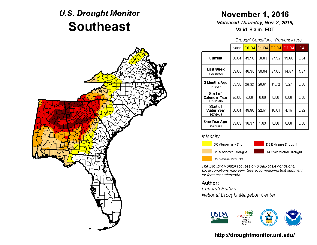
Drought conditions in the Southeast grew even worse in October. The drought that has been so severe in northern Alabama and Georgia has expanded into the Florida Panhandle. It has been several years since the Panhandle has been in the moderate drought category of the Drought Monitor.
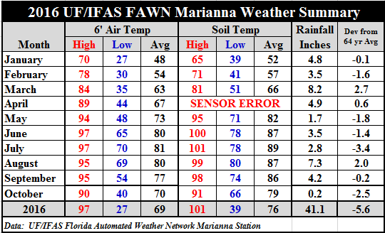 Temperatures did moderate some in October, but it was certainly warmer than normal as was forecasted. Average air temperatures fell 7° from 77° in September to 70° in October, while soil temperatures dipped 5° from 86° down to 76°. This was 2° warmer for the average air temperature and 5° warmer average soil temperature than last year.
La Niña Watch is Back On
ENSO-Neutral conditions were observed during September, with negative sea surface temperatures anomalies expanding across the eastern equatorial Pacific Ocean by early October. All of the Niño regions cooled considerably during late September and early October. La Niña is favored to develop (~70% chance) during the Northern Hemisphere fall 2016 and slightly favored to persist (~55% chance) during winter 2016-17. Climate Prediction Center
Looking Ahead – 3 Month Forecast
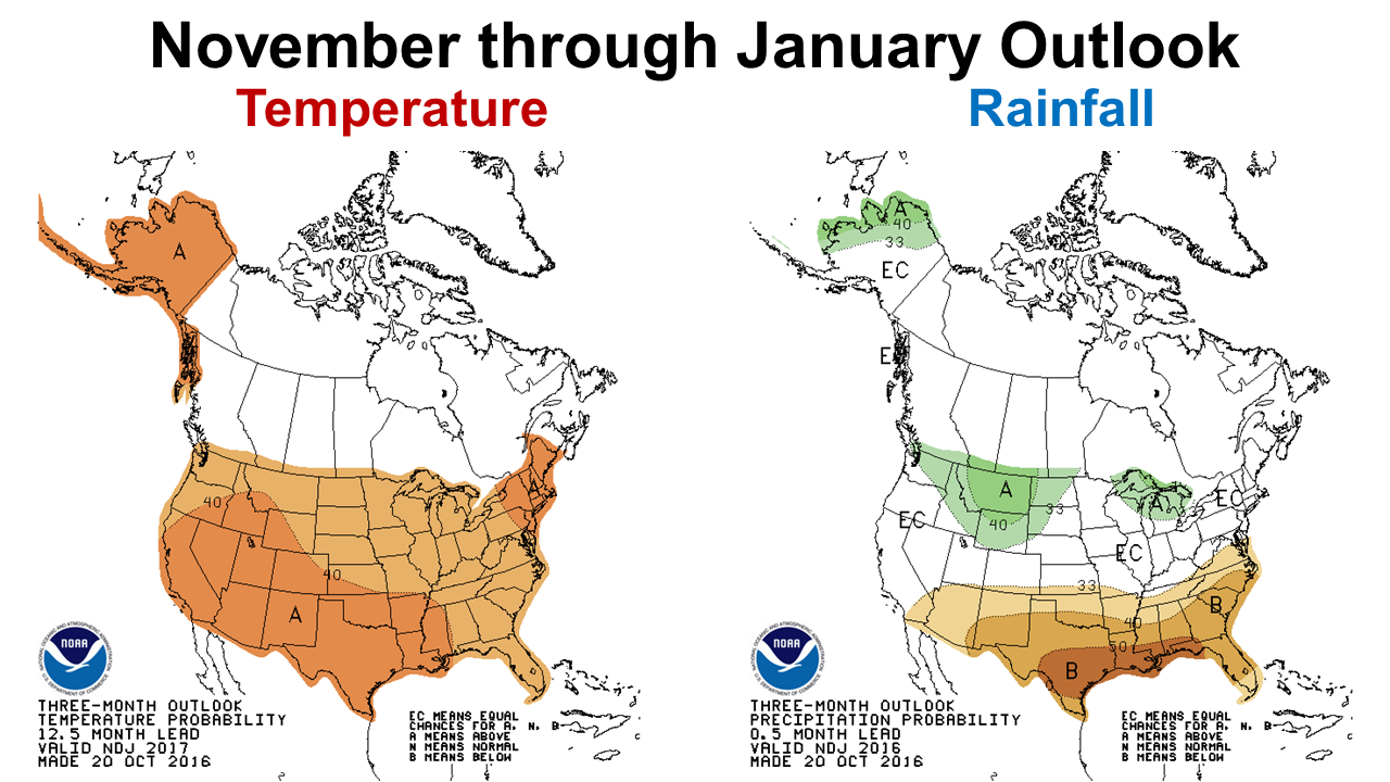 The outlook for the next three months is not very encouraging for cool-season forage or crop production. The CPC is predicting warmer than average temperatures and well below average rainfall from November though January. Clearly the forecast images above and the drought forecast below are showing the impact of the anticipated La Niña.
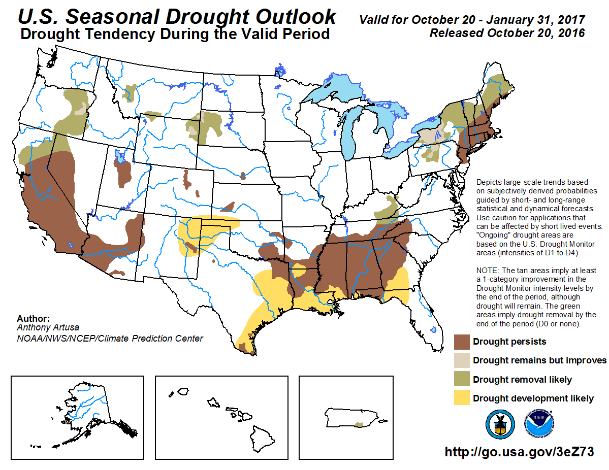 Not only is the current situation serious but is forecasted to continue into the winter months. It does not look encouraging for winter grazing, or whea or oat grain production this year. Livestock producers counting on winter grazing for supplementation may be required to invest in additional purchased hay and by-product feeds, if pastures are already planted. Producers who have been waiting on rain to plant, may want to return seed and exchange them for supplements. All indications are that the months ahead will remain drier than normal. Hopefully things will improve in 2017.
 0
0
