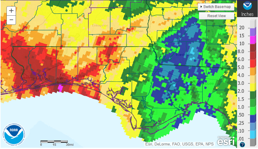
 The crazy weather year continued in October. I suspect 2015 will be remembered as the year when it did not rain when we wanted it to in the Panhandle. There was quite a difference in the rainfall that fell in the western Panhandle as compared to the eastern counties. The variation ranged from over 8 inches to as little as 1/4 inch for the month of October.
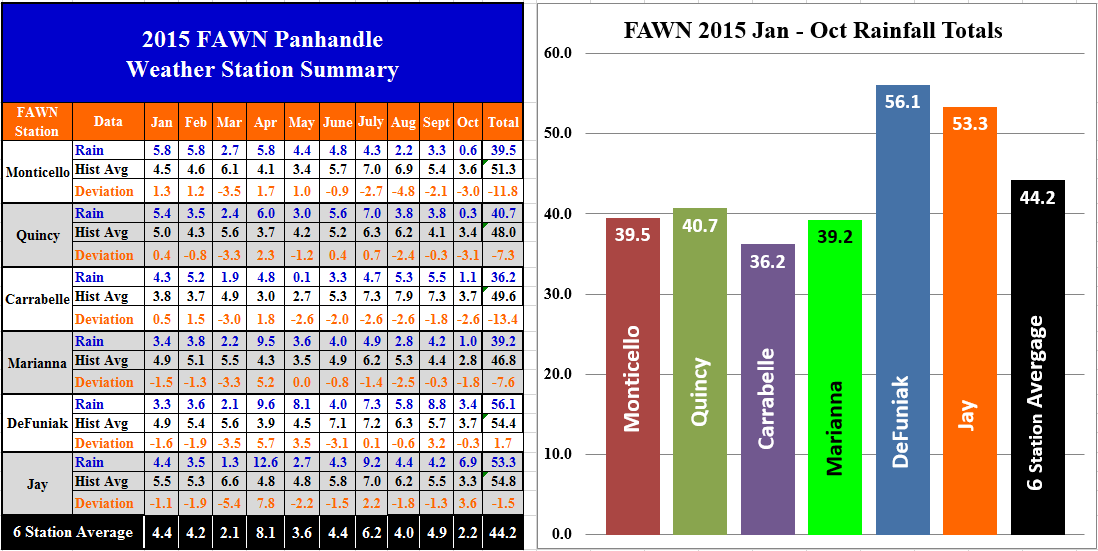
The six Florida Automated Weather Network (FAWN) stations also documented this variation in rainfall for the month of October. The driest location was Quincy where 0.3″ fell and the wettest was Jay where 6.9″ fell in October. Through the fist 10 months of 2015, only the DeFuniak station was ahead of normal, while both Monticello and Carrabelle were almost a foot behind average for those locations.
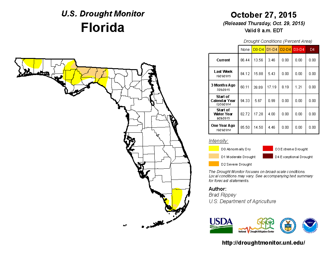 The Florida Drought Monitor shows the disparity of moisture in the region as well, with portions of Jackson, Gadsden, Leon, and Jefferson in the moderate drought category.
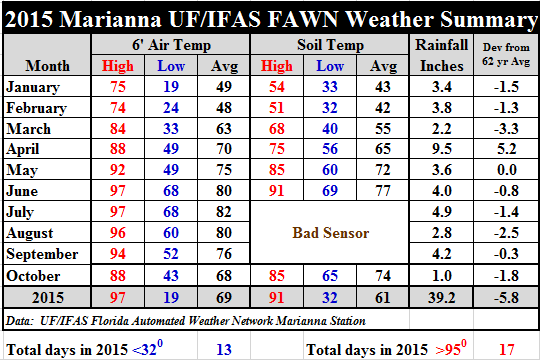 Temperatures did cool off some in October. Lows in the 40’s were short lived, but did drop the average air temperature down eight degrees from September.
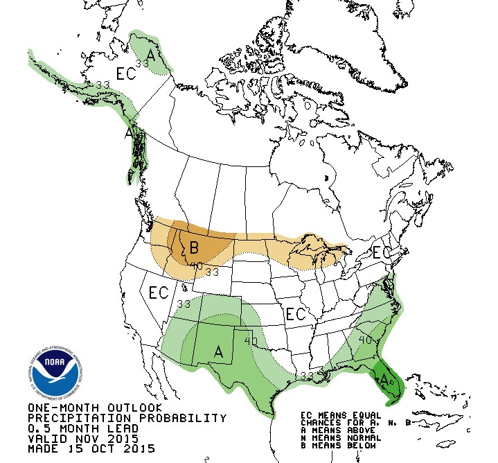 The forecast for the month of November suggests that the El Niño is going to impact the area with above average moisture.
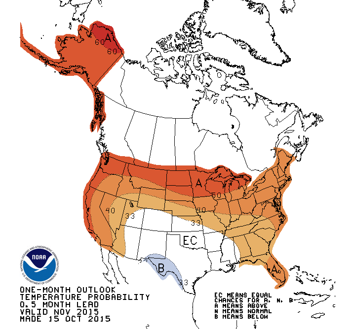 Temperatures for November are expected to remain above average. While these forecasts should encourage cool-season crop growth, the extra rainfall could further delay and lengthen crop harvests.
Most farmers are beginning to lose hope of having the crops all in by Thanksgiving, because of delays that heavy rains in September and October caused. It has been a dry year, yet right when we need it to be dry, at harvest time, heavy rains have halted peanut and cotton pickers. At least winter pastures that have already been planted are not lacking for moisture, but with cotton and peanuts still waiting for harvest, many acres are still yet to be planted. Again 2015 has been a crazy weather year. Who knows what 2016 will bring?
 0
0
