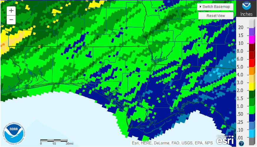
November was a very dry month across the Florida Panhandle. For a good portion of the region the limited rain that fell came on November 30, the very last day of the month from a single cold front. For the month, the vast majority of the region received less than 1″ (blue and bright green). Small pockets had higher totals (dark green), but were still below 2″ in November.
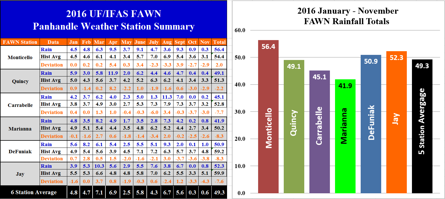 The University of Florida’s Florida Automated Weather network (FAWN) has six stations across the Panhandle. it is clear that the November 30 cold front brought more rain to the western portion of the Panhandle and diminished as it moved east. The six stations collected an average of 0.6″ for the month of November, with 1.0″ at DeFuniak which was the wettest location, but only 0.2″ at Carrabelle. For the year thus far, January through November, the station in Monticello has recorded 56.4″ of rain, which is actually 2″ above historic average for this location. Much of this extra rain came from Hurricane Hermine. Only 41.9″ of rain has been collected in Marianna, which is 8″ below historic average for this location. The average across all six stations was 49.3″, which is more than 5″ below historic average through November.
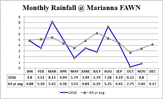 Looking at the monthly rainfall totals compared to historic average is also important. The chart above shows that, at the Marianna FAWN Station, 15″ of the 42″ total rainfall in 2016 fell in March and August. The rest of the year was average or well below average for this location. This chart shows why annual rainfall totals don’t always tell the whole story. While adequate soil moisture was available at planting, crops suffered through the heat of summer with reduced rainfall. So there were 8″ fewer inches of rain for the year that ended in serious drought. The record low October rainfall at the Marianna station was 0″ in 1961, and the record low for November was 0.21″ in 1959. However, the two month total of only 1.02″, in October and November 2016, was the driest October-November on record in the 64 year history of data collected at this location.
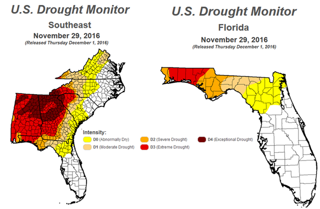 The U.S. Drought Monitor highlights how serious the current drought is across the Southeast. More of Florida has been categorized as under drought conditions, with severe and extreme drought conditions across much of the Florida Panhandle. It will take much more rainfall than what little fell with the recent front to improve this status. The current La Niña has clearly influenced rainfall for the Southeast thus fall.
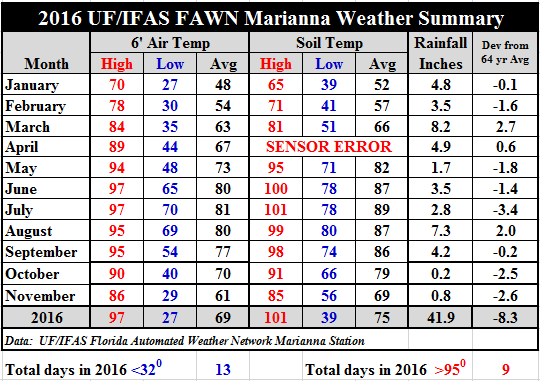 Temperatures have cooled considerably as compared to October. The average air temperature dropped from 70° in October to 61° in November, and the average soil temperature dropped 10° from 79° to 69°. While not extreme, there were three nights that dipped below freezing, with a low of 29° on November 21st. When compared to the high of 86° back on November 3rd, that is a large temperature spread for a single month.
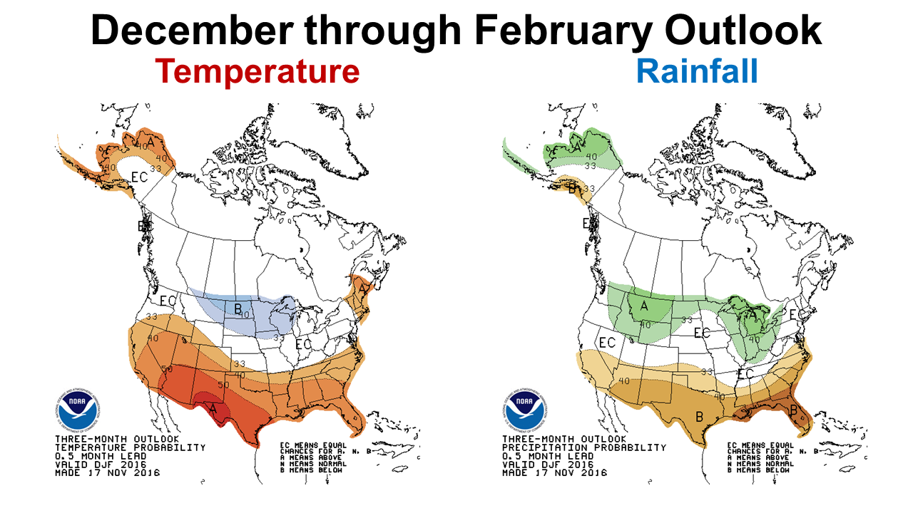 The Climate Prediction Center’s (CPC) outlook for the next three months is not very encouraging. Warmer than average temperatures is not such a bad thing, but well below average rainfall is not good at all.
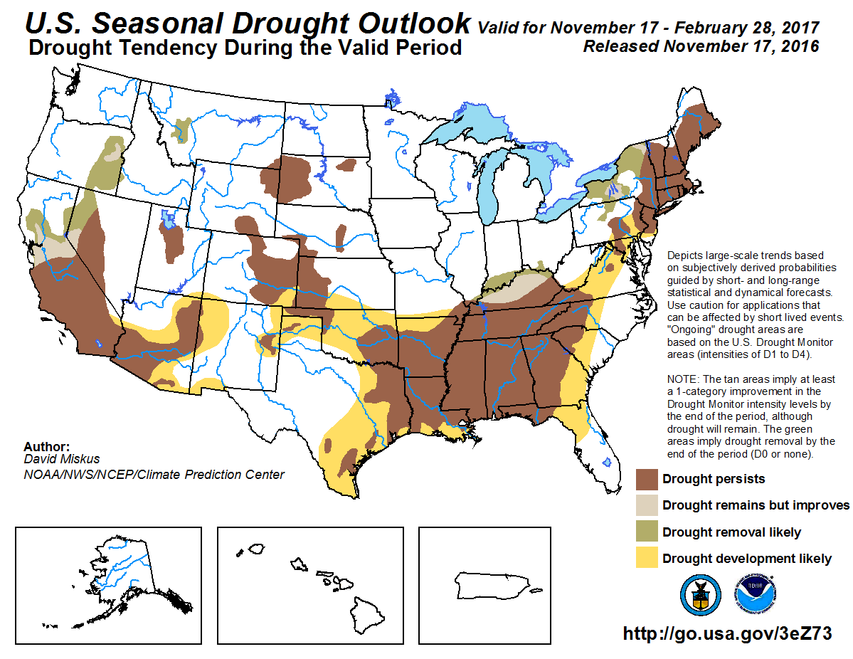 As you can see the CPC’s Seasonal Drought Outlook through the end of February is not encouraging either. The one month outlook for December did show some slight improvement, but it does not look like we will see normal rainfall again until Spring. From both of these graphic forecasts it does not appear that this will be a good year for winter grazing or grain crops. Certainly fields with better moisture holding capacity would be the best choices, if you do decide to gamble on planting cool season forages or crops. Sandy, well drained fields could be even more risky. Who knows what the future will hold, but the best scientific guess does not look favorable at this point.
 0
0
