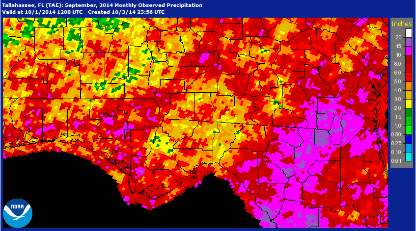
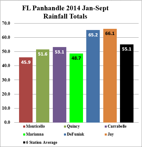
Many areas of the Panhandle finally got more normal rainfall again in September, after two months of dry weather. Like previous months, however, there was considerable variation. The areas highlighted in yellow or green had less than 3″, while the areas in hot pink had over 10″ in September. The Florida Automated Weather Network (FAWN) data also show some variation across the six Panhandle sites.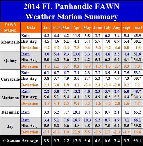 The highest rainfall total for the first nine months is the Jay location, but it was the only location that had below average rainfall for September. For the month, the wettest location was Carrabelle with 7.5″. The driest locations were DeFuniak and Jay with only 4.1 inches of rain recorded in September. For the year, however, these locations had the highest totals, with DeFuniak measuring 65.2 ” and Jay 66.1″. Through the first nine months the Marianna only reported 48.7″ and the Monticello station only 45.9 inches. The average of all six stations was 55.1″ of rain, from January through September.
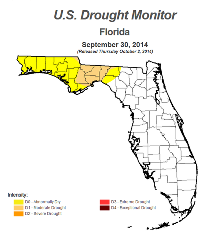
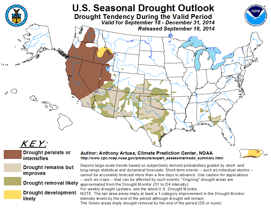
 According to the US Drought Monitor the eastern portion of the Panhandle is experiencing moderate drought, and the rest of the Panhandle is abnormally dry at the end of September.
 There is good news, however. The Climate Prediction Center is expecting improvement in drought conditions for the Panhandle through the end of the year. They are not expecting as much improvement for Southwest Georgia.
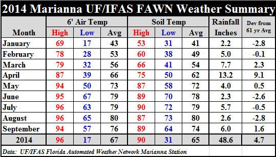
 Cooler weather returned in September. For the first time since May, there were low temperatures in the 50’s. The average air temperature dropped four degrees from 80 down to 76, and average soil temperatures dropped six degrees from 80 to 74.
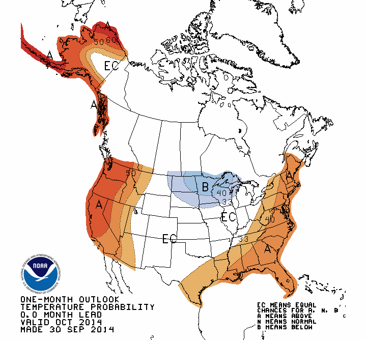
 Even though temperatures have been cooling off significantly lately, it may be short lived. The NOAA temperature outlook for October is predicting above average temperatures for much of the southeast.
El Nino Update
It does not appear that El Nino will have a major impact on our winter crops based on the following information from the International Research Institute. Even a weak El Nino could mean slightly more rainfall than normal through the late fall and winter.
During August through early September the observed ENSO conditions moved to those of a borderline El Niño. Most of the ENSO prediction models indicate weak El Niño conditions during the September-November season in progress, strengthening slightly and peaking at weak strength during winter 2014-15 and lasting into the first few months of 2015. Source: IRI
 0
0
