 January 2014 was a rough month in the Florida Panhandle. Unusually cold weather kicked off the month and then sleet, ice and even a little snow shut down major highways.
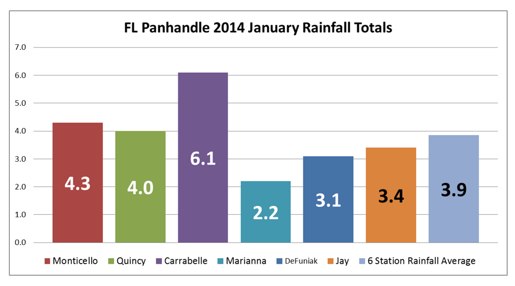
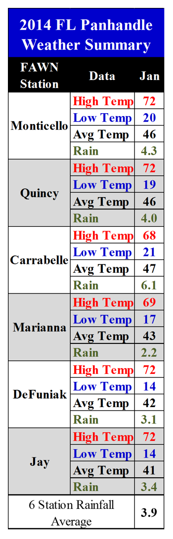
For the month of January, the wettest location was Carabelle with 6.1 inches of rainfall, and the driest was Marianna, collecting only 2.1 inches. The average was 3.9 inches, for all six Florida Automated Weather Network (FAWN) locations across the Panhandle.
The real weather story was not the rainfall but the cold temperatures. Jay was the coldest location with a low of only 14 degrees and a monthly average temperature of just 41 degrees. As would be expected, Carrabelle near the coast was the warmest location, but even there it dropped down to 21 with a 47 degree average for the month. The temperature summaries from the six stations show how strange weather can be. DuFuniak had the widest range with a high temperature of 72, and a low of 14 degrees all in the same month.
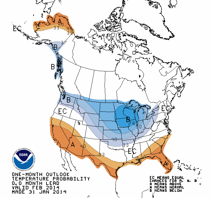
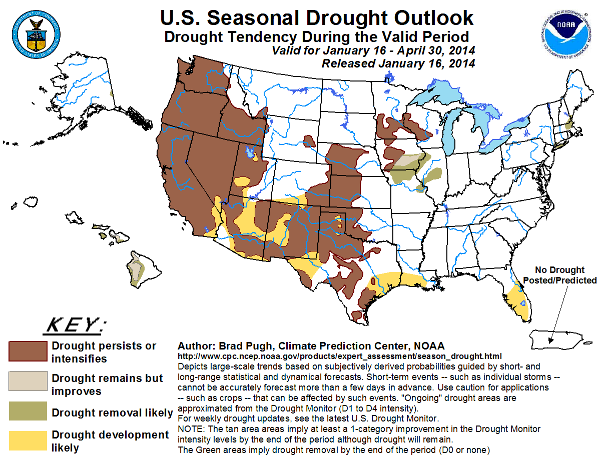
The NOAA One Month Temperature Outlook predicts above average temperatures for February in the Southeast. If they are correct, it may be that the extreme cold is over for our area this winter. NOAA has also changed their prediction of anticipated drought as seen in the bottom graphic. At the end of 2013, NOAA was predicting developing drought in the Southeast, so this is good news. (click on the following graphics to enlarge for better viewing)
Related articles of Interest:
History of Snowfall in North Florida
2013 Panhandle FAWN Weather Summary
 0
0
