David Zierden, Florida State Climatologist
El Niño fails to materialize in the Pacific Ocean
Following two consecutive years of La Niña (colder than normal sea surface temperatures along the equator in the eastern and central Pacific), ocean temperatures began to warm over the summer and approached El Niño thresholds in July and August. At that time, many modeling centers and NOAA were predicting that waters would continue to warm and El Niño would continue to build and impact our fall, winter, and spring climate patterns.
In the last few weeks, however, ocean temperatures have cooled in the eastern and central Pacific and there are no significant warm anomalies anywhere to be found. Atmospheric indicators also fail to show any signs of El Niño, including the SOI actually turning positive in September (strong negative values are indicative of El Niño). Most importantly, it takes disruptions in the trade winds in the central and western Pacific (westerly anomalies) to cause the downwelling Kelvin waves that travel east and reinforce a building El Niño. We have not seen any such wind anomalies in months.
Climate Outlook
Neutral Pacific means more variable weather patterns over the Southeast. With Neutral conditions firmly in place in the tropical Pacific Ocean, there is no indication that temperatures or rainfall will be either above normal or below normal. More variable weather is common in neutral winters, with periods of very cold weather mixed in with warm spells.
Near-normal rainfall is the best forecast, as there is no El Niño or La Niña to tip the balance towards wetter or drier than normal. Keep in mind that winter is the critical recharge period for surface and groundwater in Alabama, Georgia, and the Carolina’s. The good coverage and slow soaking nature of winter rainfall that is cause by fronts and low pressure systems is much more effective at refilling rivers, lakes, reservoirs, and aquifers than the scattered summer thundershowers. In addition, the colder temperatures and mostly dormant vegetation result in much less loss to evapotranspiration. Normal or above normal rainfall during the coming season is critical to easing the prolonged drought conditions these states have experienced.
For more detailed information on climate impacts in the Southeast, see the Climate Risk tool:Climate Risk Tool.
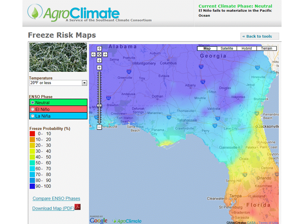
Severe freezes that can impact citrus and other winter crops are more likely this year. Studies have shown that of the dozen or so catastrophic freezes that have impacted the Florida citrus industry since the late 1800’s, nearly all of them have occurred during times of Neutral conditions in the Pacific. We believe that the predominant jet stream patterns set up by El Niña and La Niña tend to “block” the major intrusions of Arctic air masses that cause these severe freezes. With neither in place this season, the jet streams are more susceptible to the dramatic dips, or “troughs” that can allow these air masses further south. For more information, see our winter freeze forecast.
 0
0
