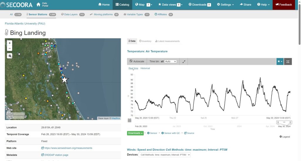
Within the past year, two new water level sensors and accompanying weather stations have been installed in Flagler County. The data from these water level sensors and accompanying weather stations is available to the public in real-time. In addition, the data collected over time will help us better understand flooding and sea level rise in our communities.
These sensors are part of the SECOORA (Southeast Coastal Ocean Observing Regional Association) Southeast Water Level Network. SECOORA is supporting the installation and long-term operation of approximately 200 new water level stations in the southeast United States, from Florida up through North Carolina. The goals of the program are to expand the real-time water level coverage throughout the southeast and to provide data that will help emergency managers, design engineers, and the public be informed and make decisions regarding coastal flooding.
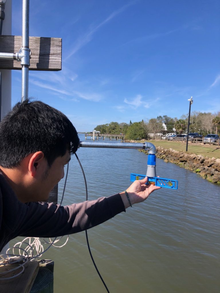
Each station includes a water level sensor, a weather station, and a solar panel with a battery that can hold enough charge to power the station for over a month. The data is automatically sent from the sensors to the public-facing websites every five minutes. The public can access the data from our local sensors through the SECOORA website or the SenseStream website. In addition to the water level data, users will find environmental conditions including air temperature, wind speed and direction, solar radiation, and the rate and total precipitation. Users can search for data from today, the past week, past month, or a custom date range. The websites can also produce graphs or allow users to download data.
Like most great things, the installation of these sensors came about through a series of collaborations. Several universities are involved in the development, installation, and monitoring of these sensors, including the Florida Atlantic University Institute for Sensing and Embedded Network Systems Engineering (I-SENSE lab). Based in south Florida, the I-SENSE lab was eager to connect with communities further north in the state to expand the network of sensors they have built.
One such connection was with the Flagler County Coastal Engineer, who agreed that this would be a beneficial resource for the county as they continue to work towards understanding local coastal conditions and increasing resiliency. Shortly thereafter, the I-SENSE lab drove up to Flagler County to install two sensors at the county park of Bing’s Landing and at the University of Florida Whitney Laboratory for Marine Bioscience.
As the Florida Sea Grant Agent with UF/IFAS Extension Flagler and Volusia Counties, I am happy that I was able to facilitate connections that led to these collaborations and resources for our communities. Some of my colleagues in the panhandle of Florida also worked with the I-SENSE lab to get water level sensors installed in Okaloosa County! If you work with a coastal community in Flagler or Volusia Counties interested in increasing their access to local water level data, please reach out to c.kovacs@ufl.edu.
 3
3
