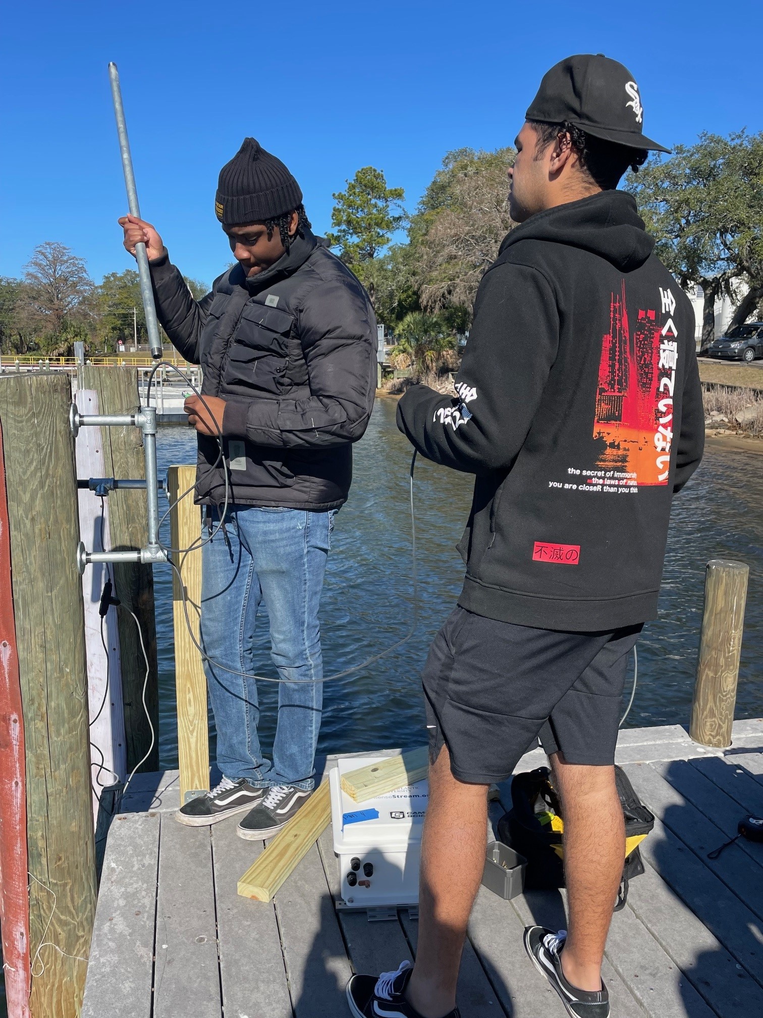
Somewhere on the road between Okaloosa County and Boca Raton, three guys are driving a van and their equipment all the way back to the Florida Atlantic University (FAU) campus. An engineering professor and two undergraduate students (one in mechanical engineering, another in computer science), have been on a road trip to the frozen tundra of northwest Florida to install the latest iteration of a large grant-funded project.
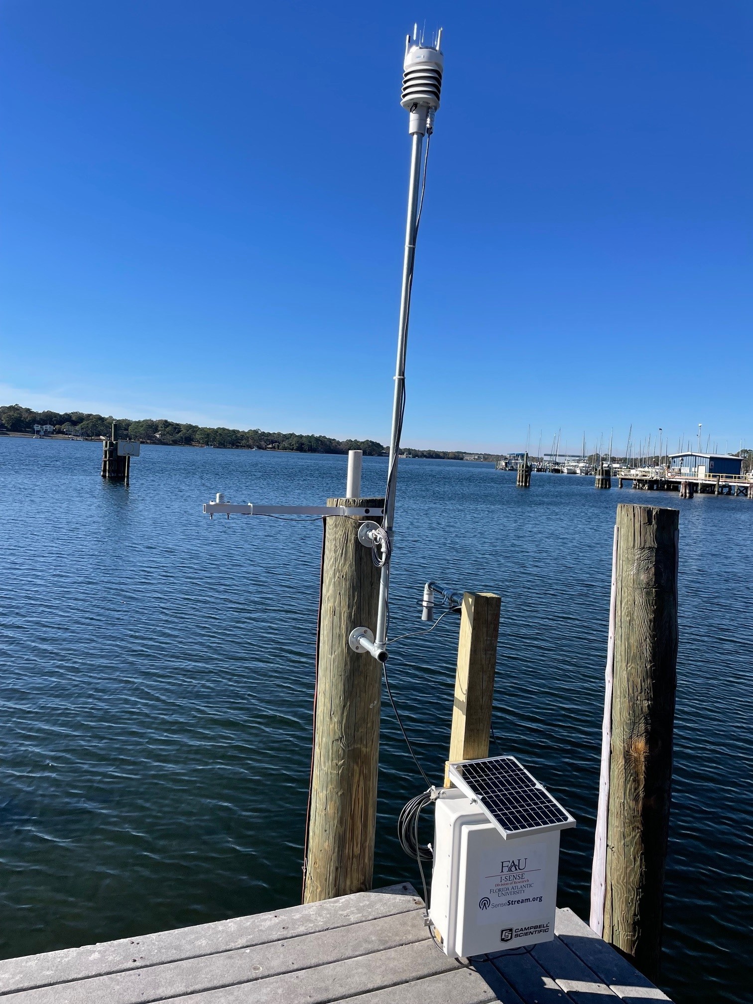
Part of the Southeast Water Level Network, the project is funded by and partnered with the Southeast Coastal Ocean Observing Regional Association (SECOORA), and they aim to install 700 water level and weather monitoring stations around Florida. Provided at no cost to communities interested in partnering with them, these digital stations are installed onto existing docks and will post real-time data on 24 weather and water level parameters. Ideally, they can also serve as early warning systems for incoming floods, extreme rainfall, and changes in sea level.
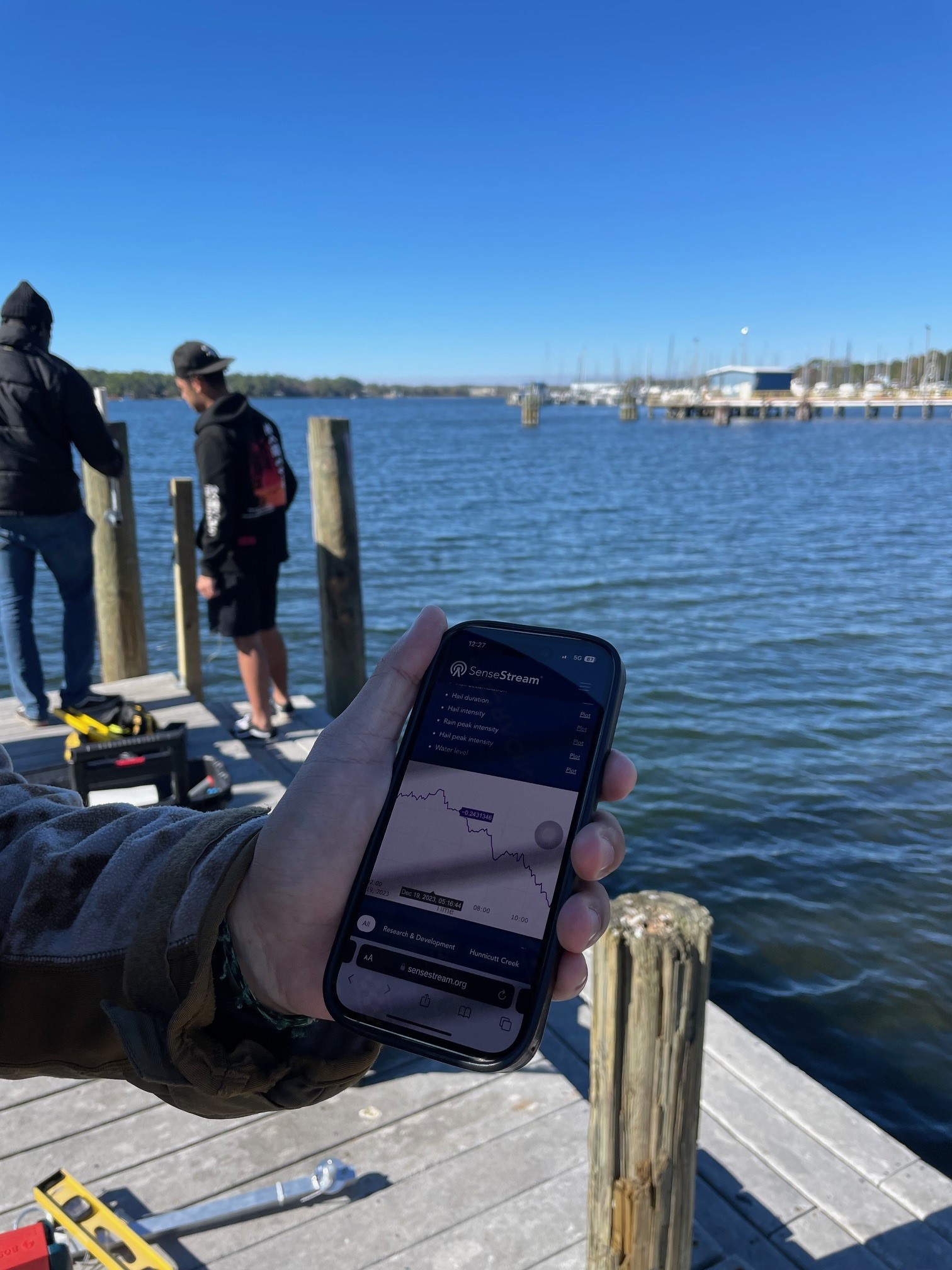
The equipment installed by the FAU team yesterday afternoon on Boggy Bayou in Niceville is already transmitting data to a website accessible to residents, scientists, and community decision makers alike. In fact, I can tell you at the exact time of writing, the air temperature at Lions Park in Niceville is just above 12.1°C (53.8°F), having increased from a low of 1.9°C (35.4°F) at 4:28 am this morning! The monitors are powered by solar panels and use a variety of sensors to transmit data every 5 minutes, creating an easy-to-read chart for each parameter. Nearly 200 locations are currently listed on the site, all with updated information. At least three more monitors will be installed this summer in Escambia County, with plans for one on a public pier along the Escambia River and two at private property on Bayou Davenport and Perdido Bay.

The overall goals of the program are to produce a network of data analysts and community stakeholders who can use the information to improve local decision making and keep nearby residents safe. An example of this might be closing a road if water levels are approaching flood conditions, or warning downstream locations of impending floodwater due to extreme rainfall rates. With up-to-the-minute data, quicker and more accurate decisions can be made, avoiding property damage and loss of life. By working closely with nearby stakeholders, local eyes are on each set of monitoring devices and partners can repair and update equipment or notify the FAU team quickly if there are mechanical problems or damage. The data collection systems also serve as an excellent teaching tool for students and interested residents.
South Carolina is about a year ahead of us on this project, and their grant managers have produced some excellent websites explaining the goals and functions of the monitors. Taking field data can be expensive and time-consuming, so much work has gone into remote sensing to reduce effort and increase the accuracy of data collected.
 14
14
