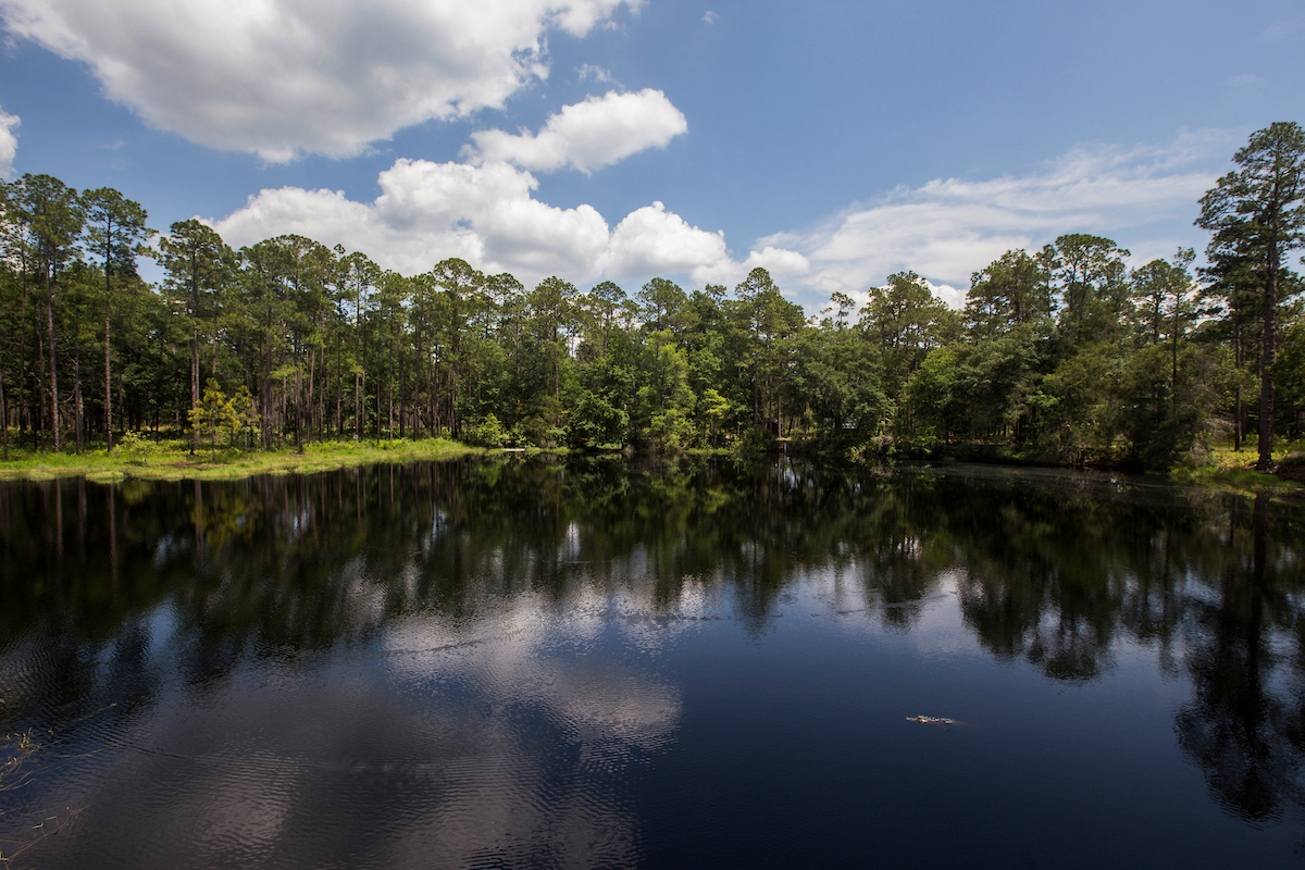
GAINESVILLE, Fla. — The project started as many seem to do among curious people — hanging out and discussing unanswered questions. In this circumstance, that meant an opportunity to check out an oft-shared tale that Lake Mize in the Austin Cary Forest could be the deepest lake in Florida.
“I said, ‘No, no it’s not,’ you know, I said, ‘We’ve measured it before,’” distinguished School of Forestry, Fisheries, & Geomatics Sciences (FFGS) alumnus and Measutronics President Lou Nash said, referring to remarks between himself and FFGS Director Red Baker during a spring event. “That just led to a discussion (and) we shared the data set with him.”
However, one aspect of that data set, from 2016, was that the data collected came when the lake was well below normal depth. Nine years out, and this time with more-advanced technology, there was a better chance to get an accurate depth measurement and an improved view of how things looked underwater.
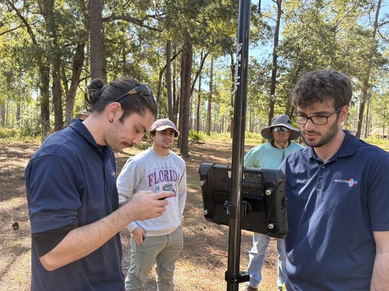
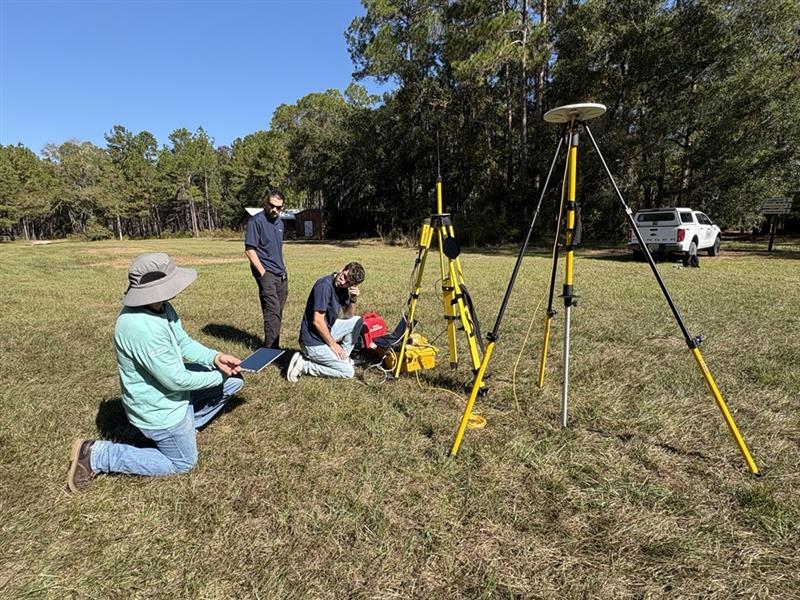
Nash and Parker Rowe of Measutronics, with Alejandro Perez and Frank Sawyer of FFGS, are working on the project, one of the end goals of which is to create an interactive educational experience regarding the lake at the lodge and conference center that abuts it.
“What, after, we’re doing is creating a kind of an interactive display before you step out the door (to the deck overlooking the lake) — a big screen where you can go in and touch and see the 3-D image of the lake and spin it and do those kind of things,” Nash said.
But wait, there’s more.
“Then also on the same display, the forestry guys talk about the habitat and such at Lake Mize, and the fisheries guys talk about whatever critters and stuff are in that lake…,” Nash said. “It’s meant to be a means to kind of showcase the entirety of the programs out there.”
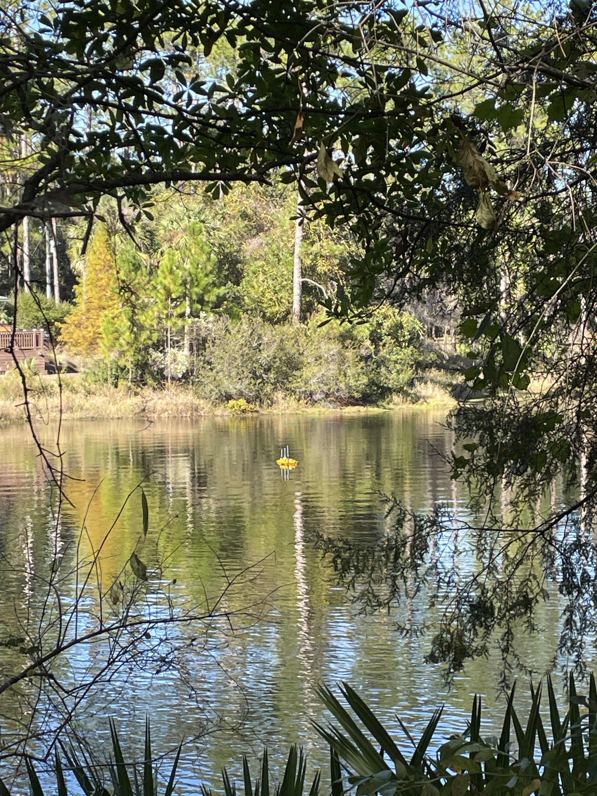
The starting point, though, is the 3D imagery. Shots captured with high-tech equipment, including an unmanned surface vehicle, show what looks like a champagne glass-shaped void with a stem that goes down into a bulb.
In the next phase of the project, researchers will drop a scanning sonar down to measure the size of the bulb. A straight-ahead mission, but not without its mysteries.
“Part of that, we’re also told that that hole kind of plugs up, and the plug moves up and down,” Nash said.
The question here is whether researchers can get the sonar to the bulb, or whether the plug is too far up and blocks the ability to do those readings.
Right now, it appears the maximum depth is around 86.32 feet below the surface. Deep Lake in Big Cypress National Preserve — which, like Lake Mize, is a water-filled sinkhole — is 90 feet deep and believed the deepest lake in the state.
“I mean, I was a little surprised because (the Lake Mize reading makes it) pretty close to the deepest lake in Florida,” Sawyer said, noting the plug depth and water level vary quite a bit.
 1
1
