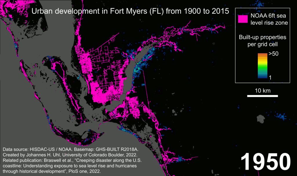
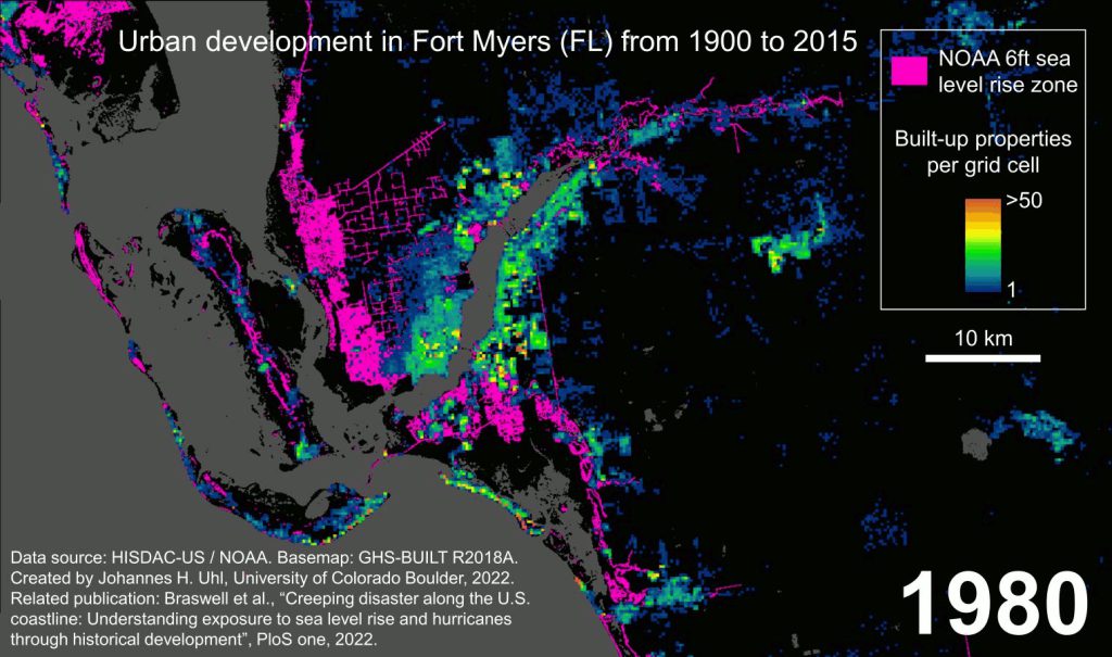
- Researchers analyzed historical building trends on U.S. coastlines in the projected sea level rise zones.
- The scientists found that areas within projected sea level rise zones developed more quickly and were more dense than inland urban areas.
- The findings suggest that communities planning for sea level rise will likely need to emphasize adapting existing structures.
A new study reveals how historic building trends on U.S. coastlines overlap with sea level rise projections, showing that areas most vulnerable to sea level rise developed faster and are more dense than inland urban areas.
“This study is the first to look at how building trends over the last century and sea level rise projections converge on a national scale,” said University of Florida researcher Anna Braswell, first author of the study now published in the journal PLOS One.
“Early on, coastal development was about expansion — increasing the area covered by development. But around the 1980s, things shifted toward densification — putting more infrastructure and people in a given area,” said Braswell, an assistant professor in the UF/IFAS School of Forest, Fisheries and Geomatics Sciences and an Extension specialist with Florida Sea Grant.
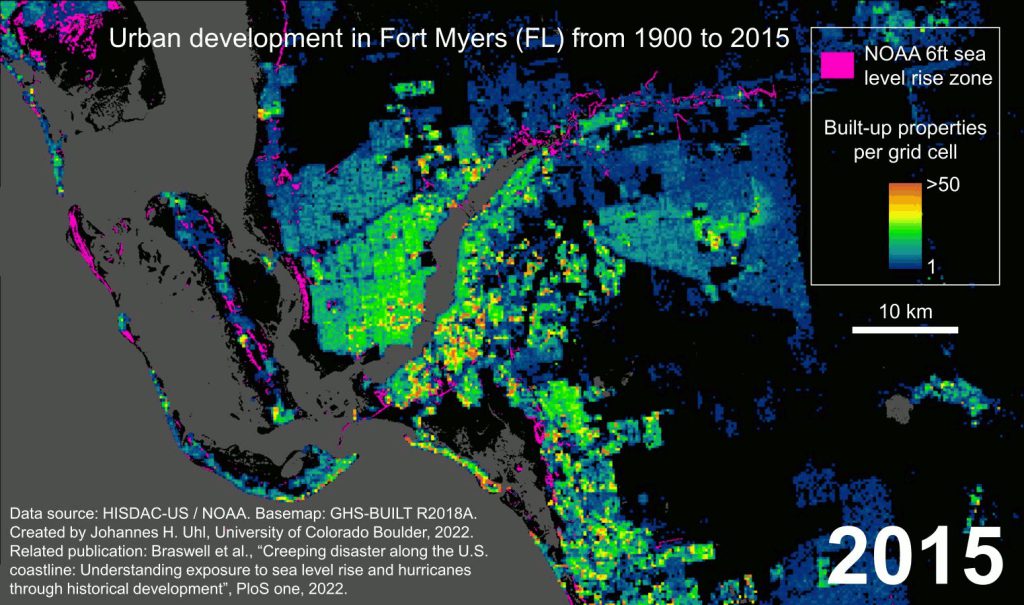
“When you think of densification, you might imagine somewhere like New York City that is packed with structures, but this trend is happening in many coastal areas. Importantly, we found that densely built areas are more likely to be in the 6-foot sea level rise zone, which is considered a higher risk zone,” Braswell said.
The study also showed that densification is even more pronounced in regions affected by hurricanes.
“Previous studies showed that when people rebuild after hurricanes, they build buildings that are bigger than what was originally there. Our findings complement this insight by showing that in hurricane prone areas, people build not just bigger but may build more densely after storms. This means that there is more infrastructure potentially in the path of a storm,” Braswell explained.
According to the U.S. census, about 94.7 million people, or 29.1% of the U.S. population, live in coastal counties.
In many of these places, communities are integrating sea level rise projections into their resiliency plans, Braswell said.
“When we talk about preparing for sea level rise, the discussion is often about whether communities will adapt existing infrastructure or limit new development. Now that we see densification becoming the norm, our findings suggest that we will probably see more emphasis on adapting existing infrastructure,” Braswell said.
The research team’s findings were made possible by using the Historical Settlement Data Compilation for the United States, a dataset created by the study’s authors using data from the Zillow Transaction and Assessment Database.
The study’s co-authors include Stefan Leyk and Johannes Uhl, both with University of Colorado Boulder, and Dylan Connor with Arizona State University.
 0
0
