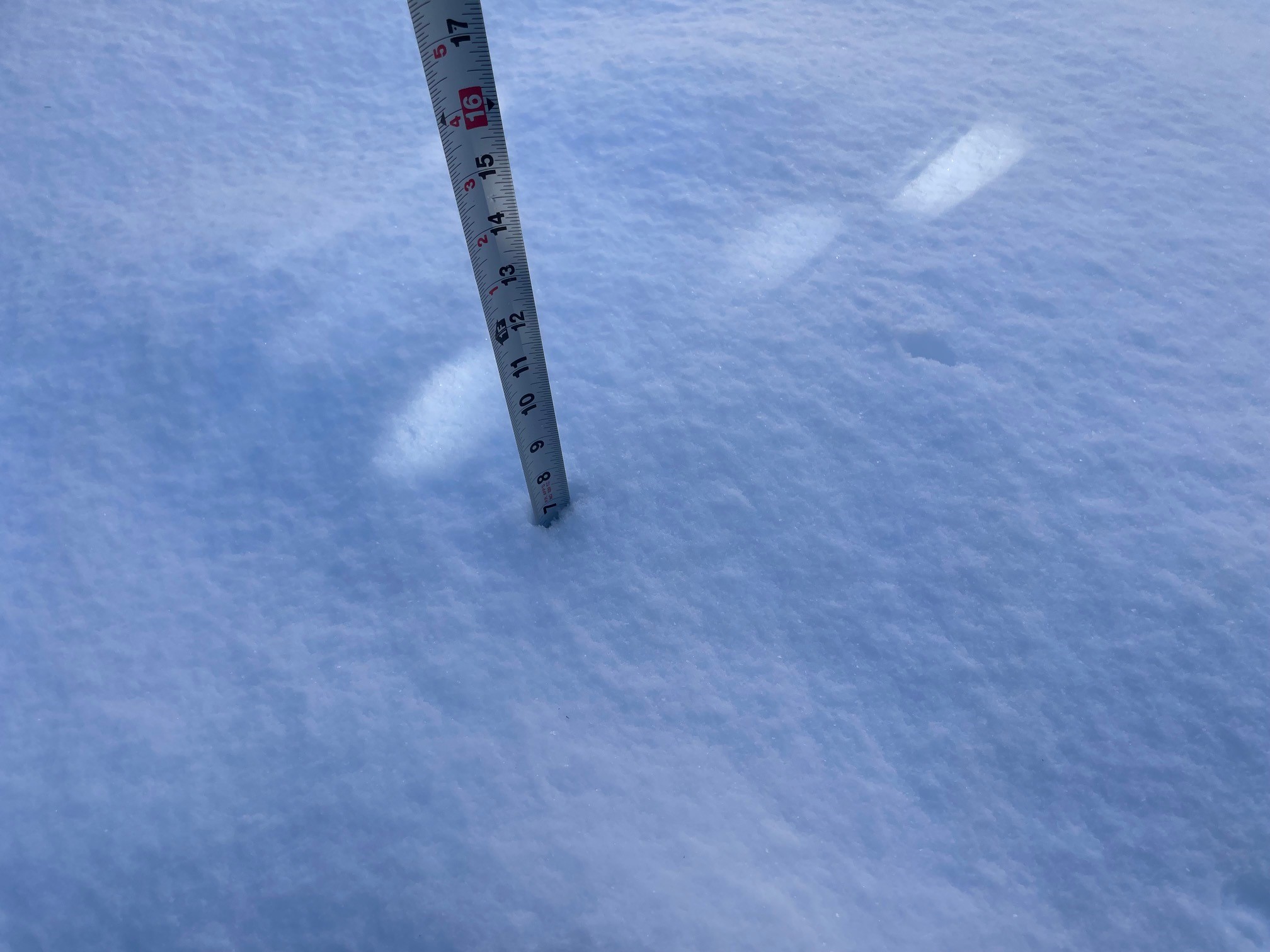
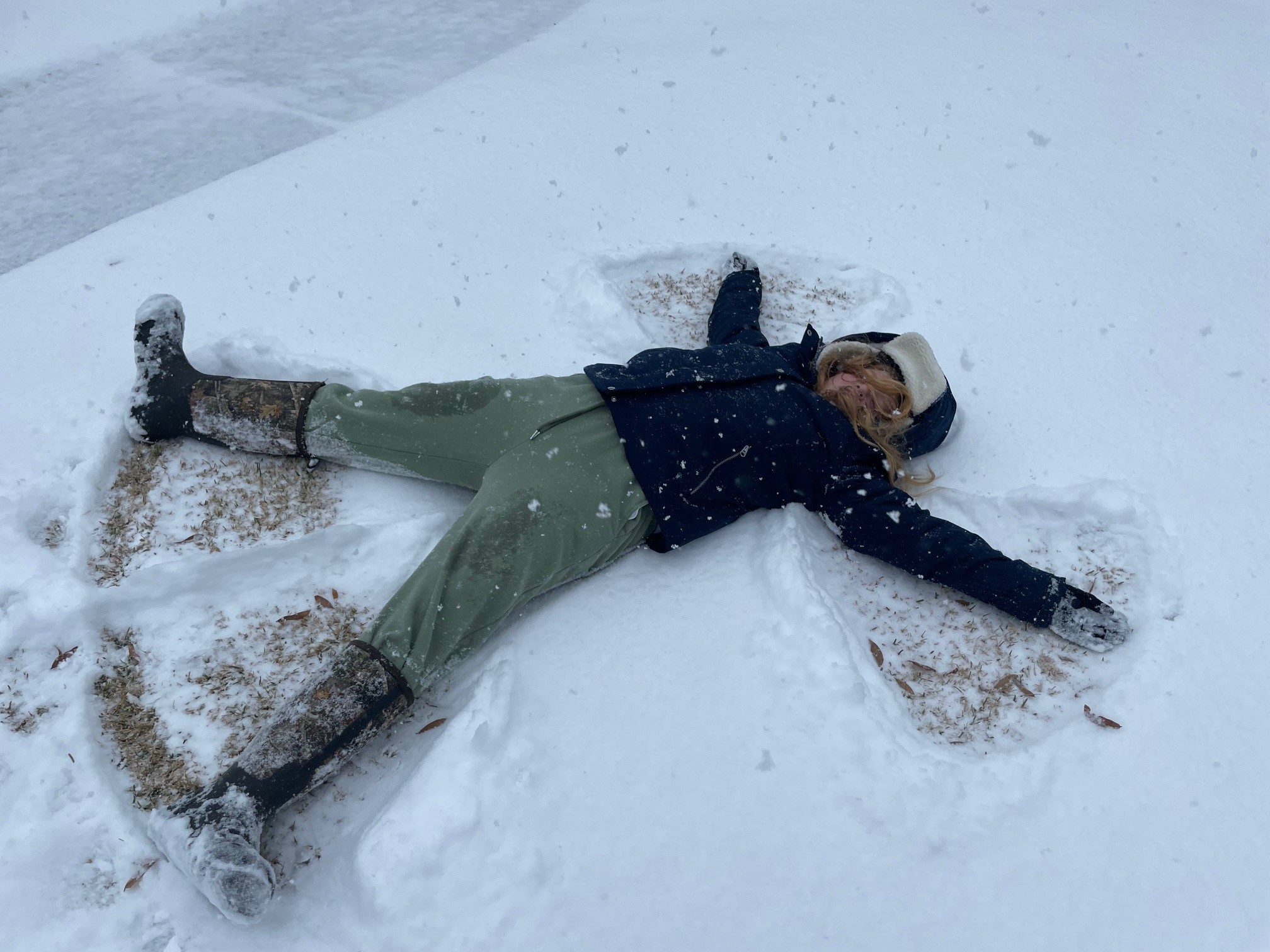
As temperatures drop precipitously this week, I know most of us are digging out those gloves and hats we needed last month. The record-breaking snowfall we experienced along the Gulf Coast in late January was nothing short of surreal. While north Florida is no stranger to below-freezing temperatures in January, 8-10” is completely unheard of. The closest snowfall on record was in 1895, when 3” accumulated in Pensacola.
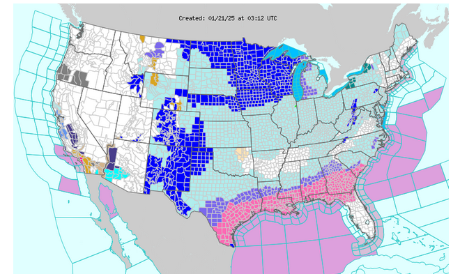
While there were jokes (?) of “global warming is fixed!,” weird weather like this appears to be a side effect of climate change. Typically, the rapidly moving jet stream (often described as an “atmospheric river”) runs west to east 5-9 miles above the midsection of the country, serving as a sort of high-level barrier between the warm Gulf waters and the cold arctic air. But climate instability essentially put a chink in the jet stream armor, bringing frigid conditions much further south than usual. The Deep South is a wet, humid region, so precipitation is typical for us. But with air temperatures in the teens and 20’s, what would normally be a cold rain or sleet transformed into snow.

Writing for NOAA, climate scientist Tim Woollings of the University of Oxford states, “the jet stream also acts as a sharp boundary between contrasting air masses, with relatively warm, tropical air to the south and much colder air on the northern, poleward side. The location of the jet, and hence also the boundary, has a strong influence on temperatures down at ground level.” According to Marc Alessi, a climatologist with the Union of Concerned Scientists, a disturbance within the polar vortex pushed the jet stream all the way down to the Gulf of Mexico, bringing with it the wintry weather systems that typically drop snow and ice on the Midwest and northern regions.
The reduced temperature differential between the equator and a rapidly-warming Arctic appears to be causing these disruptions. The snowstorm then likely fed on the warmer air and moisture above the Gulf, energized the same way a hot Gulf intensifies hurricanes. “Lake effect” snow happens in a similar manner, when cold Arctic air moves over the Great Lakes, which are still much warmer than the incoming air. The lake water evaporates into the cold air, freezing and dropping as snow.
While this was a bit of a freak weather event, these extreme situations are among the symptoms of climate change. We also had a tornado touch down in Pensacola this month. While we have had February tornadoes before, these phenomena are much more common during spring thunderstorms or when spinning off summer hurricanes. Time will tell if we get more wild winter weather, but we can be sure of continued change.
 7
7
