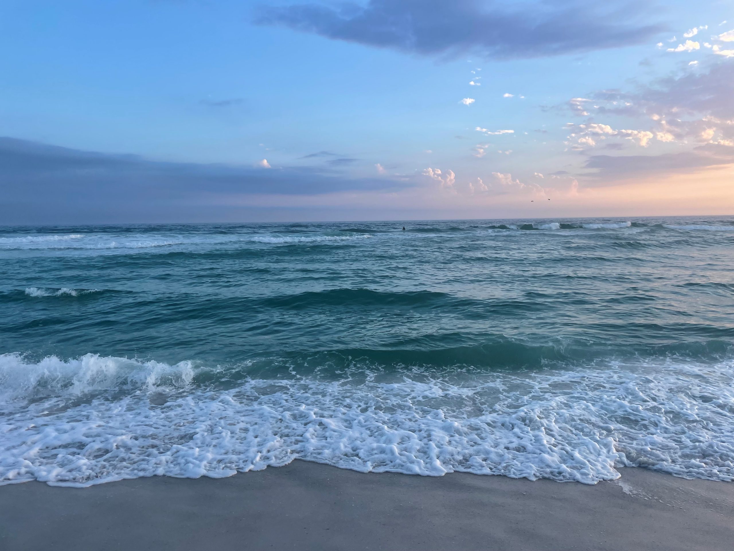
The Gulf of Mexico is a powerful force. If you’ve ever experienced a hurricane, tried to paddle a kayak against the waves, or even just tried to keep your balance at the wave break, you know this firsthand. All along the Gulf Coast, barrier islands form the Gulf’s shoreline. They are long and skinny stretches of land, often no more than 10 miles long and a half mile wide. But these strips of sand are the first line of protection from Gulf hurricanes for the highly populated cities often located just to their north or east.
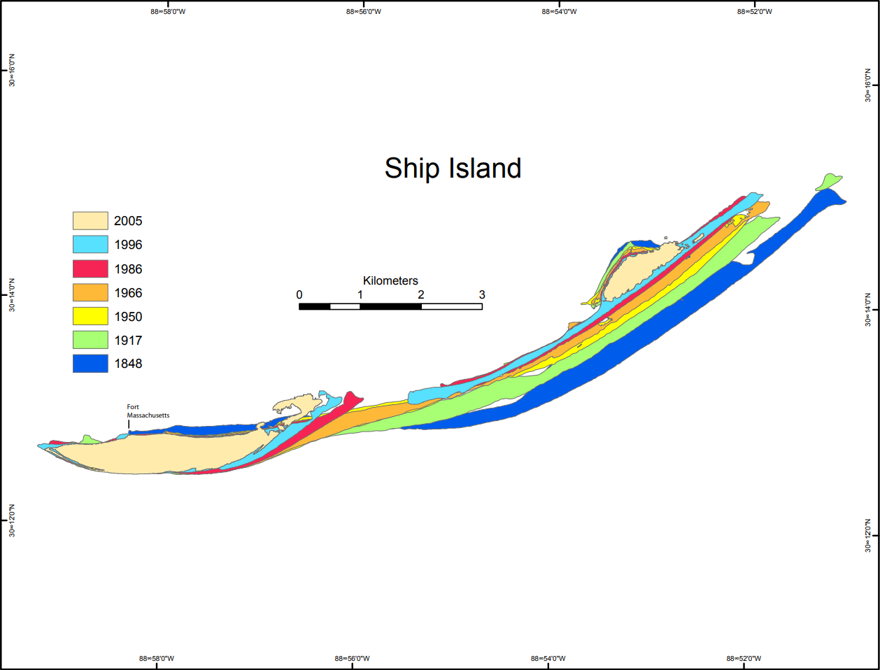
At their core, barrier islands are sandbars. They may have originated from river delta sediment or ancient high ground, but they are constantly in motion. In the northern Gulf, these barrier islands lie on a horizontal east-west plane, built by the longshore current. The current moves water and suspended sands from east to west, eroding and depositing islands along the way. If you look at a map, you can see that the coastal beaches of northwest Florida, Alabama, and Mississippi are tapered on the east end and fatter on the west—this is due directly to the current and constant movement of sand. Manmade structures like groins, jetties, piers, and bridges can interrupt this flow, building up sand on one side and depriving it from the other. This is the ancient cycle of barrier islands—always in flux. Generally, there is always a plentiful source of sand from the nearest river, unless dams or other human activities disturb it.
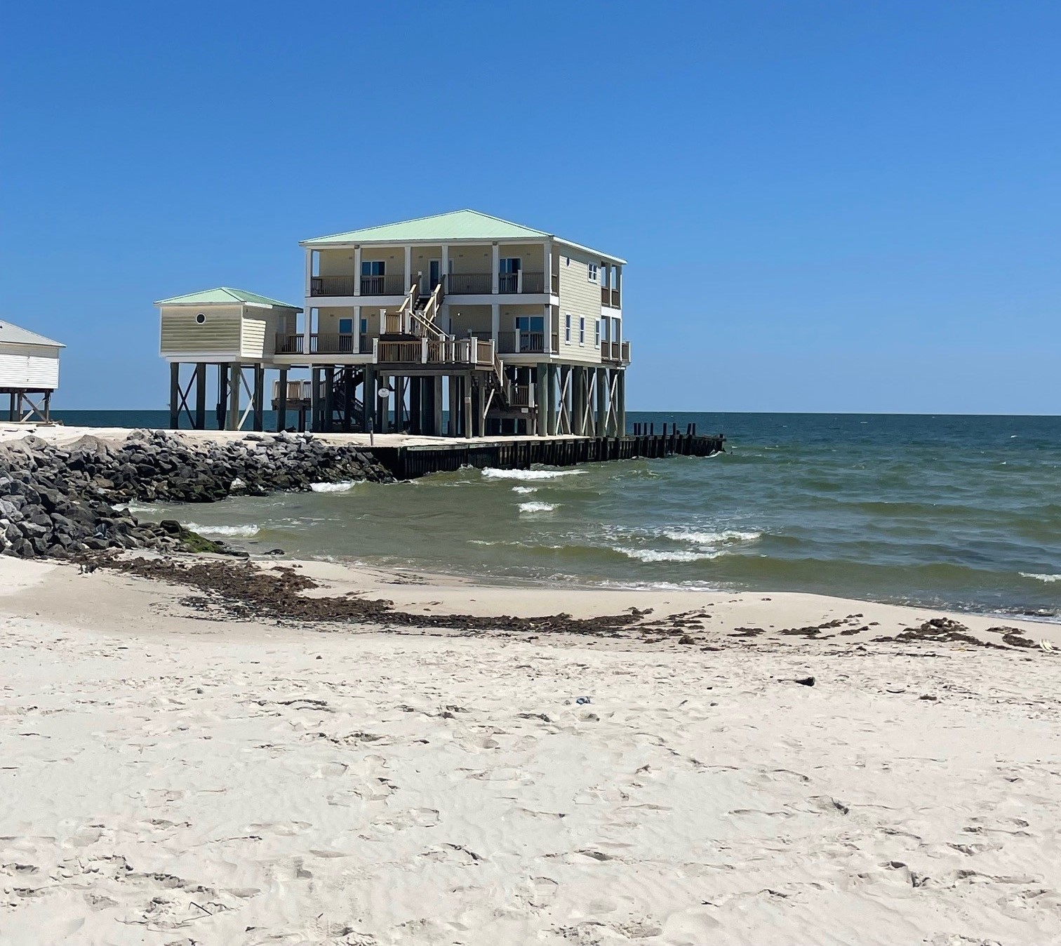
Not only do islands in the northern Gulf build up from east to west, but also from south to north. Incoming tides and storms push sand inland, sometimes building up or rolling islands to the north side. These natural processes are slow and have proceeded without issue for eons. That is, until we decided to build on the barrier islands. Coastal beaches were, for most of history, used as temporary fishing grounds or locations for military fortifications. Their transformation as permanent dwellings or year-round recreation sites has only been in the past 100 years. Once we built roads and permanent buildings, this regular movement of sand—and hurricanes—became a big, and expensive, problem. Despite legal protection, many homes are built atop or even Gulfward of the dune line. This removes the first line of defense from severe weather.
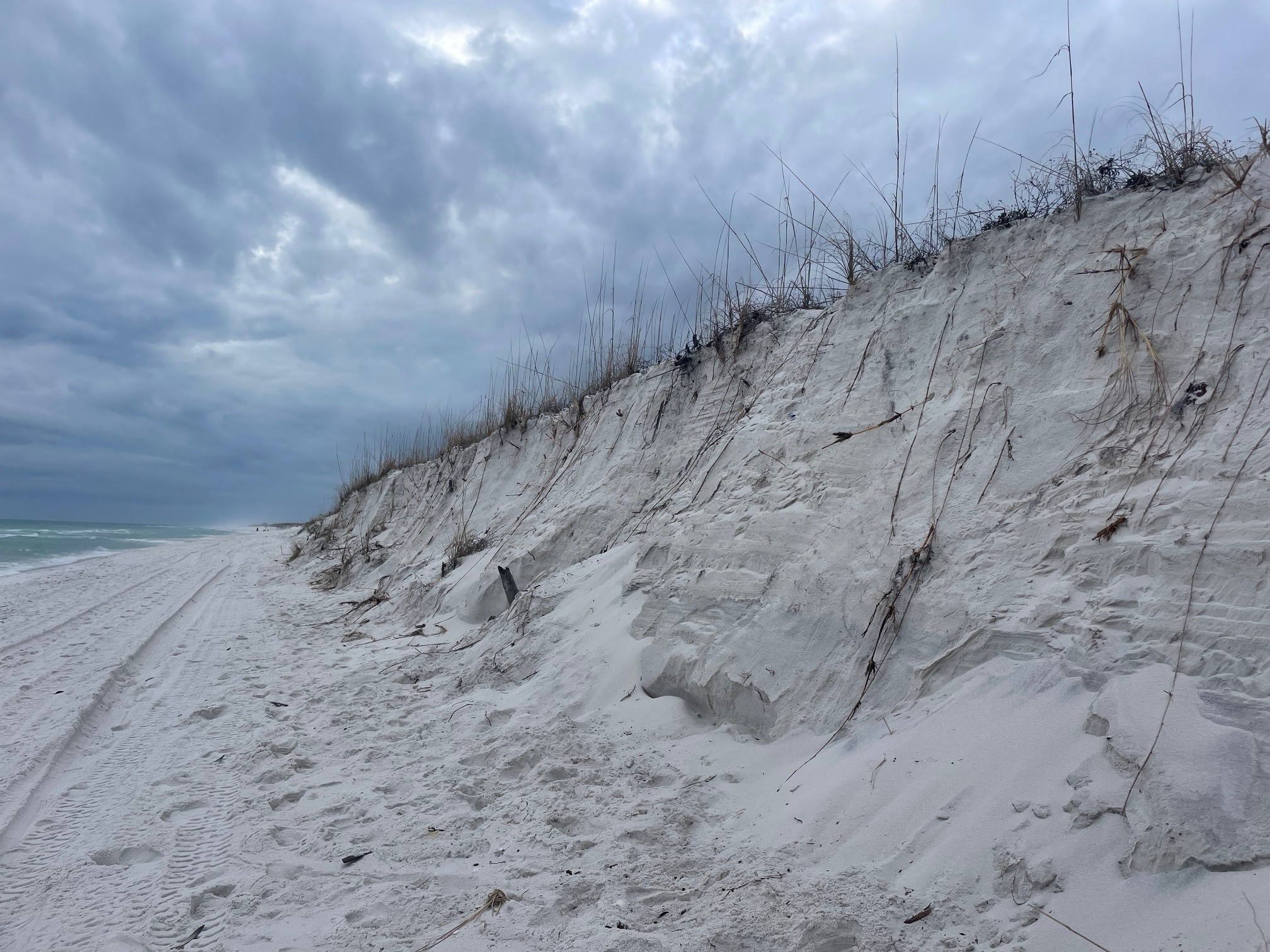
Because the island-building process is slow, plants can take root, building up dunes as high as 50 feet tall in some places. The complex root systems help hold down the sand during storms and high tides. Major storms, of course, may tear down those dunes, but eventually they’ll regrow. Dune restoration projects can also be effective, given enough time and careful planting processes. In addition, accelerated sea level rise, such as the 5” of rise our region has experienced in the last 10 years, has eroded the shoreline, and put even more infrastructure at risk. Many communities have attempted beach renourishment—dredging offshore sand and placing it on the beach—which can restore a wider beachfront and create more space between the open water and infrastructure. However, this can be extremely cost prohibitive. And if a major storm lands, all that sand may be washed away again.
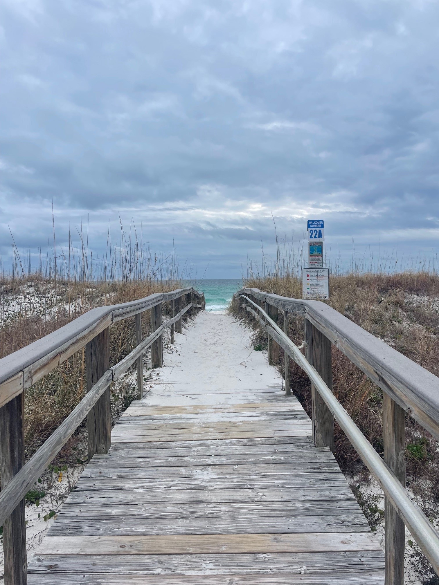
Barrier islands and their intact dunes are our natural fortresses. Managed retreat from coastal areas is likely the most sensible option, but most people won’t abandon beachfront property until they have no choice. Protecting dunes is the next best option. Next time you’re at the beach, be sure to use walkovers, which protect those vulnerable root systems. Cutting through and climbing around on dune faces quickly break down the fragile system, and cause long term problems.
To learn more about coastal erosion, climate change, and local ecosystems, join us next week online with ClimateCast LIVE, a series of digital field experiences that will be broadcast from all over the state in the next two weeks. We will be airing from Pensacola Beach on Tuesday, February 27.
 9
9
