If you take a quick scroll through your social media feed, you’ll probably see spectacular aerial images of landscapes and architecture taken by a drone. While these images are amazing to see, did you know that each of these photos can be used to gather useful data and information?
Although they were first developed for military use, unmanned aerial vehicles (UAVs), more commonly known as drones, have evolved to be used in commercial and consumer markets. The invention of small, affordable aircrafts and the implementation of civilian regulations by the Federal Aviation Administration (FAA) has opened the floodgates for industries like law enforcement, real estate, construction, agriculture, and even invasive plant management.
Drone Technology in Aquatic Plant Management
Florida’s abundance of freshwater aquatic habitats coupled with a semi-tropical climate supports a wide range of nuisance and invasive aquatic plants such as hydrilla (Hydrilla verticillata), water hyacinth (Eichhornia crassipes), and water lettuce (Pistia stratoites).
Management agencies, like the Florida Fish and Wildlife Conservation Commission (FWC), monitor these aquatic plants with regular field observation and lake surveying. These monitoring efforts are conducted on 60 thousand acres across Florida.
With the consideration of limited resources, these surveys are typically limited to an annual cycle. While these surveys remain an indispensable tool, adopting unmanned aerial technology could expand the possibilities for aquatic plant management programs.
Research in Aerial Aquatic Plant Monitoring
UF/IFAS CAIP is working to develop an aquatic plant monitoring program using aerial imagery captured by UAVs. This program will use UAV technology to enhance lake surveys for lake management agencies. This program will increase the frequency of data collection events and allow managers to develop better aquatic plant management plans.
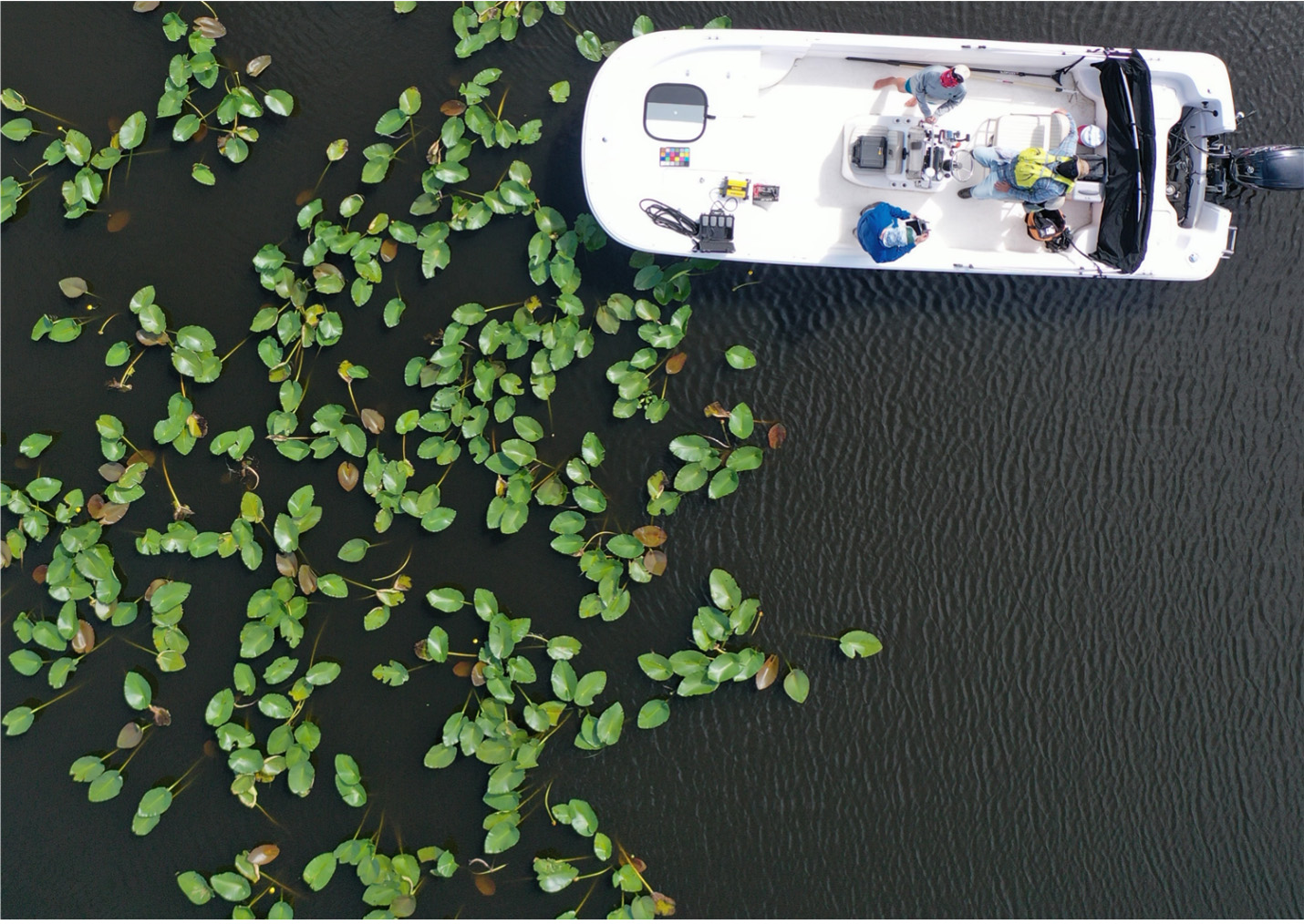
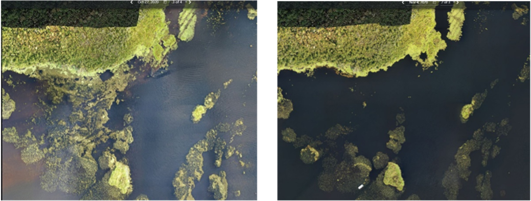
In this program, aerial imagery is used to map invasive plant infestations. Remote pilots routinely photograph over 1,000 acres of aquatic plant infestations within a flight time of around four to five hours. These high-resolution images are collected and stitched together to create a detailed, accurate photo representation of an area and are geometrically corrected to create a map known as an orthomosaic or orthophoto.
What’s Coming in the Future?
The evolution of drone technology has the potential to significantly impact the future of aquatic plant management. The addition of this technology into the toolbox of lake managers can complement existing monitoring techniques by increasing the frequency of surveys, strengthening the quality of datasets, and ultimately enhancing the implementation and planning of aquatic plant management activities.
Additional Reading:
This blog post was written by Jonathan Glueckert a biologist with UF/IFAS CAIP. Questions or comments can be sent to the UF/IFAS CAIP communications manager at caip@ifas.ufl.edu.
Follow UF/IFAS CAIP on social media at @ufifascaip. Read more blogs like this one on the UF/IFAS CAIP blog.
UF/IFAS Center for Aquatic and Invasive Plants. Turning Science Into Solutions.
 0
0
