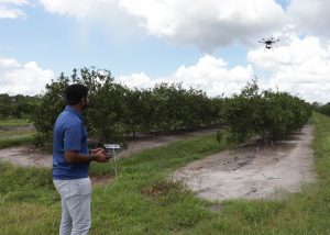
Unmanned aerial vehicles (UAVs) are a unique and useful tool in the agricultural industry. Commonly known as drones, UAVs are used to collect high-resolution data that is difficult for manned flights or satellite imagery, due to the low resolution and high cost of these methods. UAVs can alleviate this issue by quickly providing high-resolution data at a low cost.
This Electronic Data Information Source (EDIS) publication provides guidance on processing data collected with UAVs for agricultural applications. This document provides step-by-step instructions on using UAV flight data to create a variety of maps and indices.
This EDIS publication was written by Sri Charan Kakarla, engineering and research technologist, and Yiannis Ampatzidis, assistant professor of agricultural and biological engineering.
Visit the EDIS website to read more from this publication or download a printable PDF version. Read more from the UF/IFAS Agricultural and Biological Engineering department on our blog.
 0
0
