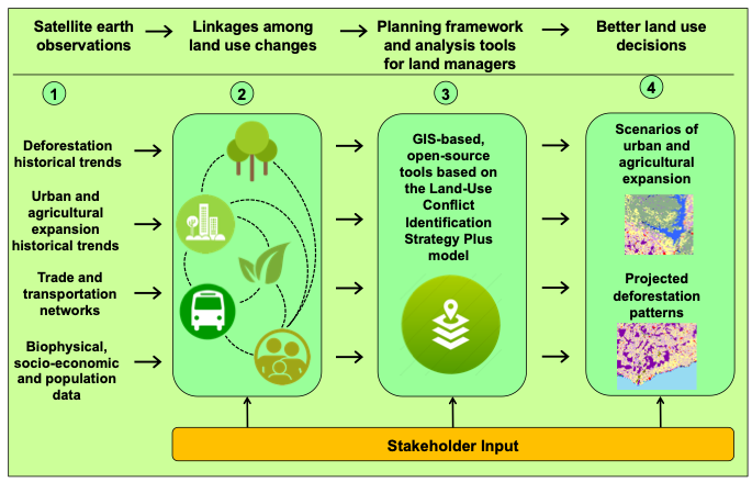
Deforestation has significantly impacted West Africa for several decades and Ghana is still experiencing pressures from an increasing population in urban areas. The challenge of identifying land cover change drivers due to the complex interactions among human and natural systems hinders effective land use planning.
Researchers at the University of Florida (UF) are working with a team of collaborators from Rogue Inc., Centre for Remote Sensing and Geographic Information Services (CERSGIS) in Ghana, and the University of Ghana to link deforestation, urbanization, and agricultural expansion for land-use decisions in Ghana.
This project has been awarded by SERVIR, a joint venture between NASA and the U.S. Agency for International Development to help developing countries use Earth-observing satellites and geospatial technologies for managing climate risks and land use.
This project will enhance the current operational planning framework and building capacity for effective land use planning in Ghana. By integrating trends in deforestation, urbanization, and agricultural expansion from remote sensing with GIS-based modeling, this project will identify potential overlaps/conflicts among various sectors and predict land-use change scenarios.

Jasmeet Judge, principal investigator and a professor in the UF/IFAS Agricultural and Biological Engineering (ABE) department, leads this project with an interdisciplinary team comprising ABE assistant professor Aditya Singh, UF Geography assistant professor Olivier Walther, Rogue Inc. co-founder Iris Patten, CERSGIS executive director Foster Mensah, ABE professor Gregory Kiker, ABE associate professor Rachata Muneepeerakul, and University of Ghana associate professor Kwadwo Owusu.
 0
0
