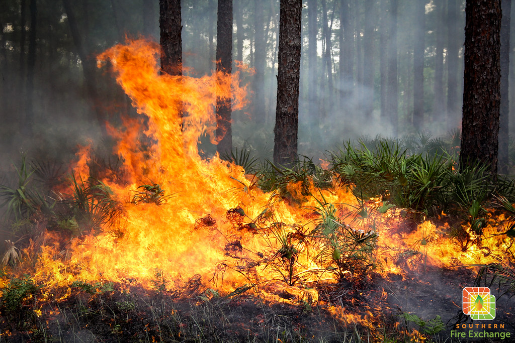
Pinellas County isn’t blessed with large stretches of green space, but we do oversee over 20,000 acres of parks and preserves. Some of these natural areas are managed using prescribed fire, and occasionally, they experience wildfires. Although urban development limits our chances to conduct prescribed burns, we might sometimes see or smell smoke from a few counties away! Earlier this year, I stepped outside my office at Brooker Creek Preserve and was met with a cloud of smoke. I thought the Preserve was on fire, but it turned out to be smoke from a large prescribed burn over 60 miles away.
If you see or smell smoke, how can you find out where it’s coming from?
Prescribed Fires

Whyprescribedfire.org
Whyprescribedfire.org is a very user-friendly website. At the top, you will see “Burn Maps” and a drop-down menu for Florida and Georgia. If you select Florida, this will open a map of “active burn authorizations.” These are all planned fires that have received outdoor burn authorizations from the Florida Forest Service, based in part on National Weather Service weather predictions. The legend on the top-right of the map shows you the outdoor burn authorizations color-coded by fire types: yellow for active pile burns and green for active broadcast burns.
-
-
Pile burns are small in size and are exactly what they say…basically burning a pile of vegetation or land-clearing debris. (Note: If you click on specific yellow points on the map, a pop-up will indicate the number of piles burning in a particular location. More piles often mean more smoke.)
-
Broadcast burns are also known as prescribed fires, well-planned and organized burns intentionally applied fire across a predetermined area. (Note: If you click on a green point on the map, a pop-up will tell you the number of acres burning in a particular information. More acres often mean more smoke.)
-
I encourage you to explore the Whyprescribedfire.org website to learn more about prescribed fire. It’s important to note that this site only provides information about prescribed fires. In Florida, prescribed fires can occur year-round, but they are most common from December to August. If you’re seeing or smelling smoke and you don’t see anything on the whyprescribedfire.org burn map, then there could be an active wildfire. Florida’s peak wildfire season is around April to June, but fires can happen any time depending on weather conditions (i.e. drought). There are a couple of options for learning about possible wildfires in our region:
Wildfires
https://ffs.firesponse.com/public/
https://ffs.firesponse.com/public/ is a public viewer that shows active wildfires where the Florida Forest Service (FFS) has staff responding to control the fire. This map is generated by the Florida Forest Service dispatch centers in each of the districts across the state.
Note: This site does not provide information on other federal, county, municipal or other fire response agencies (i.e. local fire departments, U.S. Fish and Wildlife Service).
The FFS map includes a legend indicating if the fire has just been reported (green), is under active investigation (red), is contained (brown), or is controlled (black). It’s important to keep in mind that first responders responding to a wildfire call have public safety at the top of mind, which sometimes means that adding an active wildfire to this map for public knowledge isn’t necessarily the first thing to happen.
- In wildland fire management, the terms “control” and “containment” refer to different stages in managing a fire:
-
-
Contained – A fire is considered contained when firefighters have established a control line—natural or human-made—that is expected to stop the fire’s spread under current conditions. However, the fire may still be actively burning within those boundaries.
-
Controlled – A fire is considered controlled when it is not only contained, but also no longer poses a threat of escaping the established control lines, and firefighters are confident it will not reignite or spread under foreseeable conditions. Control is a more advanced and secure stage than containment, indicating that suppression efforts have been successful and the fire is no longer growing or threatening surrounding areas.
-
Fires & Smoke
Check on Social Media
Our local Florida Forest Service and Water Management Districts do an excellent job updating the public on social media with both prescribed fires and wildfires. In our area, you can follow:
-
Florida Forest Service – Lakeland District on X
-
Covers Polk, Hillsborough and Pinellas Counties
-
-
Florida Forest Service – Withlacoochee Forestry Center on Facebook and X
-
Covers Citrus, Hernando, Sumter, Pasco, and Lake Counties
-
-
Southwest Florida Water Management District on Facebook and X
Air Quality Data
![]()
Another tool in the toolbox is to utilize air quality data through various smartphone applications. Air quality data is often a feature within weather apps, but they can also be stand alone. The standard measurement for air quality is via the Environmental Protection Agency’s (EPA) Air Quality Index (AQI). This index reports daily air quality conditions. Various pollutants, including sulfur dioxide, ozone, carbon monoxide, nitrogen dioxide, and particulate matter, are measured, and their concentrations are converted into numerical values on a scale based on the National Ambient Air Quality Standard.
Pinellas County’s Air Quality Monitoring Program recommends the AirNow website or the EPA AirNow app for current AQI readings. AirNow also features a tool that combines air quality data from multiple sensors to create an interactive map!
Are You Smoke-Ready?
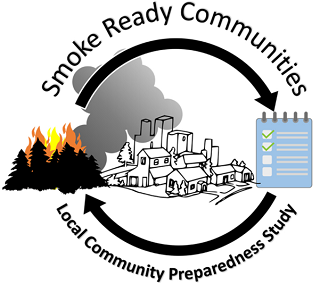 Depending on the size of the wildfire, we can receive smoke from across the country! As the Smoke-Ready Toolbox for Wildfires states, “Smoke can travel hundreds of miles and can impact the air quality and public health of communities far from the fire.” This toolbox offers excellent resources for communities to learn how to prepare for and respond to smoke events, including strategies to reduce exposure during these events.
Learn More
Learn more about prescribed fire in Florida on the “Naturally Florida” podcast episode, Florida on Fire: Prescribed Fire in the Sunshine State. This episode is now supplemented with an episode learning guide, which you can find here. You can also learn more in the “Where There’s Fire, There’s Smoke: Air Quality and Prescribed Burning in Florida” publication.
The above resources represent some options to help you solve the smoke mystery you may be experiencing, but there is no catch-all tool that can tell you where smoke is coming from. If you ever see or smell smoke, you can use the above tools and resources to be in the know with what’s happening in and around your neighborhood.
Blog review and contributions by: David R. Godwin, Ph. D, Ludie Ann Bond, Ph.D. and Raelene Crandall, Ph.D.
 0
0
