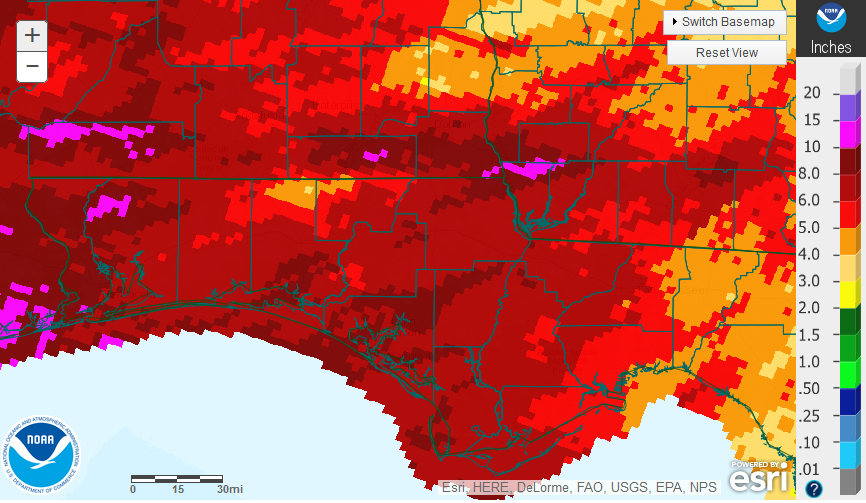
Just when it seemed El Niño had lost it’s grip, the deluges started again at the end of March. Many farmers were planting watermelons and corn, or preparing land for cotton and peanuts in mid-March, but heavy rains at the end of the month and in early April have halted field activities. The rains that fell in late March and early April came ashore from the Gulf in large bands and drenched much of the western Panhandle, but ran out of steam as they moved east. The small areas in hot pink had over 10″, most of the region received 6-10″, and the eastern counties less than 5″ in the month of March.
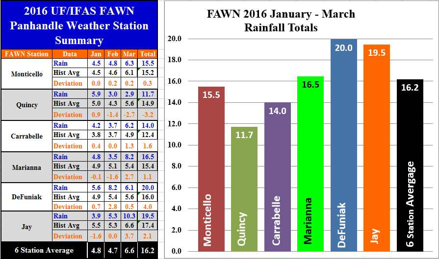 The Florida Automated Weather Network (FAWN) stations also showed the variation in rainfall in March. Unfortunately, the Quincy FAWN station has technical issues with the rain gauge, so the figures from that station are probably incorrect. In March, the other five stations ranged from a low of 6.1″ at DeFuniak to 10.3″ at Jay. Through the fist quarter of 2016, all five stations were above historical averages for those locations, ranging from 14″ at Carrabelle to 20″ at DeFuniak.
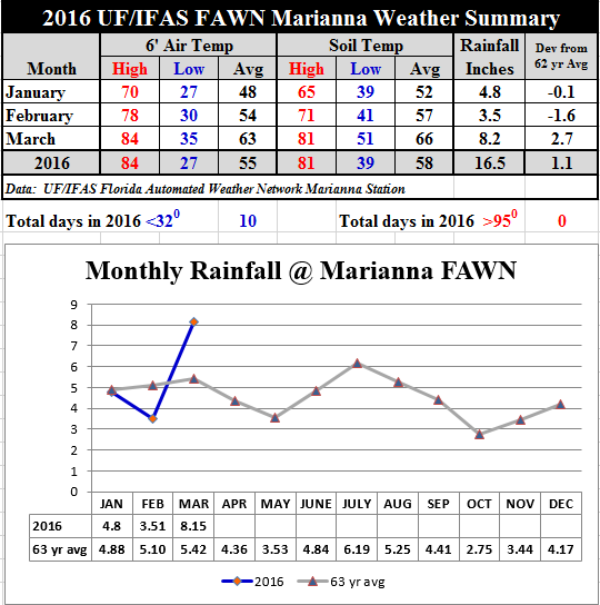 Air and soil temperatures warmed up considerably in March. At the Marianna FAWN station average air and soil temperatures rose 9° above the February average.
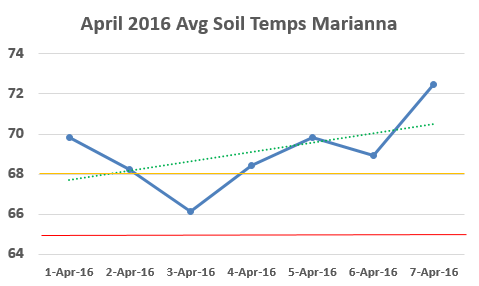 This trend has continued in April. This week the average soil temperature has risen to the level needed for cotton and peanut planting. The gold line, at 68°, represents the ideal temperature for excellent peanut and cotton seed germination. The red line at 65° is the minimum temperature for germination. The dotted trend line shows that the soil is warming up significantly, but a coming cold front may drop soil temperatures back down again in the week ahead. Even so, if soils continue to dry out, conditions should be good for planting in the near future.
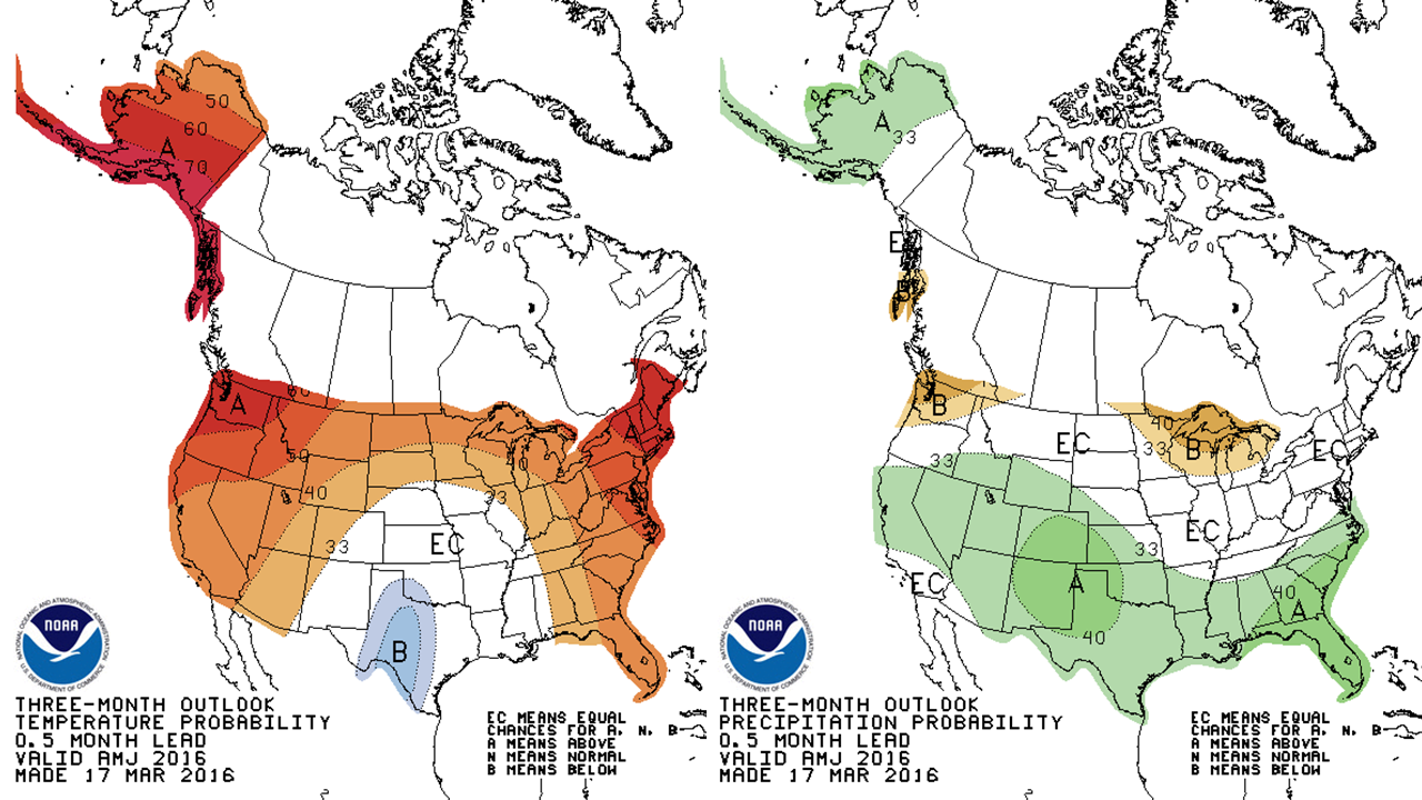 The three month outlook for the planting season calls for above average temperatures and rainfall. Typically May and early June are drier months, so this forecast may a good thing. It all depends on when and how much rain comes. Certainly most Panhandle farmers would be happy to have their land dry out more so planting preparations can resumes again.
El Niño Update
The Climate prediction Center’s El Niño forecast has not changed much, but they have increased the chances of a La Niña starting this fall:
All models indicate that El Niño will weaken, with a transition to ENSO-neutral likely during the late spring or early summer 2016. Thereafter, the chance of La Niña conditions increases into the fall. While there is both model and physical support for La Niña following a strong El Niño, considerable uncertainty remains. A transition to ENSO-neutral is likely during late Northern Hemisphere spring or early summer 2016, with close to a 50 percent chance for La Niña conditions to develop by the fall.
 0
0
