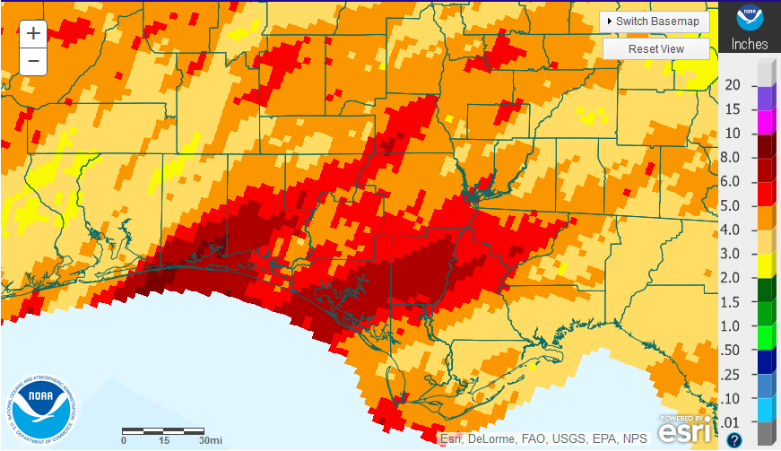
 January was a more normal month for much of the Florida Panhandle. Much of the soil is still somewhat saturated from all of the rain at the end of 2015, but from the map above you can see that the majority of the region had less than 6″ in January 2016. Portions of Okaloosa, Walton, Bay, Calhoun, and Liberty counties did receive between 6-8″ where rain streamed through from several fronts.
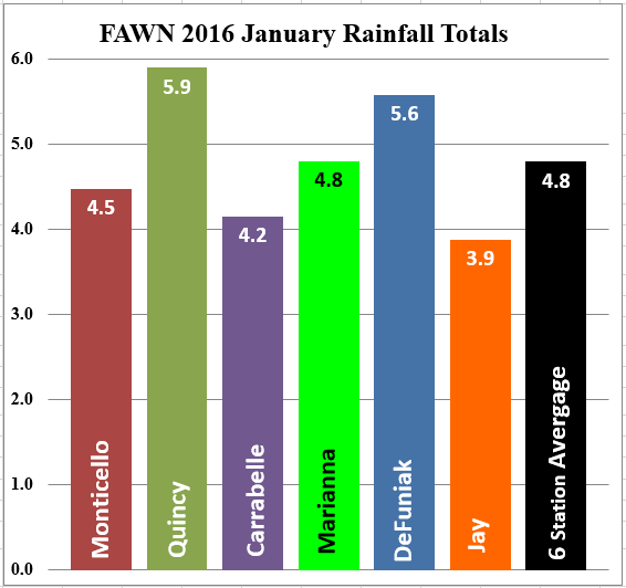
 The six UF/IFAS Florida Automated Weather Network (FAWN) stations data collected for the month of January show that Quincy – 5.9″, and DeFuniak Springs-5.6″ had considerably higher totals, while Jay-3.9″ and Carrabelle-4.2″ recording the lowest totals. The average for all six locations was 4.8″, which is right at the historic average for the month, for the region.
Temperatures did cool off and it finally did feel more like winter. The average air temperature at the Marianna station was 48°, which was 13 degrees cooler than the 61° average at that location for the month of December. Soil temperatures also cooled off from an average of 64° in December down to 52° for the month of January. Temperatures in Marianna ranged from a low of 27° on January 24th and a high of 70° on January 30th.
Looking Ahead
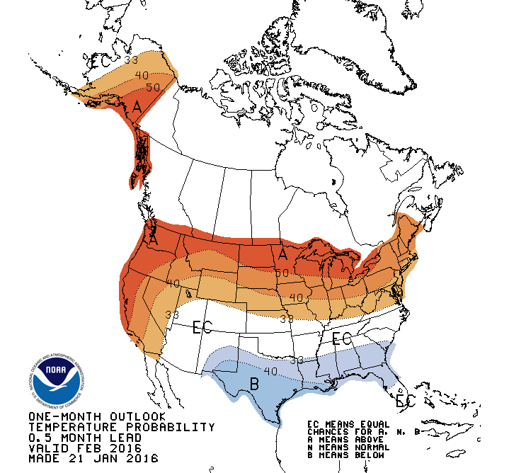
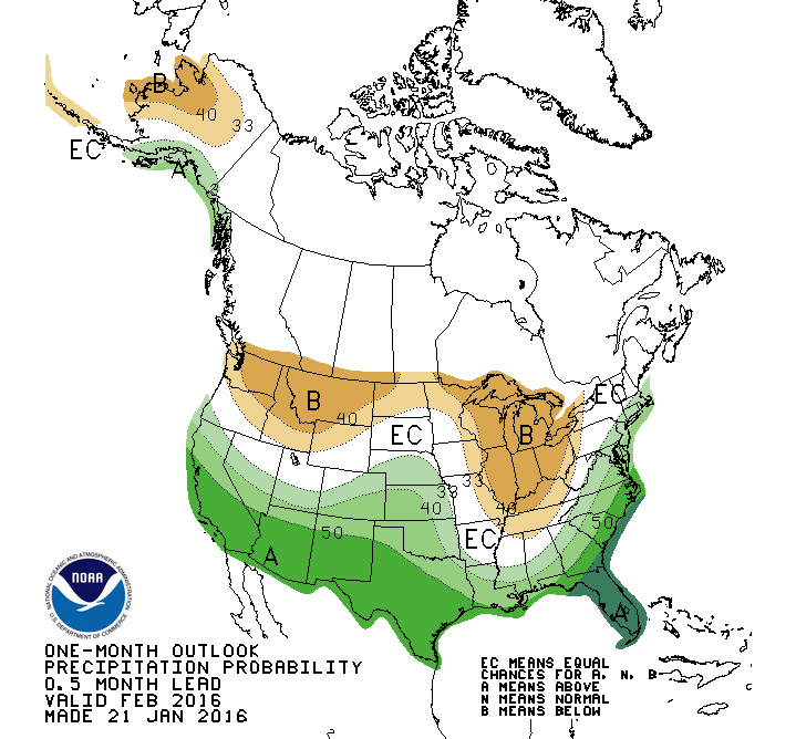
The Climate Prediction Center’s outlook for February is forecasting below average temperatures and above average rainfall.
El Niño Update
The following is the most recent forecast for El Niño from the Climate Prediction Center on January 14, 2016.
During mid-January 2016 the tropical Pacific Sea Surface Temperatures (SST) was at a strong El Niño level, having peaked in November and December. All atmospheric variables strongly support the El Niño pattern, including weakened trade winds and excess rainfall in the east-central tropical Pacific. The consensus of ENSO prediction models indicate continuation of strong El Niño conditions during the January-March 2016 season in progress. The beginning of a gradual weakening of the SST anomaly is underway, with the event dissipating to neutral conditions by late spring or early summer 2016.
The seasonal outlooks for January – March indicate an increased likelihood of above-median precipitation across the southern tier of the United States, and below-median precipitation over the northern tier of the United States. Above-average temperatures are favored in the West and northern half of the country with below-average temperatures favored in the southern Plains and along the Gulf Coast.
 0
0

