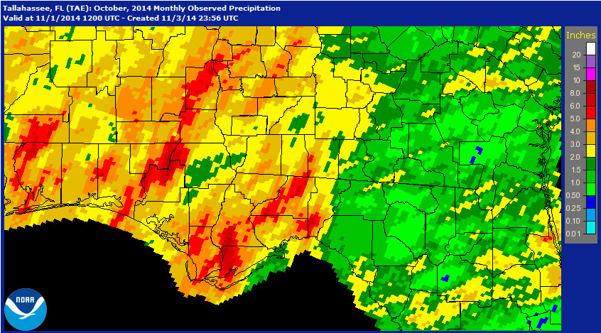
The National Weather Service rainfall estimates for October show the variation in rainfall across the Panhandle. The areas of red in the graphic received more than 5″ for the month, while the green and gold areas received less than 3″. The University of Florida’s FAWN weather stations documented this variation as well in the table below.
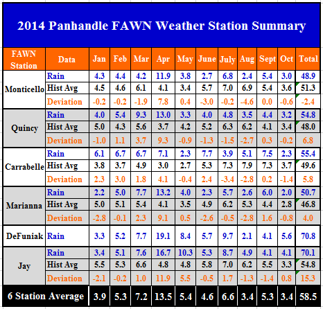
As compared to the historic averages, only the Jay station had higher than normal rainfall in October. The DeFuniak weather station is still too new to have established a historic average, but did record the highest total for October with 5.6″. Marianna was the driest location last month, with only 2″ recorded.
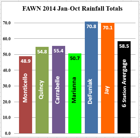
For the year the Jay and DeFuniak weather stations have recoded over 70″ of rainfall, while the Monticello station less than 49″. The average rainfall for all six stations was 58.5″ through October.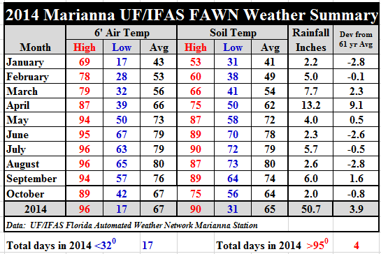 Temperatures certainly cooled off in October. Average air temperatures dropped nine degrees from 76° to 67°, and average soil temperatures dropped ten degrees from 74° to 64°.
For more specific daily temperature and rainfall records download: 2014 Jan-Oct Weather Summary
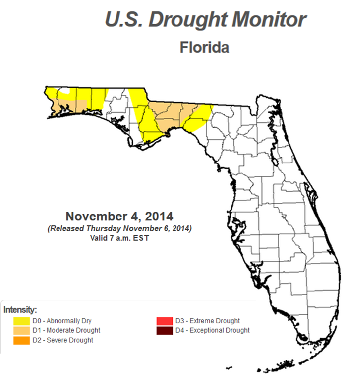 Much of the Panhandle is still experiencing drought conditions. The southern portions of Escambia, Santa Rosa, and Okaloosa have been added to the Moderate Drought category. The central portion of the Panhandle has been upgraded, and is no longer considered abnormally dry.
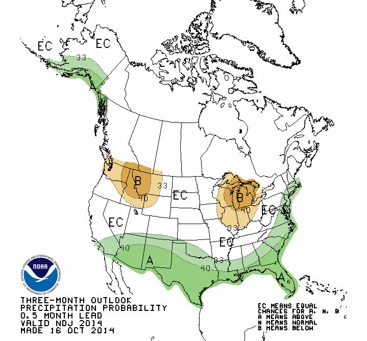 NOAA’s Climate prediction center is not forecasting variation from normal rainfall or temperatures for the month of November, but the three month outlook calls for above average rainfall. So if their predictions are correct, drought relief may be coming in the months ahead.
 0
0
