What do the Ochlockonee and Aucilla rivers have in common? Not much, it would seem, beyond the fact that both have headwaters in Georgia and flow through Florida to the Gulf of Mexico. These two rivers do share the distinction of being unusual, although they’re unusual in very different ways.
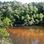
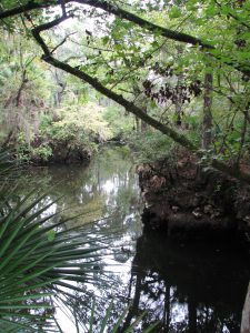
The Aucilla is a blackwater stream that goes underground and rises again before reaching the Gulf – a disappearing act that has fascinated early settlers, paddlers and naturalists alike. The Aucilla drains a smaller watershed, has lower flows, and features stream channel sediments that are predominantly sands and decaying organic material – the sediment signature of coastal plain streams with water stained dark brown, the color of tea.
In fact, blackwater rivers like the Aucilla get their color by steeping fallen and decaying tree leaves and twigs in slow-moving water, just as we steep shredded tea leaves or ground up coffee beans to dissolve their tannic acids into beverages. Blackwater steeping occurs in swamp forests up river tributaries, and in oxbow sloughs and other quiescent side channels of the downstream reaches. These form as a river “in flood” meanders and changes course within its floodplain.
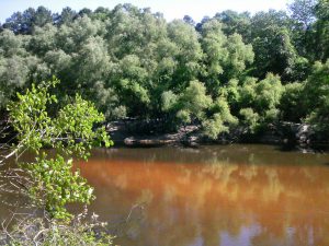
The Ochlockonee is unusual among rivers originating in the Coastal Plain: in its upper reaches it has alluvial characteristics common to streams flowing from the Piedmont. The Ochlockonee drains soils rich in silt and clay that give it a yellowish brown color when those extremely fine sediments are suspended in the water. Land use activities such as paving roads and tilling farm fields elevate the fine sediment load when it rains by setting up larger volumes of fast-moving runoff. Higher rain runoff volume and velocity conspire to erode bare fields, construction sites and river banks, accentuating this river’s color.
But in spite of these differences, the Aucilla and Ochlockonee were once branches of the same river drainage system – the Paleo-Ochlockonee River. How could that possibly be? Well, sea level rise has drowned the lower reaches of this once mightier river, leaving its upper branches to empty into the Gulf separately, as smaller streams.
Sea level along Florida’s Big Bend coastline has been rising since the end of Earth’s last Ice Age – roughly 18,000 years ago. Our shallow, gently sloping underwater continental shelf was exposed during that last period of glaciation. As higher temperatures began melting ice sheets, not only did sea level rise, but more water evaporated and fell as rain. Southeastern rivers began carrying greater volumes of water.
Before annual rainfall reached today’s level during this prehistoric period of climate change, it is likely that the Aucilla from headwaters to Gulf was even more discontinuous than it is today. A current hypothesis is that the Aucilla was more like a string of sinkholes than a river, resembling its lower reaches today in a section known as the “Aucilla Sinks.”

The Aucilla is a tannic river. Thus not as yellow-brown but rather more “blackwater”.
Photo: Jed Dillard
But the nature of the Paleo-Aucilla is just one part of this intriguing story. Using sophisticated technology, scientists have discovered clues about the ancient route of the entire Paleo-Ochlockonee as it meandered across that more expansive, exposed Continental shelf to the Gulf.
In their 2008 publication Aucilla River, Tall Timbers Research Station & Land Conservancy reports that, “Ten thousand years ago, the Florida coastline was located 90 miles away from its present position. Scientists have discovered a buried river drainage system indicating that approximately 15 to 20 miles offshore from today’s coast — and now underwater — the Aucilla River combined with the Ochlockonee, St. Marks, Pinhook, and Econfina rivers to create what archeologists call the Paleo-Ochlockonee, which flowed another 70 miles before reaching the Gulf.”
“Well, I’ll be!” you say, “That’s all pretty cool to think about.” That was my reaction, too, until I remembered that this process of sea level rise continues still, albeit at an accelerating rate thanks to global warming. Which means our rivers that join forces today before emptying into the Gulf will one day be separated. Sea level rise eventually will dismember the Wakulla from the St. Marks, and the Sopchoppy from the Ochlockonee – but thankfully not in our lifetime.
True, that’s happened before, but long before humans were on the scene. Today and for many tomorrows to come, I am grateful that we and our children and grandchildren have a wonderful watery world patiently awaiting our exploration, not far beyond the urban bustle of Tallahassee.
We’re far removed in time from the first humans beckoned by these rivers. A pause in the rate of sea level rise 7,000 years ago enabled development of coastal marsh ecosystems and more successful human habitation – supported in part by the bounty of fish and shellfish that depend on salt marshes. Farther upstream and still inland today, the sinks and lower reaches of the Aucilla hold archaeological sites about twice that old, that are integral to our evolving understanding of very early prehistoric human habitation on the Gulf Coastal Plain.
If you’re intrigued by the myriad of fascinating rivers and wetlands of the Big Bend region – this globally significant biodiversity hotspot we live in, and want to experience some of them first-hand, you’re in luck. Several Panhandle counties offer Florida Master Naturalist courses on Freshwater Systems (and also courses on Upland Habitats and Coastal Systems). You can check the current course offerings at: http://conference.ifas.ufl.edu/fmnp/
You can also explore on your own. There are many public lands in our region (and across the Panhandle) that provide good access.
Go see the Aucilla’s remaining string of sinks by hiking a short segment of the Florida Trail through the Aucilla Wildlife Management Area in Taylor County. And the Ochlockonee’s floodp
lain of sloughs and swamps, bluffs and terraces by taking trails that follow old two-track roads “down to the river” through the Lake Talquin State Forest in Leon County.
Get some maps of your public lands, get some tips on trails, get outside, and go exploring!
Posted: October 26, 2016
Category: Natural Resources, Water
Tags: Dismembered, Level, Mightier, Ochlockonee, Once, Panhandle Outdoors, Rise


