All Photos by Molly O’Connor
We began our series on Nature Tourism along the ICW at the Alabama state line on Perdido Key and discussed the ICW itself. This month we will continue in Escambia County with a visit to Pensacola Beach.
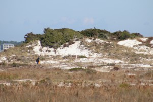
The dune fields of panhandle barrier islands are awesome – some reaching over 50 ft. in height. This one is near the Big Sabine hike (notice white PVC markers).
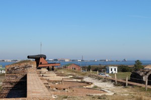
The cannons of Ft. Pickens protected the entrance into Pensacola Bay. The views of the western end of Santa Rosa Island are great from here. There is plenty of nature and history to be discovered at this park. Plan to stay the day.
BARRIER ISLANDS
Pensacola Beach is on Santa Rosa Island. The longest barrier island in the panhandle, Santa Rosa Island stretches 44 miles from Ft. Pickens, at Pensacola Pass, to Destin Pass in Okaloosa County. With miles of some of the whitest beaches in the world, these panhandle islands have a variety of ecosystems. The mineral that makes the beach so white is quartz, one of the minerals found in granite rock. Over eons weathering and erosion has released these minerals from the granite in the Appalachians and sent it downstream to the Gulf coast. The densities of the different minerals force it to settle out at different rates. Quartz, being one of the less dense minerals, reaches the Gulf of Mexico where it encounters longshore currents. In the panhandle these currents more often run east to west moving the quartz in that direction. This sand forms bars and shallows which made colonial navigation a problem and good hiding places for pirates. Some of the bars remain above sea level and form dune fields and plant communities, forming barrier islands. Many animals, such as shorebirds and sea turtles, seek these islands for nesting because of few predators. The xeric conditions favor reptiles and birds, but there are many mammals and insects as well. Freshwater ponds form on many of the islands and here amphibians and fish came claim territory. The high energy beach of the Gulf side supports a community of subterranean organisms which include the mole crab (sand flea) and coquina. The low energy bay side harbors salt marshes along the shoreline and seagrass meadows below the surface. These habitats support a rich variety of marine life, some of the most productive in the world.
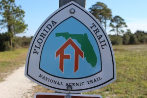
The Florida Trail extends (in sections) over 1,300 miles from Ft. Pickens to the Florida Everglades. It begins at this point.
PENSACOLA BEACH
There are many places on Pensacola Beach where visitors can enjoy these natural places. At the west end of the island is Ft. Pickens, part of the Gulf Islands National Seashore. Within the park you will find beaches to comb, piers to view wildlife and fish, jetties to fish or dive, fortifications to view the island, and a nice museum to educate you on both the natural and cultural history of the area. Here the Florida Trail begins. This trail is segmented and stretches from Ft. Pickens to the Everglades, but here it stops at Battery Langdon; it can be hiked or biked. Along the trail there are freshwater ponds and sections of maritime forest with a variety of wildlife viewing and photography. The multiple loop campground is found on this trail.
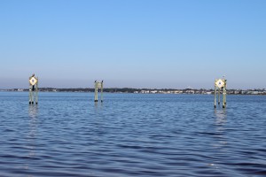
Between these pilings at Park West is one of the county snorkel reefs. Visibility is tough but the fish are there.
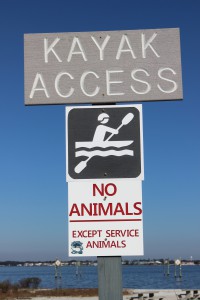
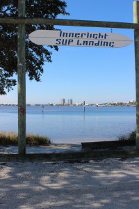
Just outside the entrance to the park is a county park named Park West. Here there is a kayak launch and nearshore snorkel reef on the bay side, with picnic area and beaches on the Gulf.
In Pensacola Beach proper there are several businesses that rent paddleboards for paddling the shallow seagrass filled Little Sabine. There are two marinas which offer sailing, fishing, and diving charters as well as dolphin tours. There are numerous artificial reefs off of Pensacola including the world’s largest – the U.S.S. Oriskany. On the Gulf side you will find the Pensacola Beach Fishing Pier where not only can you fish but, at times, see marine life. Sharks, sea turtles, dolphins, and large fish are often seen. The sunsets are great here. At the Visitors Center you can get a map to follow the Eco-Trail. This driving trail of 28 kiosks will take you to natural spots and the kiosks provide education about the area. There is a prize if you complete the trail.
Heading east from Pensacola Beach you once again pick up a portion of the Florida Trail. At this location there is a bike path, which can be walked or biked. Park East houses a popular nearshore snorkel ree
f. This snorkel reef is on the Gulf side and there are beach markers to help the diver locate it. On the bay side is Big Sabine. This area of high dunes and salt marsh has no formal trail but there are PVC pipes placed to help navigate your way in and out.
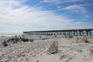
The Pensacola Beach Fishing Pier is not only a great spot to catch fish, it’s a great spot to see marine life – and great sunsets.
Further east you once again enter the Gulf Islands National Seashore. Escambia County is lucky to have almost 50% of their portion of the island within this national park. There are miles of natural beach to explore but you must use the public parking lots (no roadside parking) and watch your speed, this area supports several species of nesting shorebirds – some of which are listed as imperiled in the state of Florida.
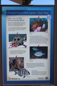
The Santa Rosa island Authority’s Eco-Trail has 28 kiosk to navigate and learn about the natural history of the island. It is a fun and educational car trip. You can get the map for this trail at the visitors center on Pensacola Beach.
To learn more about nature and farm tourism in Escambia County visit www.NaturallyEscaRosa.com and download the free app at the App Store or Google Play
Next month – Santa Rosa County.
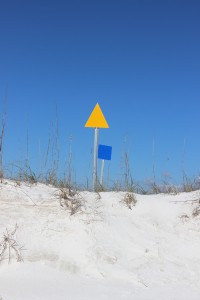
Aligning these markers will assist the snorkeler/diver in locating the Gulf snorkel reef at Park East. The swim is a bit further than Park West but the visibility is much better.
Posted: February 18, 2016
Category: Natural Resources, Recreation
Tags: Beach, Intracoastal, Nature, Panhandle, Panhandle Outdoors, Pensacola, Tourism, Waterway
