Wetlands are beautiful, important, and valuable components of our ecosystems. But for a long time, they were considered little more than insect-riddled cesspools, places devoid of worth. While not everyone fully appreciates wetlands’ many contributions to human and planetary health, state and federal laws do outline protection for these fragile systems that surround us.
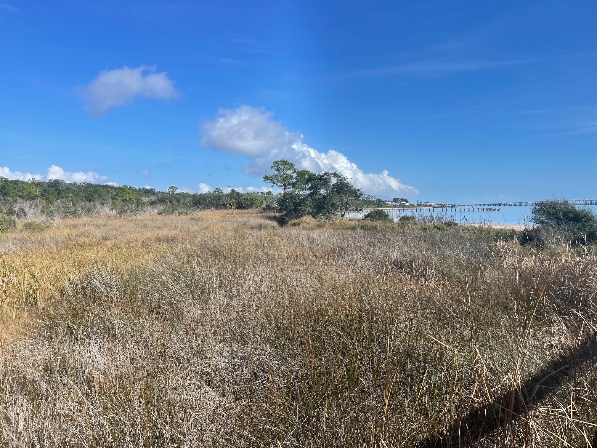
But how do you define a wetland? The Florida Department of Environmental Protection (FDEP) describes them as “those areas that are inundated or saturated by surface water or ground water at a frequency and a duration sufficient to support, and under normal circumstances do support, a prevalence of vegetation typically adapted for life in saturated soils.” Breaking this down in regular English, wetlands are areas dominated by wet (or signs of wet) soils and specific plants adapted to those soils. While soggy coastal marshes are pretty easy to recognize, freshwater wetlands can be more complicated. Besides the incredible diversity of vegetative species found in them, disturbance from construction, interruption of natural water sources, drainage, and erosion can make them hard to recognize.
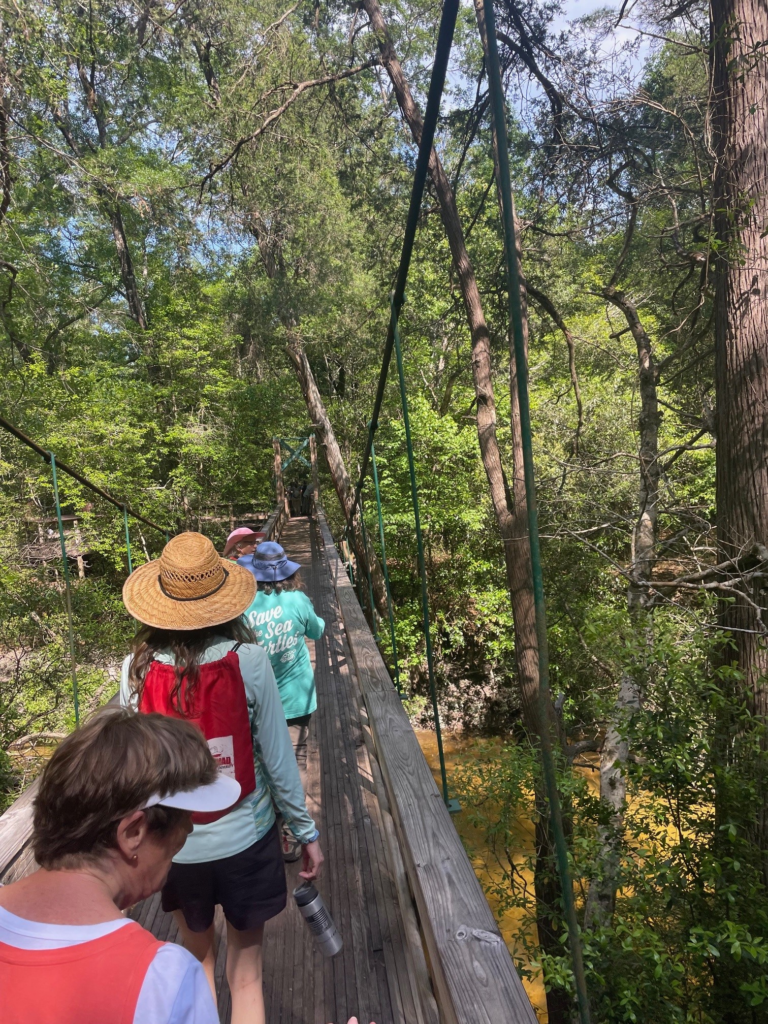
My Sea Grant colleagues and I are currently teaching a freshwater wetlands Master Naturalist class. Included in the course have been trips to pitcher plant prairies, cypress and gum swamps, and rivers. Yesterday, we had a colleague and longtime wetlands consultant demonstrate how he determines whether a piece of property includes wetlands or not, and where to draw the line between wetlands and uplands.
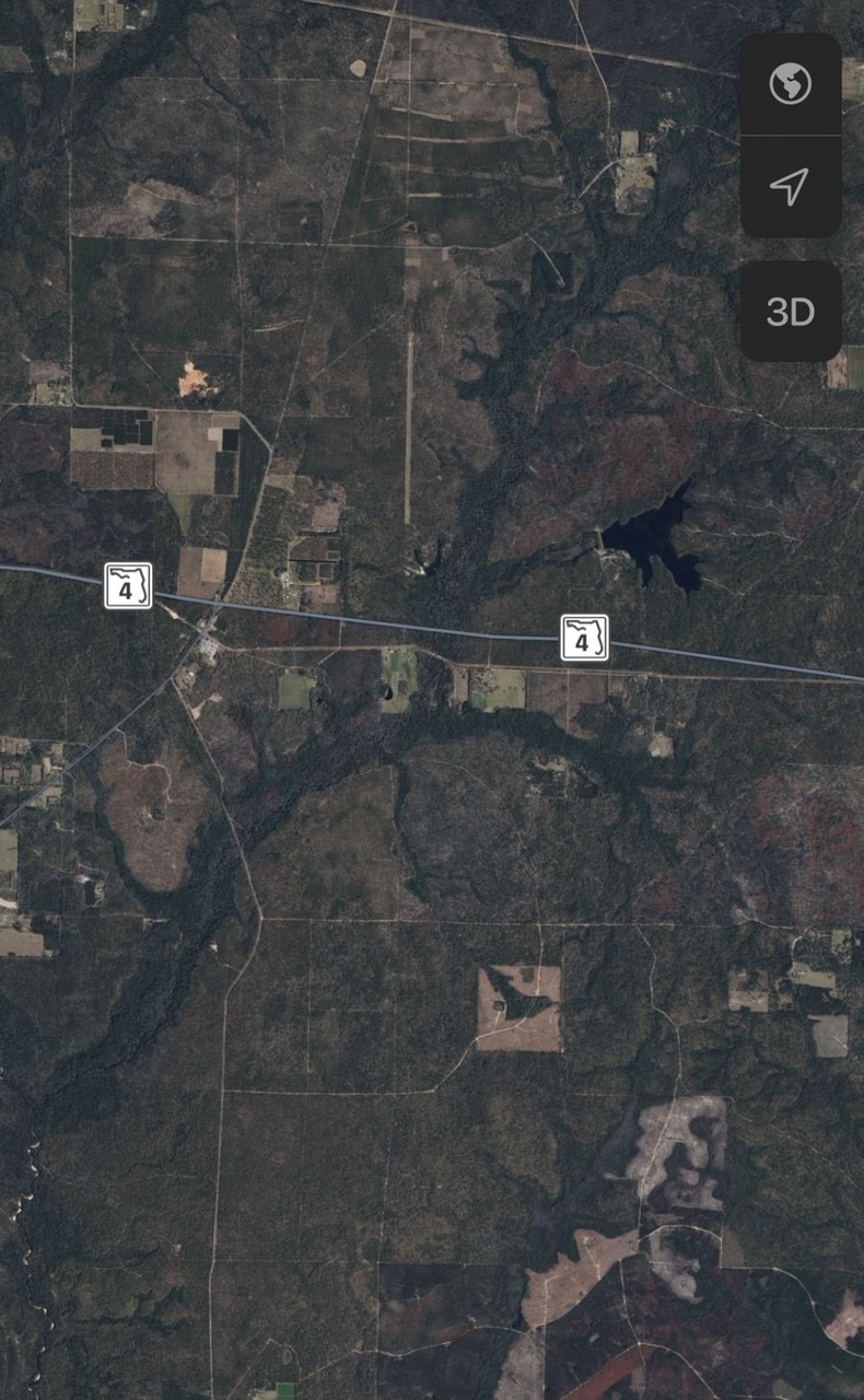
This process of wetland delineation requires a lot of background knowledge and several important tools. To begin with, you want to start with soil maps and satellite imagery. These will show wetland signatures—often appearing as darker routes of water—along a creek or riverbed. Soil maps describe the texture and water-holding capacity of hundreds of named soil types, which are divided up geographically into very specific parcels of land.
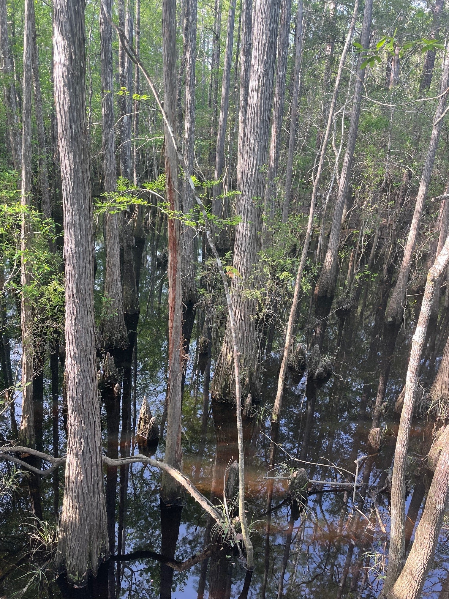
After initial analysis comes the ground-truthing. To truly evaluate a wetland’s boundaries, it’s necessary to go onsite and walk the whole area. The easiest way to corroborate those first guesses at a wetland boundary is to start looking at the vegetation. There are hundreds of groundcover, shrub, and tree types recognized as wetland species. If these dominate the landscape, odds are you’re in a wetland. Other signs of water, known as “hydrological indicators,” like buttressed trunks, crayfish mounds, or water lines yield clues about water’s presence. Sometimes, an area will have been cleared of vegetation before its proper evaluation, which are why understanding soils is so important.
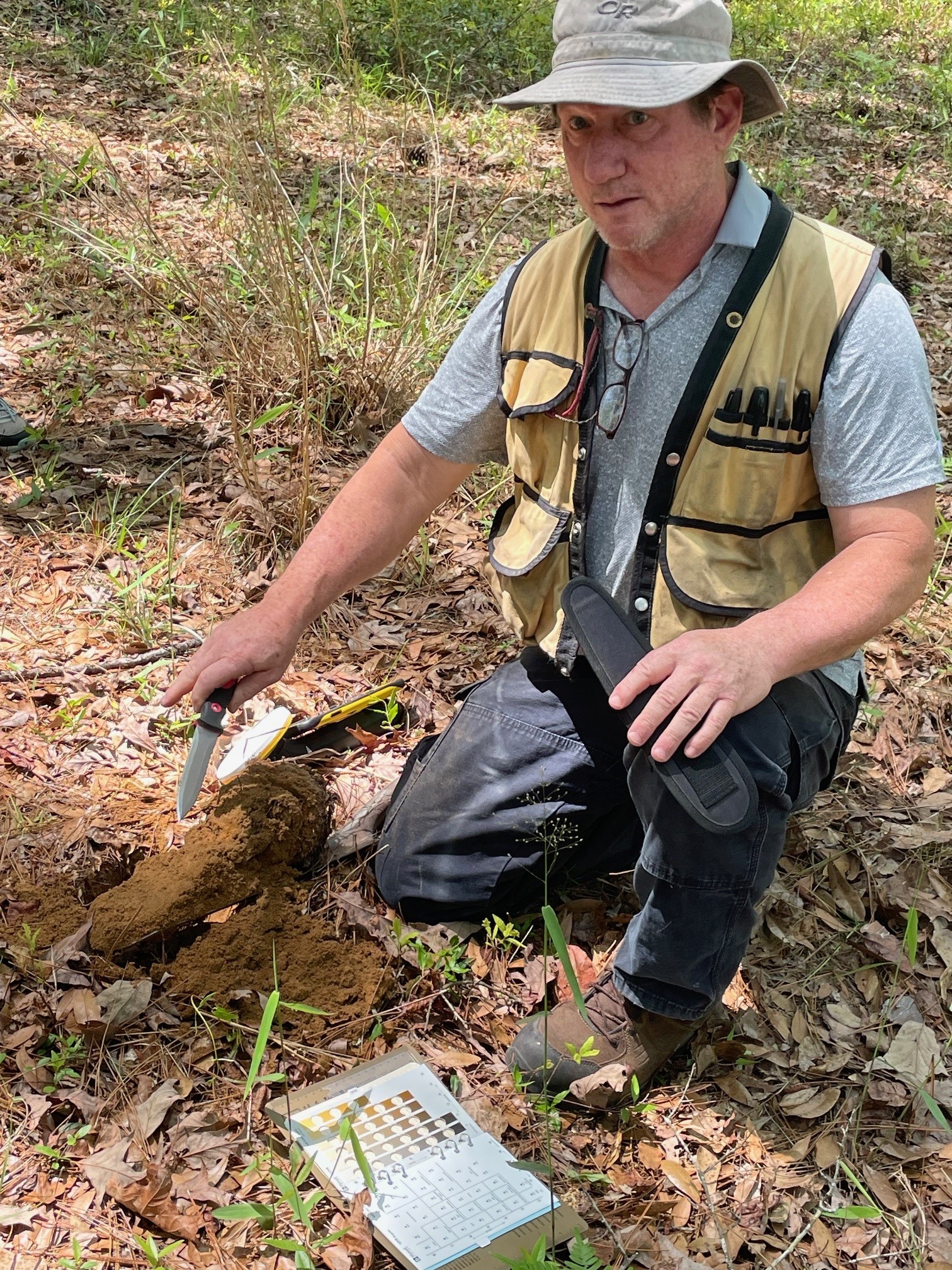
To evaluate soils, wetland consultants use a soil probe or a long spade that will allow them to remove a sample of soil and evaluate its color and texture. In general, wetland soils are darker and slicker than others, although a handful of other indicators can show wetland properties in relatively sandy soil. Soil color can be compared on a Munsell color chart, which is like comparing wetland-associated paint chips.
Once a stretch of land is identified as a wetland, consultants will generally mark it physically by tying plastic tape around trees, outlining the entire parcel to differentiate it between adjacent uplands. From there, a digital GPS-based map is created that can be easily translated into construction plans and permits.
 3
3
