For much of the Panhandle August was an improvement over July with more adequate rainfall scattered across the region. Portions of the coastal counties received over 10″ (hot pink), while there were a number of inland pockets that received less than 4″ (tan). Most of the region’s rainfall ranged from 5-8″ for the month, based on National Weather Service estimates.
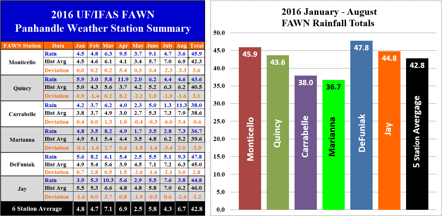 The data collected at the six Florida Automated Weather Network (FAWN) stations also show the variation in rainfall in the Panhandle for the month of August. After three straight months of below average rainfall, the Carrabelle station recorded 11.3″ of rain in August 2016. In contrast, less than 4″ of rainfall was recorded in Monticello and Jay. The six station average was 6.7″ for the month of August. For the year, Marianna has been the driest location with less than 37″, while the DeFuniak station has recorded a total of almost 48″. The six station average through 8 months was 42.8″.
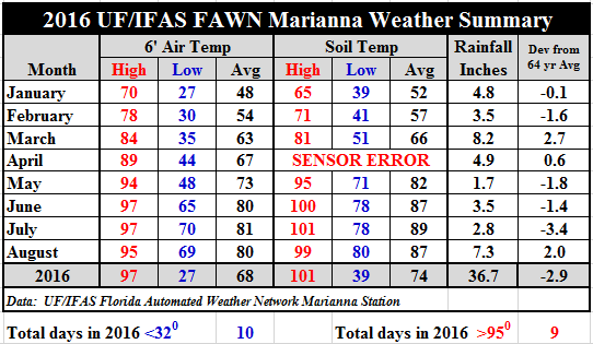 Temperatures cooled only slightly in August as compared to July. The average air temperature cooled only one degree from 81 to 80, and the average soil temperature fell two degrees from 89 to 87. For specific daily temperature and rainfall data, download: 2016 Jan-Aug FAWN Weather Summary.
 Hurricane Hermine
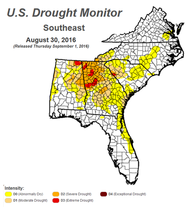
Hurricane Hermine certainly got everyone’s attention in the Panhandle and South Georgia this week as it grew stronger moving through the Gulf. Damage reports are still coming in from the coastal communities hit hardest by storm surge, power outages, and high winds. There is a silver lining to this storm, however. The graphic above is the Drought Monitor for the Southeast on Tuesday, August 30 before the storm came ashore. As you can see much of Georgia and South Carolina were in real need of rainfall.
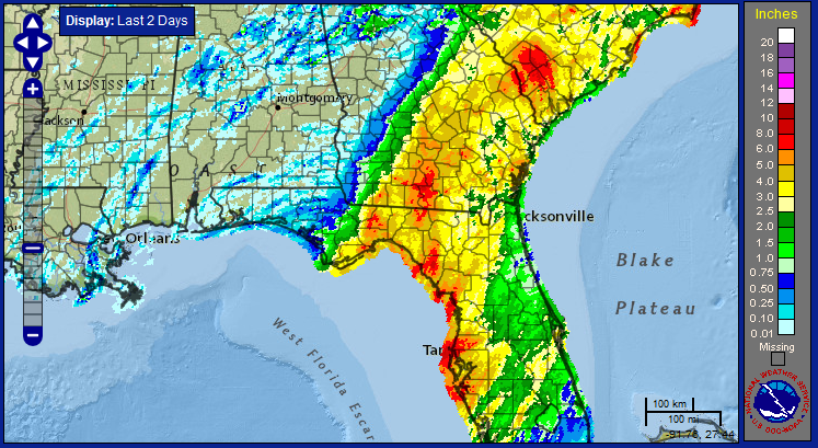
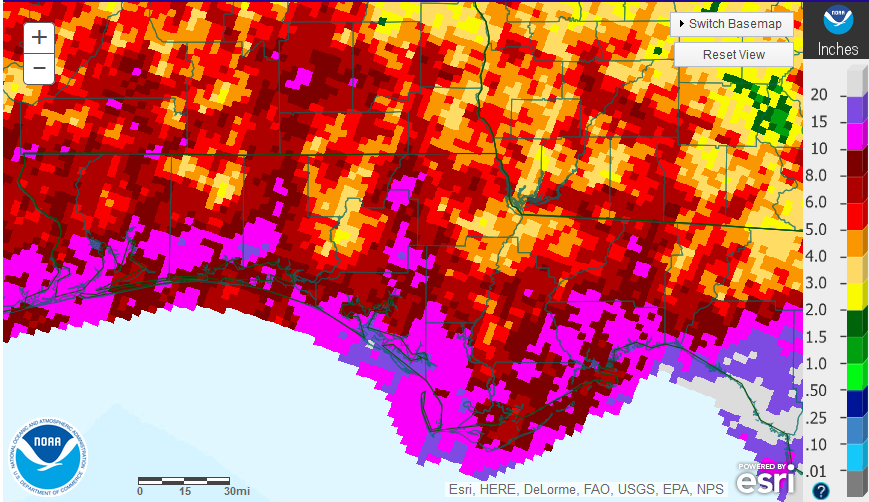
The graphic above is the estimated rainfall totals from the past 48 hours. Interestingly the rainfall total was higher in Tampa and Cedar Key than in Jefferson and Taylor Counties, where the eye of the storm made landfall. The other thing that is truly remarkable was the High-Pressure wall that guided this huge spinning top of a storm. You can clearly see how the storm was pushed eastward on a pretty distinct line.
September Outlook
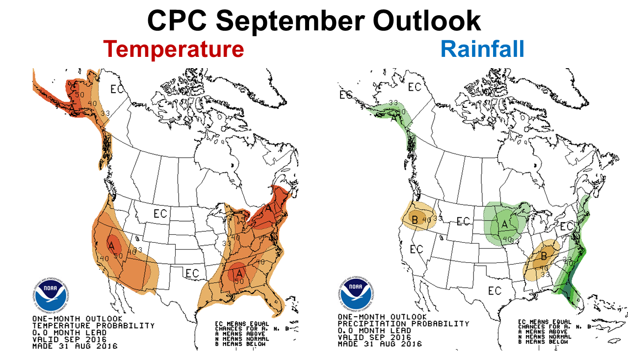 The month ahead was expected to be hotter and dryer than normal. The climate Prediction Center actually changed their outlook this week to show Hurricane Hermine’s influence, so the eastern Panhandle is expected to end the month above average. As peanut and cotton harvest is not far off, it does appear as if farmers will have better weather conditions than last year at harvest. But that will depend greatly on whether tropical systems emerge in the Gulf from now through November.
 0
0
