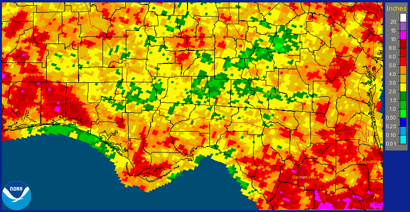
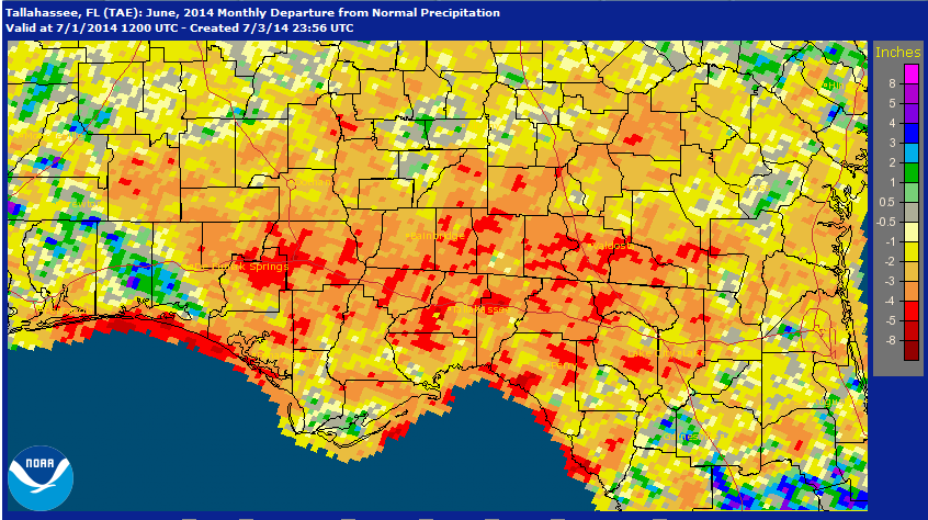
The National Weather Service rainfall estimates in the graphic above show the wide variation in rainfall that fell in June 2014. Over 10 inches fell in Santa Rosa and Okaloosa Counties, while portions of Jackson, Washington, Gadsden, and Jefferson Counties got less than 2″ in June. The graphic below shows how the June rainfall compared to the historic averages. As you can see significant portions of Washington, Jackson, Gadsden, Leon, and Jefferson were more than 4″ below normal, while portions of Okaloosa and Walton Counties were above average.
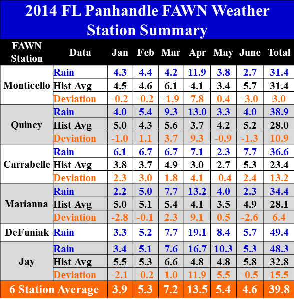 The UF/IFAS FAWN weather stations also documented wide variation in rainfall for the month of June. The station in Carrabelle recorded 7.7″, while only 2.3″ were recorded in Marianna, and the average for all six stations was 4.6″. Through the first half of 2104, 49.4″ were recorded at DeFuniak, while only 31.4″ has been recorded at the Monticello station. The average for all six sites from January through June was 39.8″.
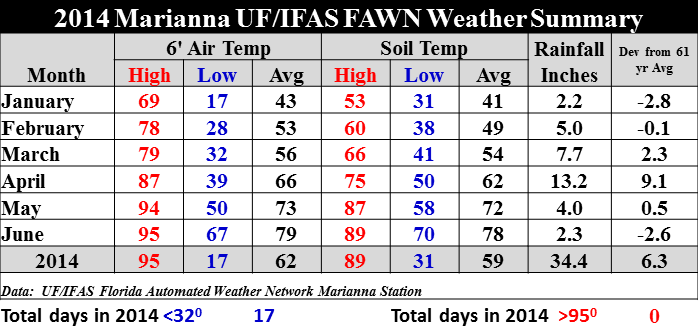 Average air and soil temperatures rose six degrees in June as compared to May, at the Marianna FAWN station. For more details, you can download the complete daily weather summaries: 2014 Jan-June Weather Summary.
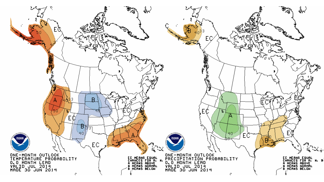 For the month of July, the National Weather Service forecast is predicting above average temperatures and below average rainfall for a major portion of the Panhandle. So far they have been correct, so let’s just hope that things start getting back to normal in the weeks ahead. What a difference a year makes, at this point last year everything was drenched and we wondered when we would get a break from the rain. It reminds me of Dr. Wrights’ famous phrase, “You may have a lifetime of experience farming, but you have never farmed this year.”
El Niño Watch
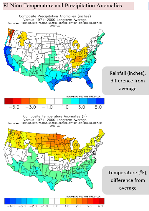
The National Weather Service Climate Prediction Center has issued an El Niño watch. They predict a 70% chance of El Niño during the summer and 80% during the fall and early winter. That should mean slightly cooler temperatures and above average rainfall from November through March in the Panhandle. We need to keep our eye on this, but this could mean it will be a good year for wheat, oats, triticale, and cool season forages in the tri-states region. Below are the average rainfall and temperature variations in past El Niño years.
 0
0
