In Part 2 and 3 of The Changing Climate we discussed some of the climate impacts of the last decade and some possible future ones. But this was on a global scale, what about the Florida and the panhandle? How will all of this affect us near home? We will take each of the issues mentioned and address them one by one.
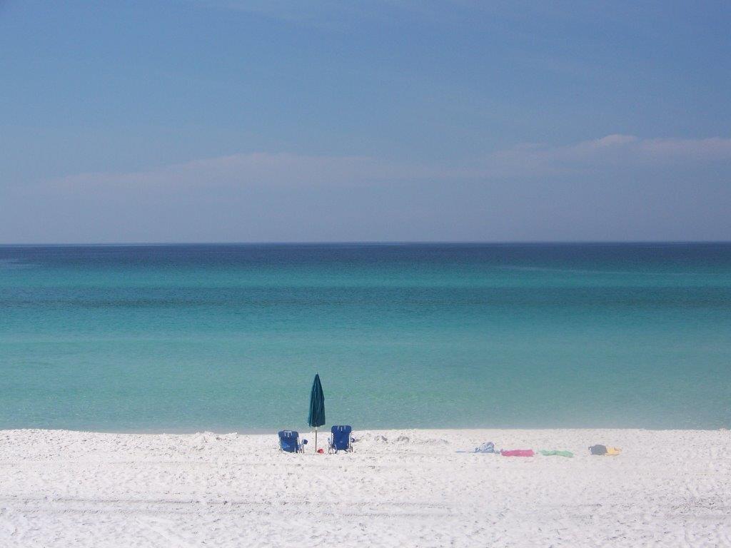
Photo: Molly O’Connor
Extreme Weather Conditions
The western panhandle is considered one of the wetter locations in the United States – with a mean annual rainfall of 64.4 inches (mean for U.S. is 38.1 inches)1. One of the climate predictions is that wet places will become wetter. This appears to be the case for this area. The table below shows the total rainfall for Pensacola FL over the last 14 years. The mean annual rainfall for this period is 70.72 inches1. Currently for 2021 Pensacola is at 84.46 inches and it is raining as I type this. It will be another wet year.
Total Rainfall Pensacola FL
| Year | Inches of Rainfall |
| 2007 | 57.76 |
| 2008 | 56.69 |
| 2009 | 88.33 |
| 2010 | 62.96 |
| 2011 | 48.68 |
| 2012 | 66.63 |
| 2013 | 74.61 |
| 2014 | 83.17 |
| 2015 | 75.69 |
| 2016 | 64.62 |
| 2017 | 91.91 |
| 2018 | 90.01 |
| 2019 | 52.56 |
| 2020 | 76.49 |
| MEAN | 70.72 |
NOAA National Weather Service
This increase in rainfall will bring an increase in stormwater issues for the area. Much of the coastal areas of the panhandle are developed. There are the dense urban areas of Pensacola, Gulf Breeze, Navarre, Ft. Walton, Destin, and Panama City. There are the less dense, but growing areas of Port St. Joe, south Walton County, and the Highway 98 corridor between Ft. Walton and Gulf Breeze.
Because the development is dense along the coast, new development is looking northward. There has been a lot of growth at, and north of, Interstate 10 across the panhandle. The communities of Ensley, Cantonment, Milton, Pace, Crestview, Chipley, Bonifay, and Marianna are all expanding.
Much of this rainfall would percolate through the topsoil to the water table and aquifer below. Some would meet hard soils and flow into creeks, streams, ponds, lakes, and rivers eventually making its way to the coastal estuaries. But most of the development described above has/is using impervious building materials that disrupts the natural flow of this water. The collecting rainwater, called stormwater, floods parking lots, yards, and streets forcing engineers to develop means of moving this stormwater off the developments and into holding ponds or discharging into one of the available streams, creeks, ponds, or rivers.
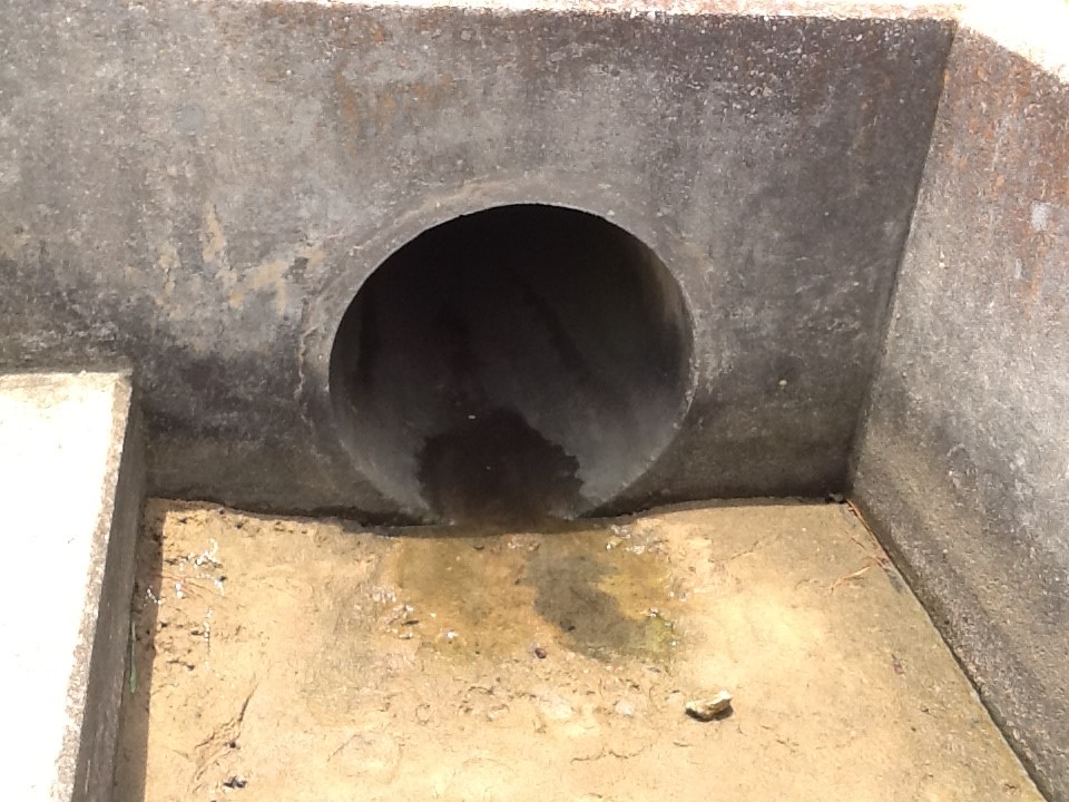
Photo: Rick O’Connor
Despite these efforts, many of these developments are still experiencing flooding. In some cases, the development was placed in a low-lying area where water would naturally flow, and flooding problems become more frequent. In the last 10 years, with the increased rainfall we have seen, there has been a lot of talk about flooding issues with residents, businesses, and local governments. If these climate models are correct, we can expect more of this.
One area of interest I have for Sea Grant Programming is how this increase in rainfall and stormwater will impact the salinity in the Pensacola Bay system. Seagrass restoration, oyster restoration, oyster aquaculture, and fisheries are all sensitive to the salinity in the bay. The hypothesis is that if rainfall is going to increase, then stormwater discharge from developments will increase, and the salinity of the bay system will decrease – at least at the surface (less saline water being less dense than higher saline water). That said, much of the estuary is relatively shallow and an increase in rainfall and stormwater could impact much of the water column. Benthic species, such as seagrass, oysters, and even possible scallop restoration could be negatively impacted by decreasing salinities.
There are species of seagrass that can tolerate lower salinities, but can they support the fisheries that many locals are interested in (such as spotted sea trout and scallops)? Sea Grant currently works with the University of West Florida using community science volunteers to monitor patches of seagrass in the bay area. Not only are we interested in density of the grass, but the species composition.
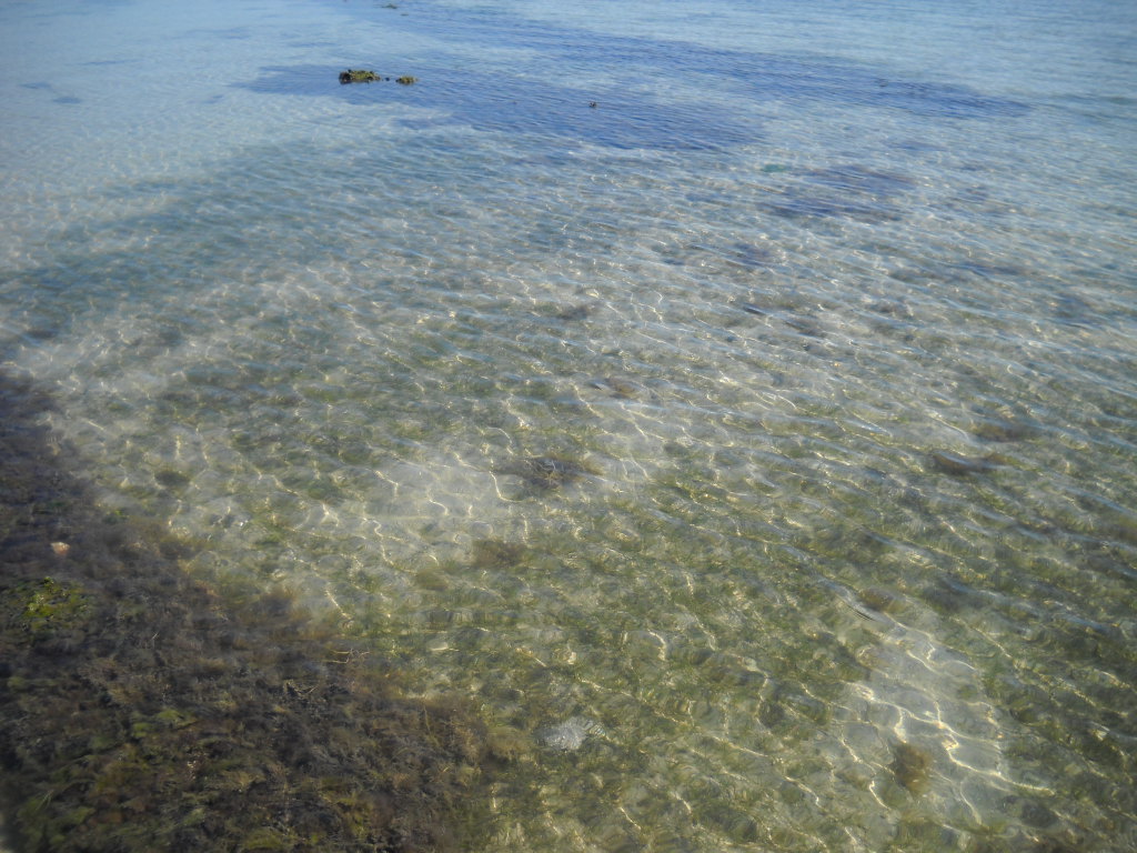
Photo: Leroy Creswell
Shoal grass (Halodule wrightii) and turtle grass (Thalassia testudinum) are species that once dominated much of the lower portion of the Pensacola Bay system (Santa Rosa Sound and Big Lagoon). Both require higher salinities – a mean of at least 20 ppt. Widgeon grass (Ruppia maritima) is a local seagrass that can tolerate lower salinities and is more common in the upper portions of the estuary. Our volunteers are currently monitoring whether the grass density is increasing over time but also looking at whether there is a species composition shift from Shoal-Turtle grass to more Widgeon grass. This could happen if salinities are decreasing and could impact fish diversity as well. It is known that the bay scallop (Argopecten irradians) is strongly associated with turtle grass and also requires the salinity to be at, or above, 20 ppt. These species that prefer higher salinities can tolerate short periods of low salinity – that is the nature of estuaries – but it is not known whether they can tolerate prolonged periods of low salinity, or a complete shift to a lower salinity bay. Most are sure they cannot. Sea Grant now has a team of community science volunteers who are monitoring salinity near the shoreline around the bay system to see how/if this salinity shift is happening with the increasing rainfall.
The increase stormwater will bring much more than just lower salinity. It brings sediment from the development mentioned above which can smother benthic life, like oysters, and lower water clarity negatively impacting seagrass growth. Stormwater also brings fecal bacteria, those bacteria associated with mammalian and avian digestive systems. The fecal bacteria concentration in the bay is an indicator of possible other pathogenic organisms associated with sewage. Heavy rainfall can initiate leaking and flooding of both septic systems and sanitary sewage overflows increasing the bacteria load in the water and requiring health advisories to be issued. This is a reoccurring issue in most of our estuaries. And let’s not forget the other organic and inorganic compounds we place in the environment. Pesticides and fertilizers on our lawns, oil and gas from our vehicles, cleaning compounds, and more. All are washed off the landscape and into local waterways during heavy rains.
Excessive rain not only increases stormwater, and the associated issues mentioned, it can be devastating to local agriculture. One would think that rain is good for crops, and it is. But too much of anything can be bad. Libbie Johnson (UF IFAS Extension Agriculture Agent in Escambia County) explained how the excessive rain has impacted the cotton fields of the Florida panhandle this year. She mentions from the highway much of the cotton looks green and healthy, but when you walk in the fields you will see they are green because the bolls are not there – so the nutrients needed for seed production are moved to the leaves. A closer look shows foliage on the ground. The plants are suffering from hard lock and boll rot – diseases caused by both fungi and bacteria. It typically occurs but in wetter conditions it is worse. Some fields are not as bad as others, and some cotton may be picked this year, but the heavy rains late into the season will be a big problem for this industry2.
Record Temperatures
High temperatures reported by Current Results; weather and science facts3 suggest that our annual high temperatures in the summer have not changed much since 1949. They range from 93°F in 1967 to 106°F in 1980. Over that 71-year period, 17 (24%) the high temperature for the year was over 100°F. Interestingly between 1950 and 1954 Pensacola experienced annual high temperatures over 100°F each year – a heat wave. But what about the annual temperatures over the course of the year? Are the winter temperatures changing?
A website entitled ClimateSpy4 reviews conditions from the weather station onboard NAS Pensacola. According to their data on the warmest and coldest months of the year at NAS, the warm temperatures range between 90-100°F between 1950 and 2020 – the warmest day being 106°F on Aug 29, 2000. The cold temperatures are all around 35°F and reported from the 1970s. As a kid in the 1970s, I do remember school being closed due to snow and they asked us to drive home… which I thought was amazing because no one knew how to drive in the snow. And sure enough, many ended up in ditches along the side of the roads from sliding. I also remember as a kid in the 1960s heavy frost on the ground during winter on many days, something I do not see much anymore.
In August 2016 the U.S. EPA developed a two paged fact sheet on the impacts of climate on the state of Florida. They state that5
- The peninsula of Florida has warmed 1°F over the past century.
- The sea is rising about one inch each decade.
- Heavy rainstorms are becoming more severe.
- They expect the temperatures to continue to rise producing more hot days and less freezing for agriculture.
They provide a graphic that shows the mean temperatures have increased over much of the country, including south Florida. But the panhandle is more stable, some areas even cooling. This is most likely due to the increase rain events this region is experiencing.
Tropicalization
Yes… we have seen evidence of this in the Florida panhandle.
The first evidence I have witnessed was the increased number of growing mangroves in this area. Red mangroves (Rhizophora mangle) and black mangroves (Avicennia germinans) are both salt tolerant tropical trees that dominant the estuaries of central and south Florida. Their current north range extends to Cedar Key Florida (29.14°N). However, both species have been found in recent years during surveys in the Florida panhandle including – Apalachicola (29.72°N), Port St. Joe (29.81°N), Panama City (30.16°N), Pensacola (30.42°N), Horn Island MS (30.24°N), and the Chandeleur Island in LA (29.84°N).
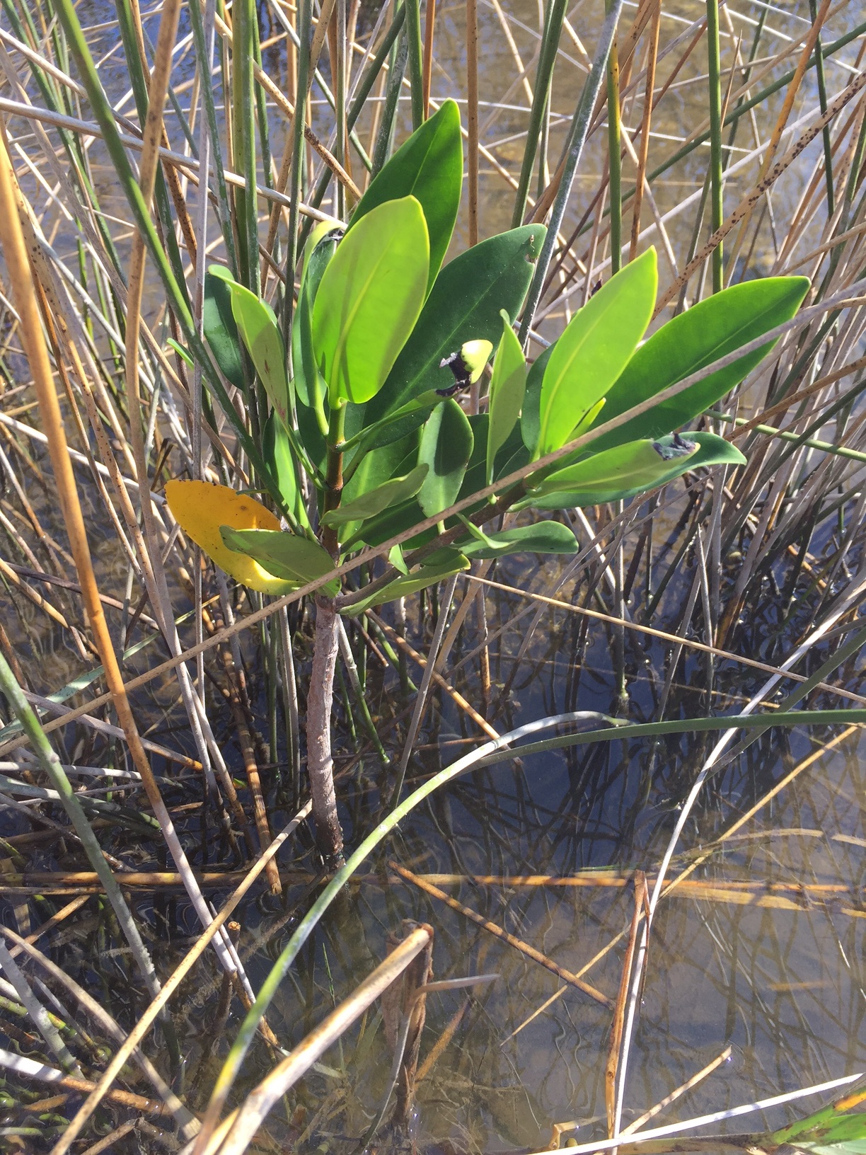
Interestingly there are records of these trees in these areas back as far as the 1940s6. This suggests that the seeds (propagules) of mangroves often drift north to the panhandle. During warmer periods they germinate and may form saplings. However, a hard freeze eventually happens, and the plants die. Snyder et.al.6 report the thermal minimum for the black mangrove is 20°F; numbers we do not see often in the panhandle, but they do occur. But Snyder also reports mangroves in the panhandle reaching heights of 20 feet or so. Suggesting that the hard freezes are not as frequent and allowing a natural range shift of these plants northward. Sea Grant and the Marine Science Academy at Washington High School in Pensacola monitored a red mangrove that was found in 2009 and was about three feet tall at that time until a hard freeze killed it in 2018. It survived nine years, developing prop roots, but never growing much taller. Partnering with Dauphin Island Sea Lab and the National Estuarine Research Reserves, Sea Grant continues to monitor for the presence of this tropical tree in the northern Gulf.
The historic range of the Florida manatee (Trichechus manatus latirostris) included the entire Gulf of Mexico portions of the northern Caribbean, and the Atlantic coast as far north as Massachusetts7. It is true that during the colder months of the year this animal would migrate to the warm water refuges of Florida. So, seeing this animal in the northern panhandle should not be unusual. But in the 1970s their populations were very low, and the animal was placed of the federal endangered species list. Sightings throughout their range, other than peninsula Florida, became rare. During the 1980s and 1990s it was not unusual to hear reports of a few manatees, maybe two or three, entering the Pensacola Bay region.
But in 2018 one of our community science volunteers monitoring seagrass in Big Lagoon saw at the end of her dock. She reported it to me. I responded by letting her know that one-off sightings of manatees are not unusual in our area. But then she began to see more, reporting as many as five at one time. Others began to let me know about sightings they had. One reported nine individuals together near Kees Bayou in the Intracoastal Waterway near the Alabama line. This was unusual.

Photo: Marsha Stanton
It turned out that the Dauphin Island Sea Lab in Alabama had been tracking manatees for about 10 years after they began to see an increase in numbers over their way. Sea Grant partnered with them to develop a Pensacola Bay Area Watch and report our sightings to their network. In 2019 we logged 66 sightings. This was definitely an increase in what this area had experienced in the last two decades. The team is now partnering with the Pensacola-Perdido Bay Estuary Program to report sightings. The program extends to Choctawhatchee Bay to our east and in 2021 a pod of 23 manatees was seen near Destin. All of this data is logged within the Dauphin Island Sea Lab’s program.
The question now is the cause of this increase. We know that manatee populations have increased in the last few decades. Is this the reason? Or are the conditions in the northern Gulf becoming more conducive to the manatees’ needs? Maybe it is both. There is now a resident population in Wakulla Springs of about 44 animals. We will continue to monitor the sightings and see if they over winter here. The need for warm water winter sites (waters where the temperatures are at, or above, 70°F) are still in the peninsula part of Florida. So, it is believed they will not overwinter here. Monitoring continues.
Then there are the snook…
Snook (Centropomus undecimalis) is a popular game fish sought by anglers in central and south Florida. Along with the tarpon (Megalops atlanticus) were one of the reasons the huge tourism industry kicked off in the early 20th century. People loved to come to Florida trying their luck catching them. And you had to come to Florida to catch them, they are a warm water species.
Like manatees, their historic range includes the Gulf of Mexico and the Atlantic coast as far north as New York8, but the fish is not common in the colder parts of their range. They are considered transients, summer visitors when waters are warmer. But warmer water temperatures maybe extending their resident range further north in the Gulf of Mexico.
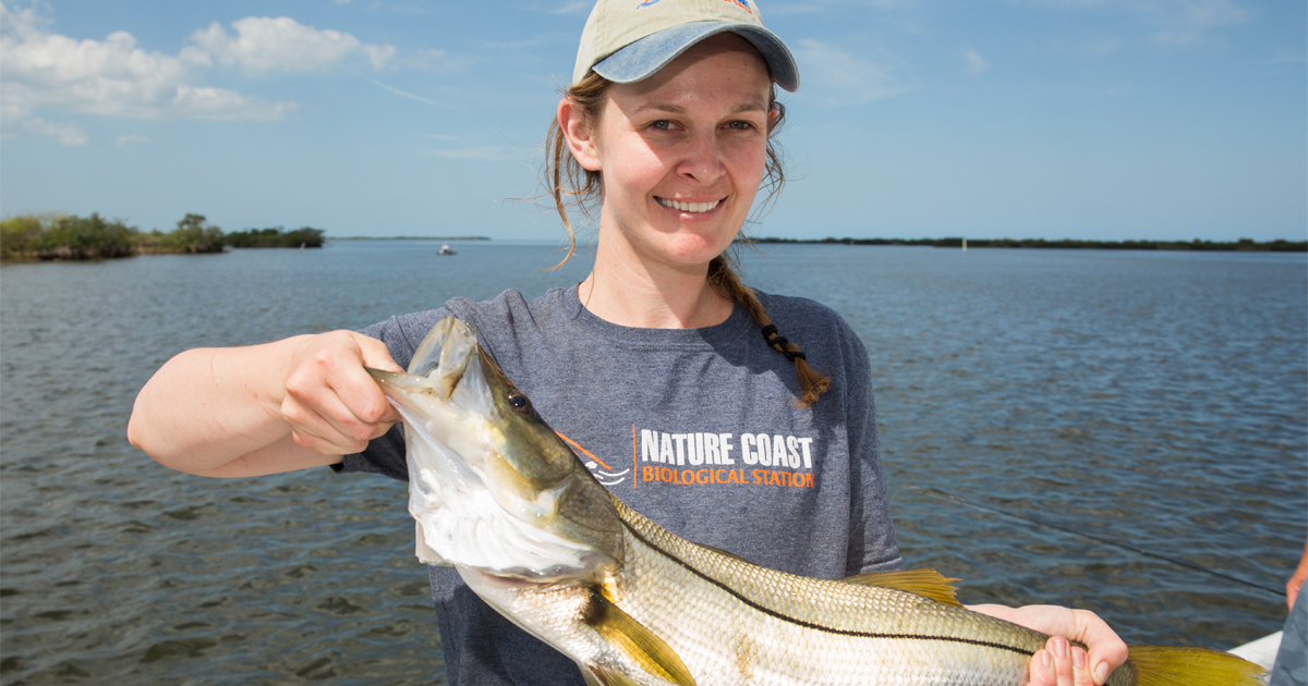
Photo: UF IFAS
Purtlebaugh et.al9 report an increase in snook catches in and around Cedar Key FL since 2007. Their studies found snook of all age classes between 2016 and 2018 suggesting that reproduction was occurring there, further suggesting that snook are expanding their range into north Florida. There have been reports of the fish in both Apalachicola and Pensacola, though no evidence that they are reproducing here – winters are still too cold for that.
Invasive Species
North Florida has its share of invasive species. But due to our cold winters, many we hear and read about in south Florida are not a threat to us… yet.
Most of the invasive species we hear about in our neck of the woods are plants. Chinese tallow, Japanese climbing fern, Chinese privet, and cogongrass to name a few. But we have had issues with some animals. Red fire ants, feral hogs, and nutria have all been problematic in this part of the Gulf.
But recently there have been increased sightings of new species historically found in peninsula Florida. The brown anole (Anolis sagrei) is a small lizard from the Caribbean, specifically the region of Cuba (hence the other common name – Cuban Anole). I first heard reports of this non-native in and around the Perdido Key area. They are now abundant there and appear to be abundant in the Gulf Breeze area, East Hill and downtown areas of Pensacola, and… all along the panhandle. I visited a wholesale nursery east of here that had one greenhouse invested with them. I have seen them at every rest area on I-10 between Pensacola and I-75. They appear to be everywhere now.
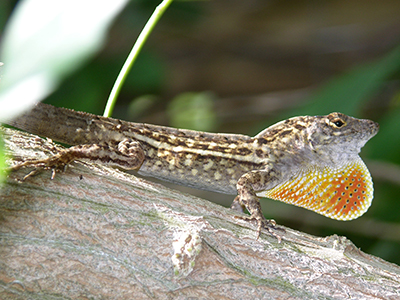
Photo: Jerry Patee
It is believed they arrived here as hitchhikers on ornamental plants grown in nurseries in south Florida. At one time, you did not have to worry about such hitchhikers because our winter freezes would end the invasion. But those freezes are not occurring as frequently and these populations, just as the mangroves, are hanging on longer. Some may believe that when a good hard freeze does occur, we will no longer have to worry about them. But that may not be the case.
Laura Rubio’s master thesis looked the thermal minimum for both the native green anole (Anolis carolinesis) and the invasive brown anole. She looked at populations along the range of peninsula Florida up to Georgia. In Georgia she found that the native green anole dealt with cold winters better than the brown anoles, and the males handled it better than the females in both species. But as her work continued, she noticed that the brown anoles did acclimate to the colder climate10.
There are studies showing that the invasive Argentine Black and White Tegu (Salvator merianae) can do the same. This is a large lizard, reaching lengths of up to three feet. They are from South America but have at least three breeding populations in central and south Florida. However, there have been reports of the animals in Georgia, South Carolina, and the Florida panhandle. Can they handle our winters?
A study conducted by Scott Goetz et. al.11 suggest yes. The study was conducted at Auburn University. They were trying to determine whether this animal could adjust to our winter temperatures. Nine of the 12 animals in the study emerged from their first winter just fine and seven made it over one year. Suggesting that these tropical reptiles could survive if they made their way to our part of the Gulf. Whether this is because the annual winter temperatures in north Florida and Alabama have warmed, or whether they are due to acclimating reptiles was not specifically addressed in the study, but the reduction of frost/freezing days could play a part.
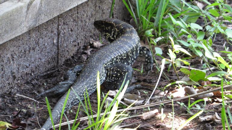
Photo: EDDMapS.org
One final note on invasive species. The Brazilian Peppertree (Schinus terebinthifolia) has been a huge problem in south Florida for decades. This aggressive invasive plant has taken over many areas of the state. Native to Brazil, it has covered much of the peninsula part of the state but not the Florida panhandle or into Georgia. A few years ago, one was found on St. George Island in Franklin County FL near Apalachicola. This year one was found in Niceville FL near Destin in Okaloosa County. Like the mangrove, one would suspect that a hard freeze would do their populations in. But we will have to see if such freezes occur.
Growth Zones
Growth zones are geographic zones extending east and west with a similar climate and help horticulturists select which plants will do best. The higher the number, the more tropical.
Historically the Florida panhandle was in Zone 8. But now we are in Zone 9… it has warmed12. These climate shifts are occurring with elevation as well. The big difference within these zones is how cold it now gets during winter. In our area, winter is warmer than it was a few decades ago allowing some subtropical and tropical to overwinter and thrive during the warmer months. This connects with the invasion of some invasive species and plants like mangroves.
Sea Level Rise
According to the 2021 IPCC Assessment Report 6 not only is sea level rising, it appears even with a dramatic reduction in greenhouse gasses, that trend will not turn around for at least a century – the sea will rise. So, how does this effect Florida?
In paper published by Thomas Ruppert (Florida Sea Grant) in 2013, our state can expect a rise of about 1.5 to 4.5 feet by 210013. One must remember that vertical rise of one foot could equal a couple of feet of horizontal flooding. The King tides of the Atlantic coast of the state have been in the news for years. These rising waters impact drainage, groundwater levels, enhance saltwater intrusion in drinking and agriculture sources. Monroe County reported impacts of SLR to include having to replace vehicles due to sitting in salt water. You can also include a rise in storm surge during tropical storms to the list of impacts.
Many coastal communities are already dealing with increased flooding due to excessive rainfall. Adding a rising sea will make these issues worse. Natural systems, like barrier islands and salt marshes, will natural “roll” inland as the sea rises but if there is development in the way (and there is), they cannot. So, the loss of the systems, the commercial and recreational economic importance, and the ecosystem services they provide will be lost.
All of these are very real, and many are occurring as this is being typed. The obvious next question is what can we do about it? That will be the focus for our last segment in this series – Part 5 (Solutions).
References
1 National Weather Service. Temperature and Precipitation Graph for Pensacola FL. https://www.weather.gov/mob/climate_kpns.
2 Johnson, L. 2021. 2021 Cotton Production Issues in the Western Panhandle. University of Florida IFAS Extension. https://nwdistrict.ifas.ufl.edu/phag/2021/10/01/2021-cotton-production-issues-in-the-western-panhandle/.
3 Current Results; Weather and Science Facts. https://www.currentresults.com/index.php.
4 ClimateSpy. https://www.climatespy.com/climate/summary/united-states/florida/pensacola-nas.
5 What Climate Change Means for Florida. 2016. U.S. Environmental Protection Agency. EPA 430-F-16-011. https://www.epa.gov/sites/default/files/2016-08/documents/climate-change-fl.pdf.
6 Snyder, C.M., L.C. Feher, M.J. Osland, C.J. Miller, A.R. Hughes, K.L. Cummins. 2021. The Distribution and Structure of Mangroves (Avicennia germinans and Rhizophora mangle) Near Rapidly Changing Range Limit in the Northern Gulf of Mexico. Estuaries and Coast. https://doi.org/10.1007/s12237-021-00951-0.
7 Florida Manatee (Trichechus manatus latirostris). 2017. Crystal River National Wildlife Refuge. U.S. Fish and Wildlife Service. https://www.fws.gov/refuge/Crystal_River/wildlife_and_habitat/Florida_Manatee.html.
8 Common Snook. Centropomus undecimalis. 2017. The Florida Museum of Natural History. Discover Fishes. https://www.floridamuseum.ufl.edu/discover-fish/species-profiles/centropomus-undecimalis/.
9 Purtlebaugh C.H., C.W. Martin, M.S. Allen. 2020. Poleward expansion of common snook Centropomus undecimalis in the northeastern Gulf of Mexico and future research needs. https://doi.org/10.1371/journal.pone.0234083.
10 Rubio, Laura Carolina Maria, “Geographic Variation in the Lower Temperature Tolerance in the Invasive Brown Anole, Anolis sagrei and the Native Green Anole, Anolis carolinensis (Sauria: Polychrotidae). ” Master’s Thesis, University of Tennessee, 2012. https://trace.tennessee.edu/utk_gradthes/1400
11 Goetz SM, Steen DA, Miller MA, Guyer C, Kottwitz J, Roberts JF, et al. (2021) Argentine Black and White Tegu (Salvator merianae) can survive the winter under semi-natural conditions well beyond their current invasive range. PLoS ONE 16(3): e0245877. https://doi.org/10.1371/journal.pone.0245877.
12 Planting an Earth Day Garden? Consider Climate’s “New Normal”. 2017. National Oceanic and Atmospheric Administration. Climate.gov: Science and Information for a Climate Smart Nation. https://www.climate.gov/news-features/featured-images/planting-earth-day-garden-consider-climate%E2%80%99s-%E2%80%98new-normal%E2%80%99.
13 Ruppert, T. 2013. Sea-Level Rise in Florida – the Facts and Science. Florida Sea Grant College Program. University of Florida IFAS Extension. https://www.flseagrant.org/wp-content/uploads/2012/02/SLR-Fact-Sheet_dual-column-letterhead_8.2.13_pdf.pdf.
 1
1
