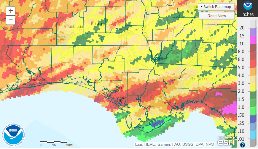
April was another dry month for much of the Florida Panhandle. There were streaks of red where heavy bands of rain came ashore and dropped 5-10″, but much of the region that is shaded beige or tan received less than 5″ of rain in April. Zones that were yellow or green had less than 3″. You can see from the map that the two fronts that came through in April did not provide even distribution at all.
 The University of Florida has six Florida Automated Weather network or FAWN weather stations in the Panhandle. There was also considerable variation in the rainfall collected among these weather stations ranging from a low of 0.6″ in Carrabelle to a high of 3.9″ in DeFuniak Springs. The average for all six stations in April was 2.6″.
Through the first third of 2017, the Monticello location has only received 9.7″, which is 9.6″ below average for this location. The DeFuniak Station collected 16″ since the start of the year, which is still 3.8″ below the historic average for this site. The average for all six stations from January through April was 12.5″.
Drought
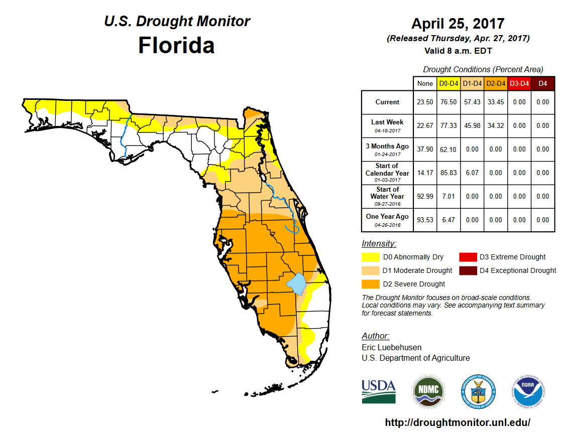 Not surprisingly, much of the Panhandle has been included in the D0 Abnormally dry or D1 Moderate drought categories. Much of Peninsular Florida has moved into the D2 Severe Drought category.
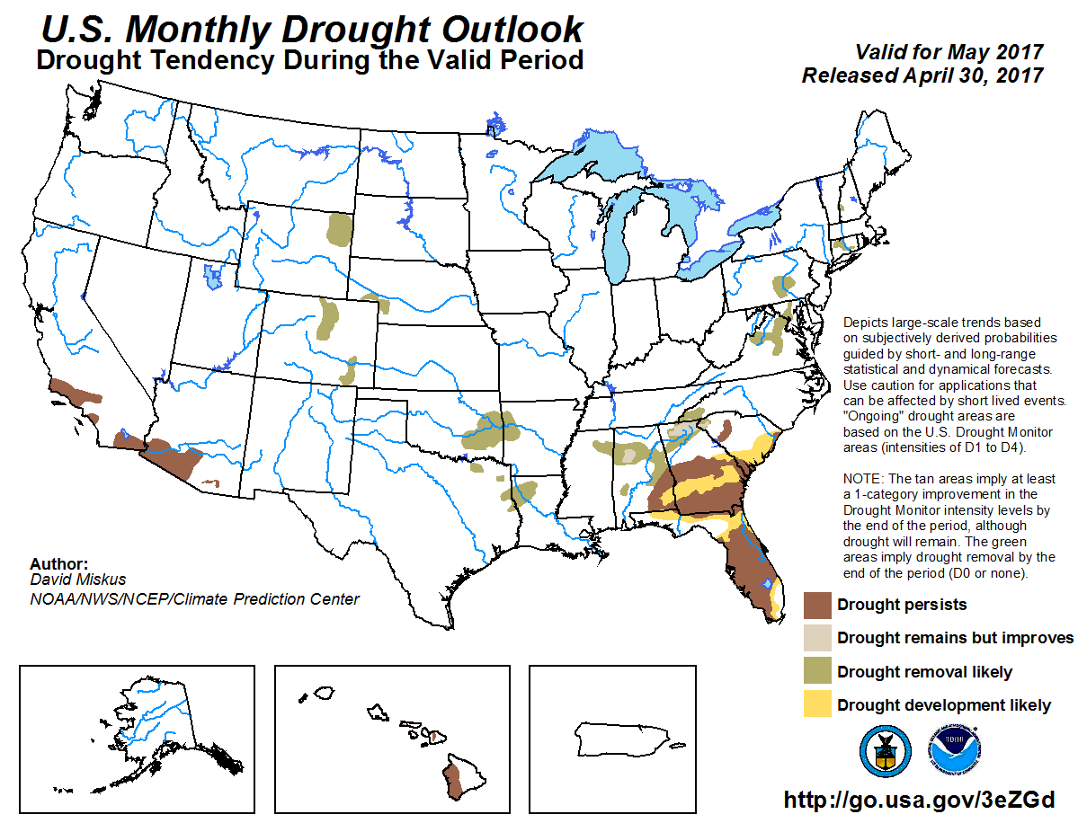 The May Drought Outlook does not look promising, as the drought is expected to continue for the next month.
Temperatures
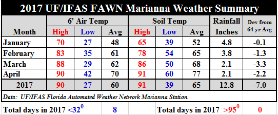 Temperatures continued to warm up in April. The average air temperature rose 8°, from 62° to 70° over March, and the average soil temperature rose 9°, from 68° to 77°. The high for the month was 90°on April 28th, and the low 42°, on April 8th.
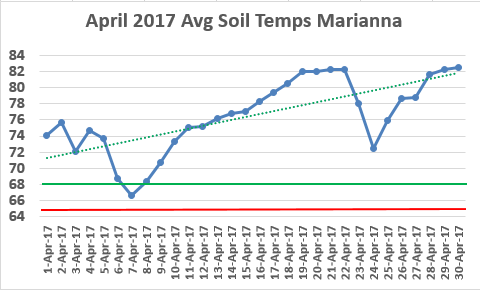 By examining the trend of the daily average soil temperatures provided in the chart above, you can see how quickly the soil warmed up, and the changes following the two cold fronts that passed through. The red line is 65°, the minimum recommended average soil temperature for cotton and peanut planting, and the green line, 68° is ideal for immediate seed germination of these crops. You can see that in 2017 It has been been warm enough to plant cotton and peanuts since April 8, 2017.
For specific daily rainfall and temperature data, as well as the 64 year rainfall history at the Marianna site, use the following publication link: 2017 Jan-Apr Weather Summary
May Outlook
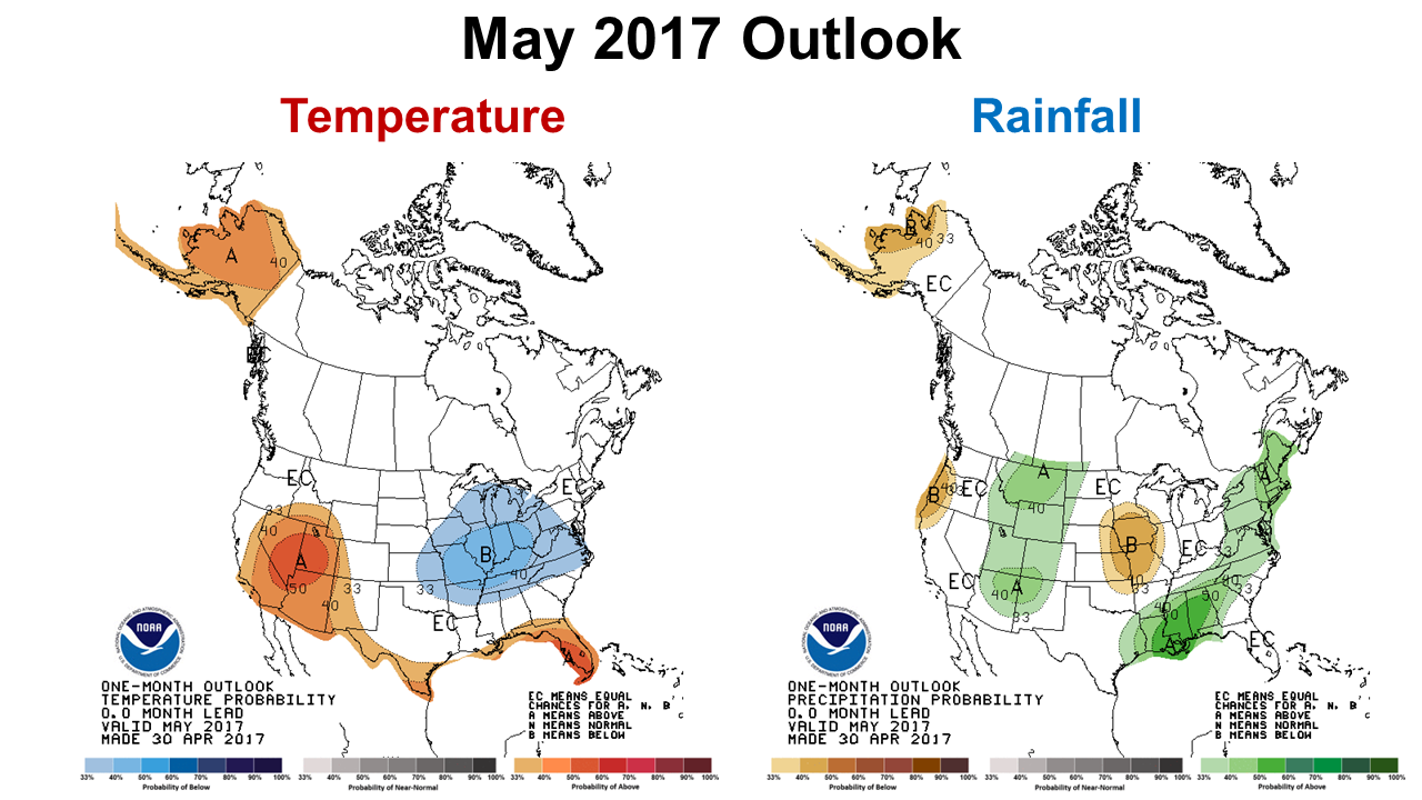 The Climate Prediction Center (CPC) three month climate outlook is somewhat encouraging. They are certainly expecting the temperatures to continue to remain above average, but there is a 66% chance of above average rainfall for the Western Panhandle. So it is possible that conditions will improve somewhat in May. Historically, however, May is one of the driest months of the year, averaging between 3″-5″ across this region, so average or even above average rainfall will not likely remove the region from the drought monitor.
El Niño Watch?
The CPC shares a climate discussion based on the ENSO phase forecast models each month. Some of their models are predicting an El Niño later in the year, but this is the time of year when forecasters are very uncertain. So it is too early in the year to truly call for a an El Niño Watch, but it is something you want to follow for the remainder of the year. Having an El Niño/La Niña/El Niño in three consecutive years has only occurred once since 1950. The following is a quote from their April discussion.
Most models predict the continuation of ENSO-neutral through the late Northern Hemisphere spring (April-June). However, at least one-half of the dynamical model forecasts, anticipate an onset of El Niño as soon as the April-June season. Because of typically lower skill in forecasts made at this time of the year, and the lingering La Niña-like tropical convection and wind patterns over the western half of the Pacific basin, the forecaster consensus favors ENSO-neutral during April-June with a 60-65% chance. Thereafter, there are increasing odds for El Niño toward the second half of 2017 (~50% chance from approximately August-December). In summary, ENSO-neutral conditions are favored to continue through at least the late Northern Hemisphere spring 2017, with increasing chances for El Niño development by late summer and fall. Climate Prediction Center-April 13, 2017
 0
0
