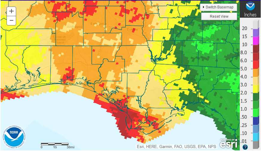
February was considerably drier than January across much of the Panhandle. There were a few areas that received over 5″ (red), while large portions had 4-5″ (light brown), or 3-4″ (tan). The eastern portion of the Panhandle received the lowest totals ranging from 1-3″ for the month.
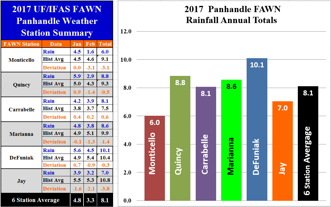 The Florida Automated Weather Network (FAWN) stations also showed similar variation in February rainfall. The station at DeFuniak measured the highest total of 4.5″ in the month of February. The lowest total was 1.6″ in Monticello. Across all six stations the average was 3.3″ for the month of February. Through the first two months of 2017, the DuFuniak Springs station has recorded the highest total of 10.1″ while the lowest of only 6″ was measured in Monticello. The average across all six locations was 8.1″ through the first two months of 2017. Carabelle was the only one of the six stations that has recorded above average rainfall so far in 2017.
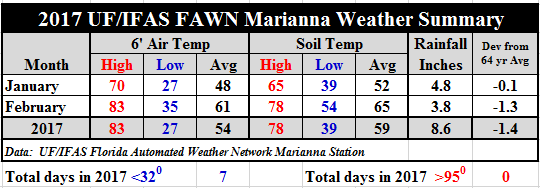 Temperatures warmed up significantly as compared to January. Temperatures rose 13° as compared to January, with an average air temperature of 61°, and an average soil temperature of 65° in February. Soil temperatures rose steadily in February, and were significantly warmer than normal for the last month of winter. For the complete daily summary, download: 2017 January – February Weather Summary
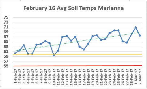
According to the UGA Corn Production Guide, the minimum average soil temperature recommended for corn planting is 55° (red line), and the optimum average soil temperature for fast germination is 60° (gold line), so you can see in the chart above that the daily average soil temperature has been above 60° since February 10th. This could certainly change with a significant cold front, but it shows how quickly the soil is warming up this year.
Spring Outlook
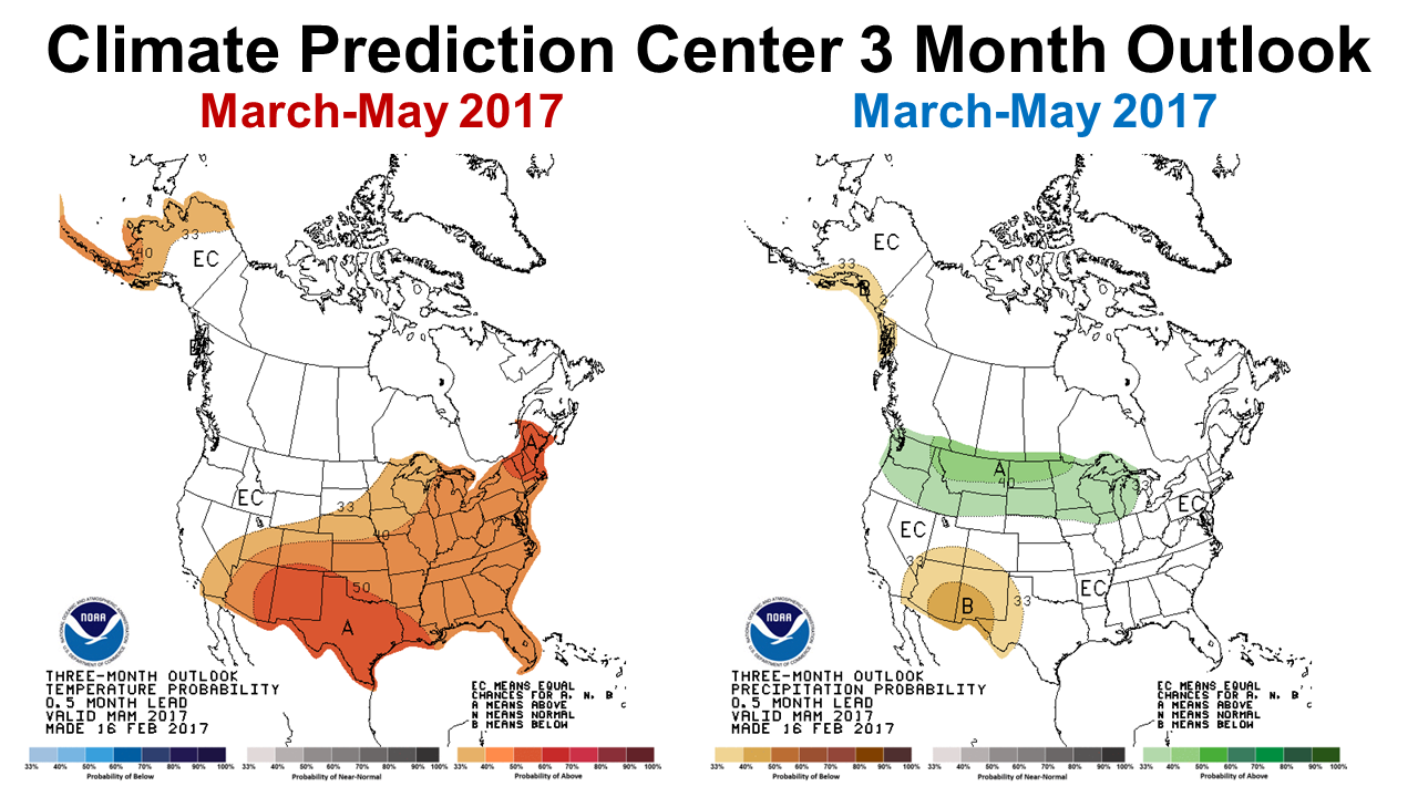 The Climate Prediction Center (CPC) is forecasting a 40% chance of warmer than average temperatures from March through May, but makes no predictions for precipitation.
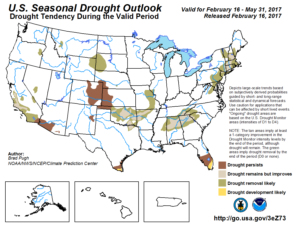 Drought is also not expected over the next three months in the Panhandle, but is expected to continue through much of South Florida, as well as Northern Alabama and Georgia.
ENSO Phase: La Niña, Neutral, or El Niño
The official CPC status of ENSO phase is now neutral, but an El Niño is possible again this fall.
ENSO-neutral conditions are present. Equatorial sea surface temperatures are near-average across the central and east-central Pacific. They are above-average in the eastern Pacific Ocean. ENSO-neutral conditions have returned and are favored to continue through at least the Northern Hemisphere spring 2017. – Climate Prediction Center
 0
0
