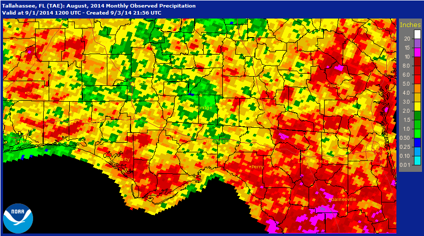
The old adage of the “Dog Days of August” certainly held true in 2014. Much of the Panhandle experienced high temperatures and below average rainfall for the month. Several coastal regions received more than eight inches of rain, while the most of the agricultural regions, along the northern border had less than four inches of rain. The green pockets on the map show the large areas of the Panhandle that had less then two inches of rain in August.
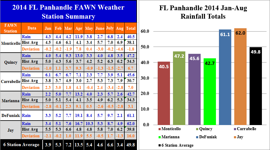 The University of Florida’s FAWN stations (Florida Automated Weather Network) documented that all six locations were well below historic average for rainfall in the month of August. Monticello was the driest location with only 2.4″ of rain, and Carrabelle was the wettest with just over five inches for the month. Through the first 8 months of 2014, the highest total rainfall has been received at the Jay station with 62″, while the Monticello station has recorded the lowest total of 40.5″ in 2014.
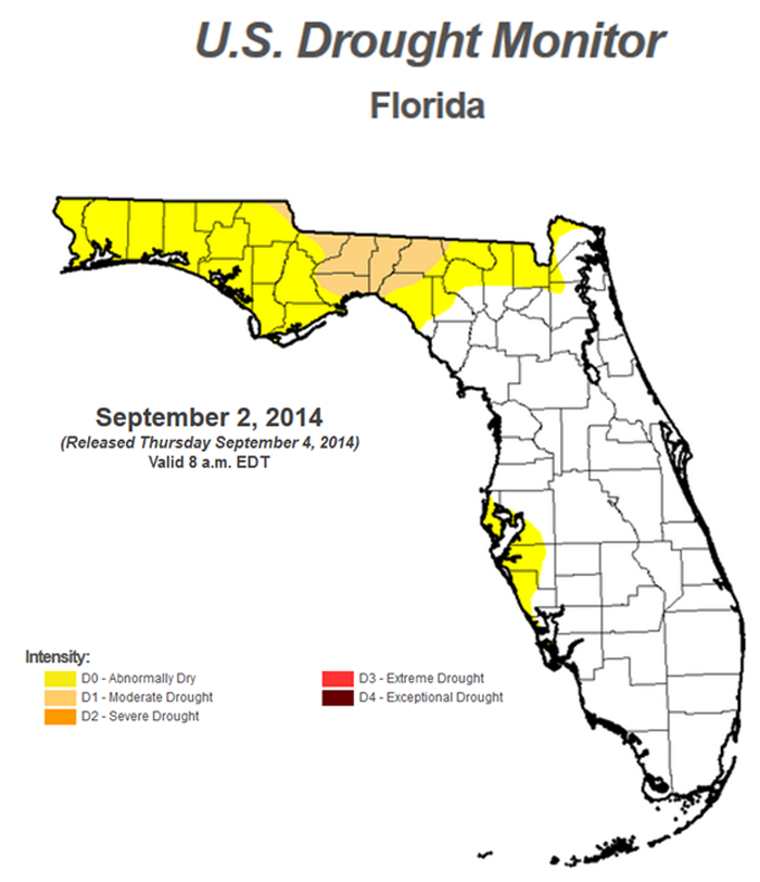 The US Drought Monitor tracks the development of drought conditions over time and is reported each week. All of North Florida is abnormally dry, and portions of Jackson, Gadsden, Leon, Wakulla, Jefferson, and Madison Counties are categorized as moderate drought conditions.
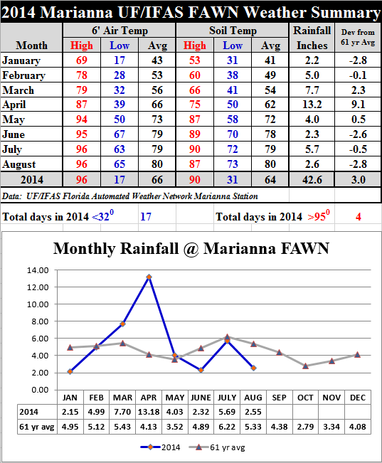 Not only was August dry, but hot as well. Saturday, August 23 was the hottest day of the year so far, with 4 stations reaching 96 degrees, Quincy recording 97, and Monticello 98. For the entire month, air and soil temperatures averaged 80 degrees, documenting what most people felt, that August was the hottest month of the year thus far.
 The NOAA forecast for September is for continued above average temperatures. NOAA did not forecast variation from normal rainfall for the Panhandle in September.
El Nino Watch Weakening
The Climate Prediction Center Released the following report this week:
Most of the models continue to predict El Niño to develop during September-November and to continue into early 2015. A majority of models and the multi-model averages favor a weak El Niño. At this time, the consensus of forecasters expects El Niño to emerge during September-October and to peak at weak strength during the late fall and early winter. The chance of El Niño is at 60-65% during the Northern Hemisphere fall and winter.
An El Nino fall and winter is generally a good time to invest in winter forages and small grains due to the boost in rainfall associated with it for the panhandle. The latest prediction, however, does not offer as strong an indication that El Nino will have a significant influence on the weather this year. By the time forecasters are more sure, most farms will have already had to make their planting decisions. Regular updates are available from the Climate Prediction Center website, if you want the most up to date information:
 0
0
